 |
| 溪頭尾土地公祠 Xitouwei Taoist shrine |
淡基橫斷古道は実行の便宜のため三段階に分け、
東側と
西側のセクションをそれぞれ今月二回に分けで歩いた。今回はその残りの中間の部分である。具体的には、冷水坑から萬里崁腳の部分だ。冷水坑は今では、多くの登山者が訪れる七星山の登山口でもあり、近くには足湯などの温泉施設もある。また近くには手軽に行ける草原の擎天崗などで、登山客だけでなく遊楽客もとても多い場所だ。一方、今回の終点である崁腳は、山間のひっそりした集落である。小学校があるが、それほど人口も多くなく山を越せば大都会台北があるとは、思えないほどの里山地区だ。この二か所の間を、淡基橫斷古道は山を越えて進む。
沿路通過する場所は、河南營,金包里大道城門,石梯嶺,富士古道,鹿堀坪古道,大坪,そして內崁腳古道などである。過去すでに訪れている場所も多い。全体では下りが多い歩きで、距離は少しあるが体力的には楽な歩き方である。最近藍天隊がこの地区の道整備、草刈りなどを行っているので、道の状態も悪くない。天気も良く、草原では暑いぐらいの陽気だった。
---------------------------------------
 |
| Walk from west to east |
So-called historical or old trails (古道) are usually dirt trails which were once travelled for a certain length of time in the distant past and left abandoned to decay due to motorization of local traffic. And then they have been brought back to public attention and put to use again for hiking or recreational purposes after some care was taken care of. The trail in this article is just one of such trails. It was built by the government of the time to link Danshui (淡水) and Jilong (基隆) in the final years of Ching dynasty reign over Taiwan (year 1892) for military purposes. The trail is thus called Dan-Ji (Danshui and Jilong) traversing trail in the present days.
 |
| Three sections of the trail that we have walked |
A part of this trail goes through Yangmingshan national park (陽明山國家公園). The park authority made a study on the trail by commissioning a group of scholars and issued a report in 2004. My plan of hiking through the old trail is based on this report, particularly for
the west end and this current hike. The report is in a public domain and you can refer to it over internet. It says that the total length of the trail is 38.6 kilometers. At its half point stood Henanying military camp (河南營, 17.9 kilometers from Danshui to be exact), and they travelled the entire length on foot for two days by stopping overnight at Henanying camp.
 |
| At Jinbaoli-dalu gate |
For ease of actual hiking I selected a part of the trail from Checheng (車埕) of Sanzhi (三芝) for the west end and Dalunwei (大崙尾) for the east. The original trail extended further west from Checheng to Danshui and further east from Dalunwei to Kekegang (蚵殼港) of Jilong. I did not include them in our plan because I was not able to find materials to show the route. I believe that it has long been turned into public roads for motor traffic. Even if I find the route for those sections, it would be less of significance. I then divided the selected section into three parts. My friends and I walked both
the east part and
the west part. So this middle section is the last one.
A big part of this hike includes trails and points that I have been in the past once for more times. It is interesting to walk the same trails with an understanding of history. It gives you deeper appreciation of your mountains and life of people in the past.
--------------------------------------
 |
| A long queue for the small bus |
It is welcome to have more hikers, which could boost public health of our community. More people, particularly the aged citizens, come outdoor and do exercise including walking and hiking, which help reduce risks of such lifestyle diseases as vascular diseases and diabetes. Given with this knowledge, it is still a pain in the neck to wait in a long queue of passengers waiting for a Xiao 15 line (小15線) bus besides MRT Jiantan station (劍潭站). When it is a nice fine day like today, there are so many passengers for the small bus heading for Lengshuikeng (冷水坑) or Qingtiangang (擎天崗).
 |
| Our Xiao 15 bus at Lengshuikeng bus stop |
We are supposed to take a 7:40 service, but there are too many in line ahead of me. Four of our participating members today told me that they would take a shortened service of Xiao 15 and walk to meet us there. One member told me that he would take a Red 15 line bus (紅15) to Yangming-shan terminus (陽明山總站) and transfer to #108 to get to Lengshuikeng. The rest of us, just three, have managed to squeeze into the small bus. Those in line ahead of me will wait for the next service so that they can have seats.
 |
| Leaving Lengshuikeng parking space |
The jam-packed bus leaves Jiantan a little behind the scheduled time. Only a couple of passengers alight en route. You have to grab something to keep you standing when the bus goes up on a winding road. A 35-minute restless ride takes us to Lengshuikeng in the end. There are extra services of a large bus for the same line on weekends. I hope that the bus company would do the same if there are so many passengers even on weekdays as well.
 |
| Passing by Yonglai clay mine, Mt. Qixing-shan behind |
At last four of us meet at Lengshuikang and at 8:32 head for the first stop of our itinerary, Hehanying camp (河南營) . There is a hiking trail leaving at the corner of the parking space where a visitor center and the bus stop are located. Usually people follow this trail to go to Qingtiangang via Mt. Jixinlun (雞心崙) where we will meet the four other friends. They took another bus and should have walked up there by now. We take the public paved road instead. This is because I assume that the Dan-Ji traversing trail should have come up from Macao (馬槽) to pass over the lowest point besides
Mt. Qigu-shan (七股山) and then directly gone to Jixinlun. It would have become a big detour if the trail had gone down to the current parking space which did not exist at that time. Our aim of this hike is to trace as close as possible the original route.
 |
| A trail opens its mouth at right, an empty bus going down |
We go along the paved road and pass by a toll gate and then a shrine named Tianbao Shengdao gong (天寶聖道宮). The road gains height as we proceed and pass by a remain of Yonglai clay mine (雍來礦場) on our left which produced clay from 1970 through 1990. The road soon meets a dirt trail on our right. We take this trail down and soon come to Jixinlun at 8:49. The four members are waiting under a observation deck there.
 |
| Observation deck at Jixinlun |
 |
| Henanying |
Finally eight of us for today's hike set off for Henanying camp site, which is just a few minutes walk away. Henan means Henan province of mainland China. Under the Chin regime solders were recruited from there because the government did not trust the local Taiwanese for military occupation. So the camp was called Henanying camp. The study tells that there were barracks on the site at that time. The building materials were later taken away for other purposes like building bunkers nearby. Now the site is just a flat open meadow. As a matter of fact,
we visited this place just last month.
 |
| Decommissioned banker #5 |
 |
| Qingtiangang meadow over a small valley |
Our next destination of tracing the old trail is Jinbaoli-dalu gate (金包里大路城門), which stands on the edge of Qingtiangang meadow beyond a creek. Jinbaoli-dalu trail existed already at the time of Dan-Ji trail was built. So it is natural that the trail employed Jinbaoli- dalu as a part of their new trail. We go down the hill via a newly opened trail by Lantian-dui (藍天隊), which we came up on our last visit. The trail meets an official Juansi pubu trail (絹絲瀑布步道) at the bottom. We then take this official trail up to Qingtiangang and then to the gate, which we reach at 9:45. We run into many hikers on our way. Some people are taking wedding photos on the meadow. This is indeed a popular route of the park.
 |
| Getting onto the official trail |
 |
| Qingtiangang meadow, Mt. Zhugao-shan (竹篙山) behind |
 |
| A water buffalo bathing by the trail |
 |
| Gate of Huangzui-shan trail |
 |
| Going over Mt. Shitiling |
 |
| The summit of Mt. Shitiling |
 |
| Azalea in full bloom |
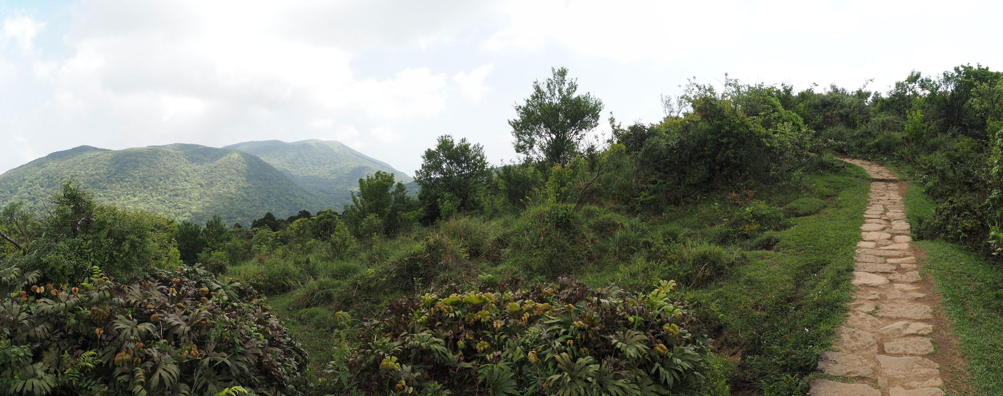
The Dan-Ji trail should have followed the ridge towards Mt. Shitiling (石梯嶺) which now the official stone paved trail follows and then left the main ridge around the current junction where a trail to Mt. Huangzui-shan (磺嘴山) diverges. The Huangzui-shan trail needs a permit to enter because it goes through a protected natural reserve. There is a locked gate for the trail. You will get a number of the combination lock when you get a permit. So we keep on the official trail, going over Mt. Shitiling and down to a large meadow. We go further down to the lowest point just beneath the meadow and have a break at 10:35.
 |
| Going down on a large meadow |
 |
| Junction for Fushi trail |
 |
| Coming out to a meadow in front of Dajian-shan |
Two inconspicuous trails hidden in a forest nearby split here while the official trail goes further south. One of the two trails goes toward north and the other towards southwest down to the valley. They are just narrow dirt paths. Most hikers do not venture onto such dubious trails or even not notice them. We take the one toward north to meet the route of Dan-Ji trail. It traverses on the east slope of Mt. Shitiling. We come to a junction to meet a trail from left. We follow it for a short while and get to another junction. This point must be a place called Shenggongma (聖公媽) at the time. We take a trail branching to right. It leaves the ridge and goes down towards Mt. Dajian-shan (大尖山). We come out onto a meadow at 11:18 where round-headed Dajian-shan stands just over there. This part of the trail is now called
Fushi old trail (富士古道). At the corner of the meadow we have a rest and an early lunch until 12:00.
 |
| Mt. Dajian-shan seen from the meadow |
 |
| Tudigong idol intact |
This meadow should be a point called Fenggushouzhai-wan (風鼓手仔彎, meaning bellows operators turn) at that time. The terrain here looks like a giant bellows: A round peak of Dajian-shan looks like an air container of a bellows. Our trails follows on the mountain side for a short while and plunges into a valley, which brings us to a stone shrine of Xitouwei (溪頭尾) at 12:11. This shrine, though deep in the mountain, is still worshipped. A small idol of Taoist tudigong deity (道教土地公) is inside the moss-covered stone shrine. A incense still sticks out in a pot in front of the deity.
 |
| Going down by a low stone-piled terrace |
 |
| Lujuping |
 |
| Passing the site of abandoned Lujuping village, note terraces on the left |
 |
| Another stream crossing |
The trail now is called Lujuping old trail (鹿堀坪古道). It goes down along Touqian-xi river (頭前溪). We come down to a water stream at 12:42 and cross it onto the right bank. A path diverges to right and goes up. This leads to a stone marker named Lujuping (鹿堀坪). This location must have been a village in the past. There still remain stone-piled walls of the time. The trail goes along the stream and crosses it again to the left bank, where a trail from the Huangzui-shan trail meets.
We came along this trail down to here several years ago.
 |
| Another stone shrine by the trail |
 |
| Going along the old tail |
This river up to this point is popular for river tracing and many people come up to this place. The track gets wider and clearer because these tracers go down along this trail and provide more traffic. We pass by another stone shrine at 13:07. This looks much more primitive with just crude stone walls and flat top without any ornamentation. The river on our right gets deeper down in the valley as we proceed. We find abandoned terrace fields along the trail which now are covered with trees and weeds. Soon after a trail splits left going up at 13:21, another junction shows up. We take right and down to a water fall called Shiche pubu (石車瀑布) and have a nice brake with beer.
 |
| At the water fall |
 |
| Going down Sanshiliukeng(三十六崁) |
After a 25-minute break by the water fall we resume our hike further down. The trail passes such spots called as Sanshiliukan (三十六崁) and Sanzaiwanzai (三載彎仔) and comes out to Choukoupu (圳口埔) where the dirt trail ends. We follow the paved road all the way to Daping road (大坪路) where a lonely bus stop shelter stands. #888 line bus serves only three times a day. Daping is a large plateau that was cultivated to a farm land. We walk along Daping road to a large shrine called Xuenwu-gong (玄武宮) at 14:43 where we have a final break. It gets hot to walk even under the April sun.
 |
| Passing Sanzaiwanzai(三載彎仔) |
 |
| Coming out to Daping road |
 |
| Xuanwugong to have a rest in the front yard of the building |
 |
| Daping primary school |
 |
| Walking in a land development area |
We follow Daping road further down passing Daping primary school (大坪國小) and at 15:03 come to a junction where a wide road leads to a large land development area. An old dirt trail called Neikanjiao trail (內崁腳古道) starts at an edge of the plateau which is located at the corner of this development. We walk along the roads in the empty development area and come to an electric tower at 15:13. The trail goes down by the tower with a steep grade. Stone stairs show up to prove this is indeed an trail of the past. People used to travel this steep trail to connect the two places, one under the plateau and one on the top of it until motorization took over the local transportation.
 |
| Coming out to a family tomb |
 |
| An empty F922 bus is arriving at Kanjiao |
The old trail ends by a large family grave at 15:32. We walk down along Bei 28-2 county road (28-2縣道) to reach Kanjiao primary school bus stop (崁腳國小站). A F922 bus comes just on time at 16:16. A short ride takes us to Wanliqiaotou bus stop (萬里橋頭站) where each of us takes his/her convenient line of bus like #1815 or #1068 back to Taipei. I myself wait for a few more minutes and take #923 line back home.
-----------------------------
We walked 13 kilometers for 7 hours and 15 minutes including rather long breaks. The ascent is just 332 meters in total while 932 for decent. This is basically a downhill hike. The route physical index is 21, rather an easy one. It is fun to walk along such historical trails like this on a sunny spring day where you meet no other hikers.


0 件のコメント:
コメントを投稿