 |
| 熊野古道大門坂 Kumano Kodo Daimonzaka |
熊野古道は、平安時代から紀伊半島の熊野神社三山詣のために歩かれた道である。現代では、自動車道に拡張変更されたところも多いが、まだ当時の様子を保持しているところもある。2004年にユネスコ世界遺産に指定され、その存在の認知が海外に広まり、今や日本人よりも海外からの訪問者が多い。今回、台湾の山仲間を連れて四日半にわたり、古道の中辺路を一緒に歩いた。この記事は、その歩いた記録である。
----------
 |
| 全程地圖 map of our entire trip |
熊野古道為自從一千多年前的日本平安時代起,皇族﹐貴族﹐武士和平民為朝聖三處熊野神社而行走的路徑。如今被列為世界遺產,不單本國人而且外籍人士嚮往此古道群。我們在此次的古道行中遇到好多外籍人士,而且比本國人還多的。
 |
| @新宮速玉神社 Shingu Hayatama Shrine |
所謂熊野古道涵蓋
幾條啟程於不相同出發點的路徑,而最終都通到熊野三山(處)神社:熊野本宮大社、新宮速玉大社以及那智大社。現近被認定的古道有小邊路、中邊路、大邊路,紀伊路、伊勢路和大峯奥駈道。在此幾條路徑裡,中邊路曾是皇族和貴族從京都出發由紀伊路到紀伊田邊後,往熊野本三山行進於山中的路徑。它保留較多的原始型態,可說是較有代表性的路徑。如果要走所有的路徑,恐怕需要好幾十天的時間,不過走中邊路中之有特色的路段,就能體驗古人走的路徑且欣賞古道的精髓。
 |
| 世界遺産石碑 Monument of World Heritage |
以上的理由,我選出下列中邊路中之路段,費時四天半的時間走完,就如古人朝聖一樣造訪了所有熊野三山神社:
1. 龍尻王子 - 近露王子:自紀伊田邊起到龍尻王子止的路段今日大部分轉為公路,而自龍尻王子起的路段才行進於山中森林中的原始路徑,經過一處山中聚落。整體來說可體驗山中的中邊路之精髓。古道上的所謂王子是指小神社。
 |
| 瀧尻王子 Takijiri Ohji |
2.小廣峠 - 發心門王子 - 熊野本宮大社:從小盆地的近露又進入山中,為整體的時間安排上自近露王子啟程會太趕路,因而設計從小廣峠起步。不過當天早晨下雨,因此我們搭巴士一直到發心門王子才起步走去熊野本宮大社。此段是整條中邊路段中,算是踏入本宮神社的聖神領域,且最多人走的觀光路線,所以不能錯過的。
 |
| 發心門王子 Hosshinmon Ohji |
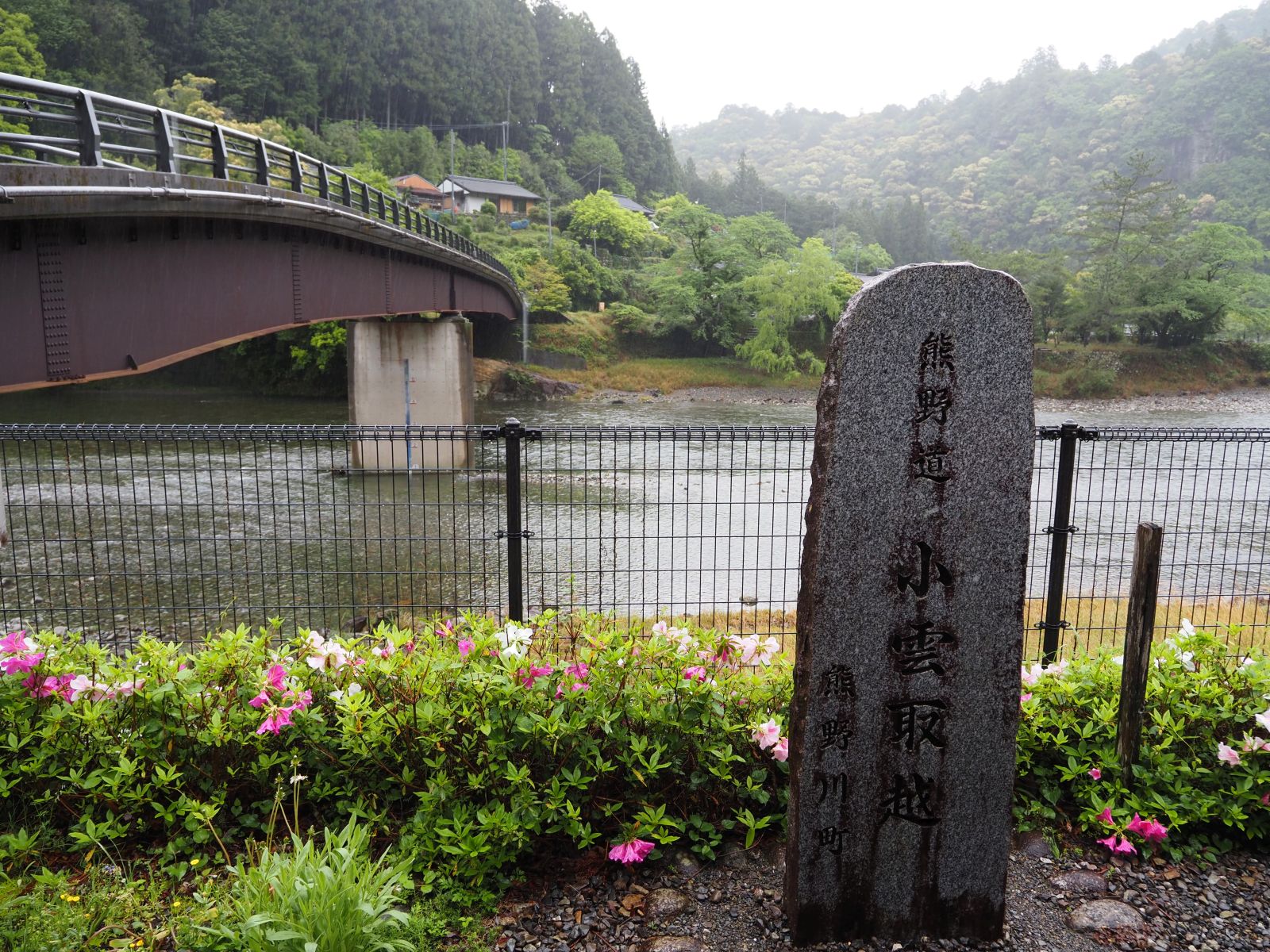
3.小和瀨 - 小雲取越 - 伊勢路 - 志古:從本宮大社有兩條路線可去其他兩處神社,一條是經由小雲取越和雲取越走去那智大社,另一條則是搭小舟沿著熊野川下去新宮速玉大社。一天內走完小雲取越和大雲取越去那智可太累,我只選小雲取越路段,也故意從小和瀨出發逆向走,經過百間嵓之後便進入紀勢路小段而體驗另一條少人走的古道。下去志古後,搭乘巴士前往新宮,也沿途可看熊野川。
 |
| 小雲取越百閒嵓 Kogumotorigoe Hyakkenngura Lookout |
4.小狗子峠 - 大門坂 - 那智大社 (那智瀑布):從新宮的濱王子到濱の宮王子止的路段是中邊路中唯一靠海行進的路段。不過此路段包含相當多的公路段,所以我們僅自小鉤子峠起步走到那智大社為止。在自濱の宮王子至大門坂止的內陸路段中,除市野々王子之前的山間小路段外,也走柏油路而前進。大門坂是代表熊野古道的路段,在各種古道相關宣傳中一定出現的情境。
 |
| 大門坂入口 Daimonzaka monoument |
5.神倉神社、速玉大社和濱王子:都是新宮城市內的幾處熊野古道相關之要點,從速玉大社走民宅之間的古道路段至濱王子為止,為半天行程。
 |
| 神倉神社 Kamikkura Jinja |
----------
The year 2024 is indeed a year for Japanese tourism. With a help of weak Japanese currency and diminished interests for destinations in China, foreign tourists flock to Japan and can been seen anywhere on the Japanese soil. Kumano Kodo (熊野古道) where twelve of us hiked is not an exception. As a matter of fact, we came across much more hikers from abroad than Japanese. All members but myself being a Japanese native are Taiwanese, so in fact we added the count of foreign visitors too.
 |
| 熊野本宮大社 Kumano Hongu Shrine |
Komano Kodo is a group of long distance ancient trails that was designated as a world heritage site in 2004. All trails are destined to one of three Kumano Shinto Shrines, to which Japanese people, noble and common, have pilgrimaged since more than a thousand years ago. The three Shrines are Kumano Hongu Shrine (熊野本宮大社) located in the heart of Kiyi Peninsula (紀伊半島) and most important of the three, Shingong Hayatama Shrine (新宮速玉大社) by the Pacific Ocean and Nachi Shrine (那智大社) on a mountain.
 |
| 新宮速玉大社 Shingu Hayaama Shrine |
Kumano Kodo comprises of six major routes: Kohechi (小邊路), Nakahechi (中邊路). Ohhechi (大邊路), Kiyiji (紀伊路), Yiseji (伊勢路) and Ohmine Okugakemichi (大峯奥駈道). They are more than a hundred kilometers in length each and it would take a few months to travel all trails. Some of the ancient trails have been converted to motor roads and no longer keep their original status like Kiyiji. Among the six routes, Nakahechi keeps its original tracks and environments better than others. In addition to that, this is the very route that noble people including Emperors in the long past traveled, so it is the route most worth travelling. We picked up several sections of the Nakahechi that would represent the characteristics of the trail and hiked along them for four and a half days.
 |
| 那智大社 Nachi Shrine |
-----------
DAY 0 April 21: Kansai International Airport (関西空港)→ Kiyitanabe (紀伊田辺)
 |
| Kansai Airport JR station |
All but four members who have been around in Japan already met at Kansai Airport. It was two-and-a- half-hour flight from Taipei, which is one hour shorter than to Tokyo. Most of the members arrived around noon by a different flight and came out of the immigration by 13:00. It would be more than twenty years for me to arrive in Japan by this airport since my last occasion. I frequented this airport due to my job at that time.
 |
| Ticket from Airport to Kiyitanabe |
 |
| Inside the train from Wakayama to Gobo |
We went out of the terminal building to the adjacent train station and headed for Kiyitanabe by JR train. The ticketing machines showed only a few vacant seats for women on a next express train. Except three female members who got the express tickets, four of us but bought normal train tickets, which would take us one more hour to get to the destination. It turned out than there were plenty vacant seats on the express train as those female members told us later. Well, it saved us money as the express ticket costs double our 2530 yen ticket.
 |
| Finally at Kiyitanabe |
 |
| Django hostel |
The train from the airport station arrived at Nhineno (日根野) station across the long bridge that connects the man-made airport island to the main land. We changed over to a south-bound train that came in a few minutes. The scenery from the train window was rather drab as it drizzles outside. Our train reached Wakayama (和歌山) at 14:35 for another train that would leave at 15:00. Each train was of few passengers and it was a kind of fun to travel like this. At Gobo (御坊) we had to change to another train that came in a half hour. After the travel on four different trains and three and a half hours we arrived at Kiyitanabe a little after 17:00.
 |
| Bank Beds of Django |
 |
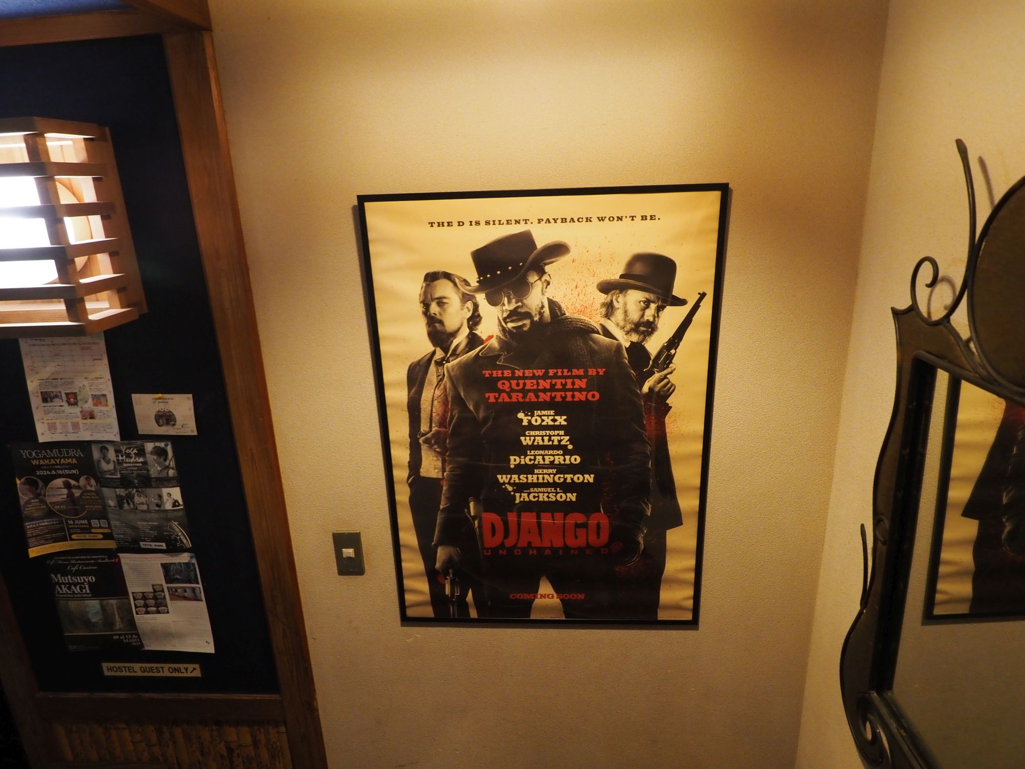
| A poster in the hostel |
It proved that our accommodation Django hostel was just across the street from the station and we got in l 17:10 where the other members had been already in. This accommodation is run by a Spanish guy thus this non-Japanese name. This is an economical bank beds accommodation, which costed us 4200 yen each. This institution has a dinner but not for business today, so we went out for a dinner outside. There are quite a few eating places nearby and we ate at a Japanese restaurant. One of the members who flew by an afternoon flight from Taiwan came in around 21:00 and all 12 members are now ready for our trip tomorrow.
DAY 1 April 22: Kiyitanabe→Takijiri Ohji(滝尻王子)→Michino eki Nakahechi(道の駅中辺路) →Chikatusu(近露)
 |
| Kiyitanabe train station |
It apparently rained hard last night and it still drizzles. We get out of the Django at 6:00 to catch a 6:13 bus bound for Hosshinmon Ohji (発心門王子) in front of the train station. A short queue is formed, most of which are foreign guests. The bus comes on time. It passes through the town and soon get out of it. Later the bus goes along Kurisugawa river (栗栖川) and reaches the bus stop of Takijiri at 6:52. This bus only accepts cash or local bus cards. It takes a little time to change a large bill by a driver-side machine and to pay exact 970 yen, but this is the way of life here.
 |
| Alight at Takijiri |
 |
| Crossing Takijiri bridge |
We are already in mountains. It drizzles here too and mountains around us are shrouded by mist. We cross the river and get to Takijiri ohji srhine. Ohji literally means princes, but here along the Kumano Kodo it is not a prince but a small shrine that was worshiped on the way of pilgrims and provided some resting places for them. It is said that there are ninety nine Ohji's along the Kumano Kodo. Nakahechi route commences from Kiyitanabe and all the way to this spot but most of this section has since been converted to a paved motor road like route #311, along which our bus has come. This is why most visitors start their journey from here.
 |
| Members besides the World Heritage monument |
 |
| O Km starting point |
The Takijiri Ohji's house and surrounding facilities like Torii (鳥居) and Chozuya (手水舎) are all intact. A resting house and a toilet are provided in front of or nearby it for visitors. The large stone monument of world heritage site also stands there. The trail starts by the shrine with a steep uphill grade. The Nakahechi trail leaves the riverside from here and goes through mountains to Kumano Hongu Shrine. The official "O" kilometer post is placed by the shrine.
 |
| Stone paved trail |
 |
| Tainai Kuguri |
The track is covered with stone steps. Kiyi peninsula is one of the most rainy areas of Japan. So they used a lot of stone pavements to keep the track in good shape. We soon pass by Tainai Kuguri(胎内くぐり, meaning passing a womb) and Chichiiwa rock (乳岩, meaning milking rock) on our way up. It was believed that women could get pregnant if they pass through this naturally formed tiny tunnel.
 |
| Milking rock |
 |
| Nezu Ohji remains |
We get into beautiful cedar woods and reach Nezu Ohji (不寝王子) remains at 7:45. This is a small flat clearing in the woods and stands a stone monument only. We keep going up for about twenty minutes and come to a rather flat stretch where the site of Tsurugi Sutra Mound (剣ノ山経塚跡) is pilled up.
 |
| Going up stepped slope |
 |
| Tsuruginoyama Sutra Mound |
 |
| Take the left path to Meshimori-yama |
The trail goes gradually down and a stepped path forks to the left, which leads to the top of Mt. Meshimori-yama (飯盛山, elevation 341 meters). Rain has stopped for a while by now and we can have a view from the top. Mist has been lifting up revealing surrounding mountains one after another. Descending for a short while, crossing a paved road and up again to walk along a ridge. We pass by Harijizo (針地蔵) at 8:58 and Meotojizo (夫婦地蔵, Husband and wife deities) at 9:12. Soon after that we step onto a narrow paved lane and get into Takahara (高原) village.
 |
| A view from the summit of Meshimori-yama |
 |
| Crossing a road and keep going up |
 |
| Harijizo |
 |
| Meotojizo |
 |
| Takahara Kumao Shrine |
We drop by Takahara Kumano Jinja (高原熊野神社) and at 9:30 get to a flat square of nice view. There is a free resting house at its corner and we have a rest there. We have come about one fourth of today's journey. The weather has turned out nice. Terrace rice paddies spread out below the square and we can see mountains across the valley.
 |
| Inside an auxiliary house of the shrine |
 |
| Takahara square |
 |
| Walking through local houses |
After a good rest of a half hour, we resume our hike at 10:04. The trail starts with a ascending paved lane and pass by a couple of local inns. About ten-minute climb brings us into woods of tall cader trees and the trail keeps going up along the mountain ridge. The trail turns level and passes by a pond at 10:36. It then goes up again and passes by Daimon Ohji (大門王子) remains. A small wooden shrine has been erected on the clearing, inside of which sit dolls of an emperor and his wife. They are in fact dolls for girls' festival (雛祭), which cerebrates girls' well-being on every March 3rd, one of Japanese traditions.
 |
| Getting into a cedar forest |
 |
| Daimon Ohji remain |
 |
| Inside the little shrine |
 |
| Juten Ohji remain |
After a while of climb the trail levels off and reaches Juten Ohji (重點王子) remains at 11:37. There a resting hut and a toilet nearby. The trail goes up again passing by Kobanjizo (小判地蔵) at 11:50. We reach Site of Akushiro's Home (悪四郎屋敷跡) 11:55, which is at 711 meters in elevation the highest point of our today's journey.
 |
| Nearby resting hut |
 |
| Akushiro's home |
 |
| Uwatawa Chaya teahouse site |
At 12:24 we pass by Uwataya Teahouse remains (上多和茶屋跡) and then go down all the way. The trail plunges down in a zigzag way, passing the site of Ohsakamoto Ohji (大坂本王) and reaches to a small creek in twenty minutes. It then follows the stream and gets out to Michino Eki at 13:18. This is a resting area for the highway 311. Quite a few visitors are resting by a house that sells local produces and refreshments.
 |
| A long stretch of descent |
 |
| Site of Ohsakamoto Ohji |
 |
| Down to a small stream |
 |
| Michino Eki resting area |
 |
| Local produces on sale |
 |
| Hashiori-touge |
After a good long rest of 45 minutes we get back onto the trail. It goes up again to reach the summit called Hashiori-touge (箸折峠) at 14:21 where Gyuba-doji (牛馬童子) statute is placed. According to the legend, Kazan (花山) Emperor on his first pilgrimage made a sutra mound here. On that occasion he used a pair of straw stems as chopsticks, thus named Hashiori-touge (meaning bending chopsticks). The statute is considered to be his majesty himself.
 |
| Gyuba-doji statute |
 |
| Giant replica of Gyuba-doji at Michino Eki resting area |
 |
| A pavilion on our way down |
We step in our last leg and go down. In a few minutes we come out of woods and stop by a pavilion where a nice view of peaceful Chikatsuyu spreads out in front. We have chat with a young Taiwanese girl who has passed us a couple of times on our way here. The last section is pretty easy. We reach a bridge over Hiokigawa river (日置川) and stop by Chikatuyu Ohji (近露王子) shrine at 15:00.
 |
| A view over Chikatsuyu village |
 |
| Down to Chikatsuyu at last |
 |
| A view of Hioki-gawa River from the bridge |
 |
| Chikatusu Ohji |
 |
| Walking down to our inn |
We walk down a local narrow road to our accommodation Minshuku Chikatuyu (民宿ちかつゆ) by the river. On our check-in we are assigned to four Japanese style rooms. This inn has a hot spring large bath, which proves to be very nice. We have a wonderful dinner at 18:00 at the inn's dining hall. The cost of stay was 12400 yen a person inclusive of dinner and breakfast.
 |
| Minshuku Chikatsuyu by the river |
 |
| Dinner at the inn |
The guests looked all foreigners. The inn keeper told me that few Japanese visitors come nowadays because all accommodations along the trail have been booked way in advance, sometime one year ahead. No wander we come across very few local Japanese visitors. We walked 13.4 kilometers for eight hours including breaks today.
DAY 2 April 23: Chikatsuyu→Hosshinmon Ohji→Kumano Hongu Shrine→Kawayu Onsen(川湯温泉)
 |
| Breakfast at inn's dinning hall |
It is good that it does not rain this morning though the weather forecast looks no good. We leave for the Chikatuyu bus stop at 7:00 after having breakfast at 6:30. Shortly after we reach the bus stop, more and more people have showed up and formed a long queue. A impromptu bus ticket counter stands just by the stop and an agent is selling tickets. This is to shorten the time of paying fare on a bus.
 |
| A long queue for the bus |
 |
| Bus ticket and a slip to show the location of boarding |
The bus shows up on time at 7:23. This is in fact the same service of the bus that we took yesterday from Kiyitanabe to Takijiri Ohji. It has passengers already aboard so the bus is quickly filled up with passengers. As soon as we get aboard, it starts raining again as expected. Our original plan was to walk from Kohiro Touge (小広峠) but it would not be fun to walk along mountain trails in rain. So I decided to skip the section from Kohiro Touge to Hoshinmon Ohji where this bus can bring us.
 |
| Our bus at Hosshinmon Ohji |
 |
| Author at Hosshinmon Ohji |
A few people get off along the way, but most of passengers stay on. Our bus keeps on highway #311 and stops over a few hot spring areas including Kawayu Onsen. It then stops at Kumano Hongu Shrine and climbs to the last stop of Hoshinmon Ohji at 8:47. The bus fare was 1330 yen.
It is still raining. We have cut almost half the original journey so it would turn to be an easy hike. We put on rain ware and start for Hoshinmon Ohji shrine just a few minutes away. The shrine in drizzle feels more tranquil. The sacred field of Hongu Shrine is regarded to start from this point onward. It must have been an utmost joy for those ancient pilgrims when they arrived here after their long journey.
 |
| Hosshinmon Ohji |
 |
| Resting house by bus stop |
 |
| Waking down a narrow paved lane |
We go back to the bus stop and keep on our way along the trail. The first section is a paved road that local people travel. At 9:48 we have come to Mizunomi Ohji remains (水呑王子跡) where we have a rest under a large roofed resting area.
 |
| Mizunomi Ohji |
 |
| Going through woods |
The trail turns to be a more primitive dirt track and goes in woods. It gets out onto a paved road again in about a half hour. A bus stop sign by the road says Kikusui (菊水). We see a few abandoned houses along the way, some of which are pretty dilapidated. It indicates that old residents died out and their children no longer keep living. This is one of the hard issues that the contemporary Japanese society faces.
 |
| Passing by Kikusui bus stop for local residents |
 |
| Going along a rural village, the house below is abandoned |
 |
| A short way up to Fusegami Ohji |
We keep on the paved road for about 10 minutes and climb a little up to a hilltop where Fushiogami Ohji (伏拝王子) used to stand. This location is said to be so close to the sacred Hongu Shrine that one can see it from here. Pilgrims were so awe-struck by the sight that they kneeled down to pray. This is the reason for the name of this shrine. There is a resting hut beside and we have a good rest under the roof. While we are resting a large group of Taiwan tourists come and meet us. This proves that this section of the trail is pretty popular, so even tourists come and walk.
 |
| Fusegami Ohji |
 |
| Rest house by Fusegami Ohji |
 |
| Walking again in woods |
 |
Ancient junction sign:
Left Kimii-tera temple (Nakahechi route)
and Right Koya (Kohechi route) |
The dirt trail goes down in woods to the bottom where Kohechi route from Koyasan (高野山) merges. There is a small hut besides the junction. There was a official checking gate here to scrutinize passing pilgrims and to collect toll in the past. The trail from Hosshinmon Ohji to Hongu Shrinse is basically downwards, but there is a last hill to go over. We finally reach the rear gate of the Shrine at 12:30.
 |
| Final #75 kilo post for Nakahechi between Takijiri and Hongu |
 |
| Kumano Hongu Shrine rear gate |
 |
| Inner gate for the main shrine |
We go into the sanctum and come to the main shrine houses. There are three houses. one large and two smaller ones, and four gates in front of them. They are usually all closed. The legend has it that this shrine was established more than two thousand years ago under the 10th Emperor Shujin (崇神天皇) 's reign. As a matter of fact, these houses are not that old. They were moved from the original site by Kumano-gawa River (熊野川) to this hillside in 1889 after a devastating flood destroyed the shrines.
 |
| All members in front of Kumano Hongu Shrine |
 |
| Main gate of the shrine |
We go down to the main Toriyi gate and further down to Ohyunohara (大斎原), the original site of the shrine. A large Toriyi gate marks its location. It is said that this toriyi is the largest of all toriyi gates of Japan. The original site is located on the spot of three rivers marge and naturally prone to floods. Now thre is no shrines house but stone monuments marking the original location.
 |
| A large torii gate of Ohyuhara |
 |
| World Heritage site |
 |
| Original location of the main shrine |
 |
| A room of Sumiie inn |
After a short trip to Ohyunohara we are back to the bus stop across the street of the Hongu Toriyi gate. We take 14:23 bus and head for our accommodation at Kawayu Onsen, where we reach just before 15:00. Today's inn is called Minshuku Sumiie (民宿すみ家). This little inn has several Japanese stype rooms, five of which we occupy. It does not provide a dinner but a breakfast. The cost is 8850 yen per person inclusive of the breakfast. Today we just walked 7.7 kilometers for three and a half hours.
 |
| Open-air hot spring bath by the river |
Kawayu, meaning river hot spring, is literally a river with hot spring poring out along its river shore. You can dig your own hot bath by the river. It is still early thanks to our shortened journey and we go out for bathing by the river. There is an open hot bath across the river. All members but one go there and enjoy the natural spring until 17:00. We had a dinner by next door restaurant and back to our inn for rest.
DAY3 April 24: Kawayu Onsen→Kowase (小和瀬)→Kogumotorigoe (小雲取越)→Iseji (Banze-touge 万才峠)→Shiko (志古)→Shingu(新宮)
 |
| Travel from south to northeast |
 |
| Breakfast table |
Overcast sky hangs over the valley of Kawayu Onsen. The sky through the window of our inn's dining hall is not promising, though it is not raining. We leave the inn and wait for our bus at Kameya-mae (かめや前) bus stop just next to our inn. The bus comes at 7:00, which brings us to Kamimaru (神丸) bus stop. This is the bus stop to change over to another line of bus to Kowase where we will start our journey today.
 |
| Kameyamae bus stop in front of our inn |
 |
| Alight at Kowaze |
By the time the bus bound for Koguchi (小口) comes around, quite a few hikers are queuing for the bus. The bus finally comes at 7:54. A 15-minute bus ride has brought us to Kowaze. It now drizzles. Everyone takes out rain gears and put them on under the roof of a pavilion by the trail head.
 |
| Trail head by a river bridge |
 |
| Climb by houses |
We start off at 8:30 by crossing over Akagi-gawa river (赤木川), a tributary of Kumano-gawa river (熊野川). The trail soon climbs, passes by a couple houses and enters into a cedar forest. The steep grades have stone-stepped and look slippery with wet surfaces. The forest is pretty impressive as so many upright and straight seeder trees stand side by side.
 |
| Soon into a forest |
 |
| Jizo deity by the trail |
 |
| The trail keeps going up |
Kogumotorigoe route is a part of Nakahechi, which connects Kumano Hongu Shrine and Nachi Shrine by way of mountain ridges. It has a big brother called Ohkumotorigoe ( 大雲取越) route on the south closer to Nachi. As its name implies the latter route is harder to go over. In the early years of pilgrimage, noble people did not pass this route, but by boat along Kumano River. It is said that this route got popular only after the 14th century.
 |
| Having come up to view the river benath |
 |
| Another milepost system for this route |
 |
| A poem is engraved |
 |
| The trail levels off |
 |
| Having a rest at a hut by Sakura Chaya |
We keep on climbing for an hour and twenty minutes to reach Sakura Chaya Teahouse remains (桜茶屋跡). Drizzle has since stopped but mist hangs around and prevents any disntant view. There is a resting hut and we have rest under its roof. There is still a small hump to go over, but we have completed most of ascending by now. At 10:40 we make another break at Ishido-chaya Teahouse remains (石堂茶屋跡). The trail crosses a paved road where the inn keeper has been waiting for us to hand over lunch boxes. Some of us ordered lunch boxes but the catering service did not deliver them before we left the inn, so he has brought them over here.
 |
| Going up in an impressive forest |
 |
| Walking along a ridge top |
 |
| Resting pavilion at Ishidou Chaya |
 |
| Inn keeper delivering lunch boxes |
 |
| Hyakkengura monument |
A small ascent bring us to Hyakken-gura Lookout (百閒ぐら) at 11:52. This is a sole spot for the entire route where you can have a wide view. It is a pity that mist still hides a large part of the scenery, though we can still glimpse how mountainous the terrain is. The route turns downhill from here all the way to where another route to Banze-touge pass forks. We reach the junction at 12:20 and have a lunch break.
 |
| Foreign visitors with a baby |
 |
| All members at Hyakkengura |
 |
| A panorama from Hyakkengura |
 |
| Descending from Hyakkengura |
 |
| Junction for Iseji route |
The trail from here belongs to Iseji route, another route system. As soon as we step in this trail, it is obvious that how few people travel this route. The track is narrow and some sections are moss-covered. It reminds us of the way the trails of Taiwan's less popular mountain trails look like. It goes down to a small creek, cross the creek and up again. Crossing another small stream, the trail gets steeper still and finally reaches its Banze-touge pass 13:23. It took us more than a half hour from the junction.
 |
| Entering Iseji on the left |
 |
| Going down to the bottom |
 |
| Sing of Iseji route |
 |
| Moss covered track in a thick forest |
 |
| Final ascent to the summit |
 |
| Banze touge pass |
 |
| Descending from Banse touge pass |
The trail descent for a while to come to a ruins of abandoned village. Grave stones show up in the cedar forest and soon a solid stone wall blocks the passage. It has a gap between the wall. The entire area is not that steep and it could have hold many houses in the past. We have no idea what it was but obviously there must have been a place for people to live.
 |
| Look like tomb stone |
 |
| Abandoned village? |
 |
| Coming out of the stone wall |
 |
| Walking along a paved road |
After a short rest we go down a little to get out onto a paved road at 14:00. The road goes down a little and passes a site of timber harvesting. At a corner opens a dirt path, which is the track of this Iseji route. It makes a short cut to the paved road, but it must have been an original track. The trail crosses the paved road for a couple of times and down to the bottom of the paved road at 14:36, from which we follow the paved road all the way to Shiko bus stop on the highway #168.
 |
| The dirt trail forks left at the sign |
 |
| Going down a steep trail |
 |
| Coming out to the paved road |
 |
| Another section of dirt trail |
 |
| A steep section |
 |
| Hitting the paved road again |
 |
| Again along another dirt track |
 |
| Steep track continues |
 |
| Finally a flat paved road to go |
 |
| Shiko bus stop on the highway #168 |
We reach the bus stop at 15:00 and in a few minutes comes our busto Shingu. The highway 168 goes down along Kumano river. This section of Kumano river is wide enough for boats to carry people as well as goods. While imagining what was like those noble people were travelling up and down along the river a millennium ago, we reach our bus stop Sinkoseimonmae (新高正門前, meaning the front of Shingu Highschool main gate) at15:38. Our accommodation for two days, Gran Hotel Shingu (グランホテル新宮) is just down the street and we have reached it in a few minutes. The hike today was 12.7 kilometers in distance and 6 and a half hours in time.
 |
| A view over Kumano-gawa river from the bus window |
 |
| Our bus at Shinkoseimonmae stop |
 |
| Gran Hotel Shinguu |
The hotel costed us 10620 yen each for two days including breakfast. The bus fare for Kawayu-Onsen to Kowase was 900 yen and Shiko to Shingu 950 yen each.
DAY 4:April 25: Shingu - Ukui(宇久井)→Kokuji-Touge(小狗子峠)→Hamanomiya-Ohji(浜の宮王子)→Daimonsaka(大門坂)→Nachi Taisha(那智大社)→Nachi Ohtaki water fall(那智大滝)→Shingu
 |
| Walk from east to west |
 |
| Taking a bus bound for Nachikatsuura(那智勝浦) |
We have an early breakfast and leave our hotel at 7:10. After three days of gray and gloomy sky, a beautiful blue sky this morning makes us very happy!! We walked down to a bus stop Hashimoto (橋本) along the highway #42. Our bus came on time at 7:41 and has brought us to Ukuyi just in 16 minutes. On our way here we see the beautiful blue ocean, which makes us forget the last three days of nasty weather.
 |
| Blue ocean on our left |
 |
| Trail to Kokuji-touge |
We walk down along the highway for a while to get onto the trail to Kokuji-touge Pass. The entrance of the pass is just by a housing complex. Once you are in this short section of Kumano Kodo, you are just as if back in the time of hundreds years ago. It takes only a matter of 10 minutes, passing a remain of Kajiyaguchi Chaya Teahouse (鍛冶屋口茶屋) and to reach the summit. The other side of the summit is also short. It passes a house and further down to the highway #42 by the ocean.
 |
| Kajiyaguchi Chaya remain just ahead |
 |
| A beautiful bamboo forest |
 |
| The summit of Kokji-touge pass |
 |
| Descend from the pass |
 |
| Down to the highway by the ocean |
 |
| Ohkuji-touge trail head |
We go along the highway to come to the head of another short over-hill path called Ohkuji-Touge (大狗子峠). We go up a steep trail for less than 10 minutes to reach the summit and down again to the ocean side. The track is not as good as Kokuji-Touge, though. From the other end of Ohkuji-Touge, we walk along the highway. It is not fun to walk along the highway where cars are passing by, but it goes along the coast line which makes it tolerable. After a couple of kilometer walk we leave the highway and get into a small lane, then reach Hamanomiya Ohji at 9:23.
 |
| A primitive track to the summit |
 |
| The summit of Kokuji-touge pass |
 |
| The other side of the trail |
 |
| Walking down the highway |
 |
| Hamanomiya Ohji |
 |
| Michino eki Nachi on the other side |
Before going further, we take a break at Nachi Michinoeki (那智道の駅) resting area, which happens to be by Nachi train station. We buy some food for lunch there and back to Hamanomiya Ohji to take a look around. This millennium old shrine has a large camphor tree by its main toriyi gate. Besides the shrine stands a temple called Fudarakusan-ji (補陀洛寺). It was believed that one can go to Heaven which is supposed to exist at the other end of the Ocean, towards which this temple was built. A small hut by the main temple building holds a miniature boat that was supposed to bring one's soul to the Heaven. |
| Big camphor tree |
 |
| Hamanomiya Ohji shrine house |
 |
| Fudarakusan temple house |
 |
| A boat to "Heaven" |
 |
| Tombs behind the temple/shrine |
 |
| Heading for Nachi shrine by a local lane |
We drop by a small hill behind the shrine where tombs of ancient important persons before leaving for Nachi Shrine at 10:13. The trail is now heading for mountains where Nachi Shrine stands and going along Nachi River. This section of the Nakahechi route has long been converted to paved motor road, so we have to go along the boring section for a while. As we go further down the road, the valley gets narrower.
 |
| A typical rural scene with rice puddy ready for planting |
 |
| Going along Nachi River |
 |
| Ancient stone monuments |
 |
| Entering a forest after crossing the river |
 |
| Entering a forest |
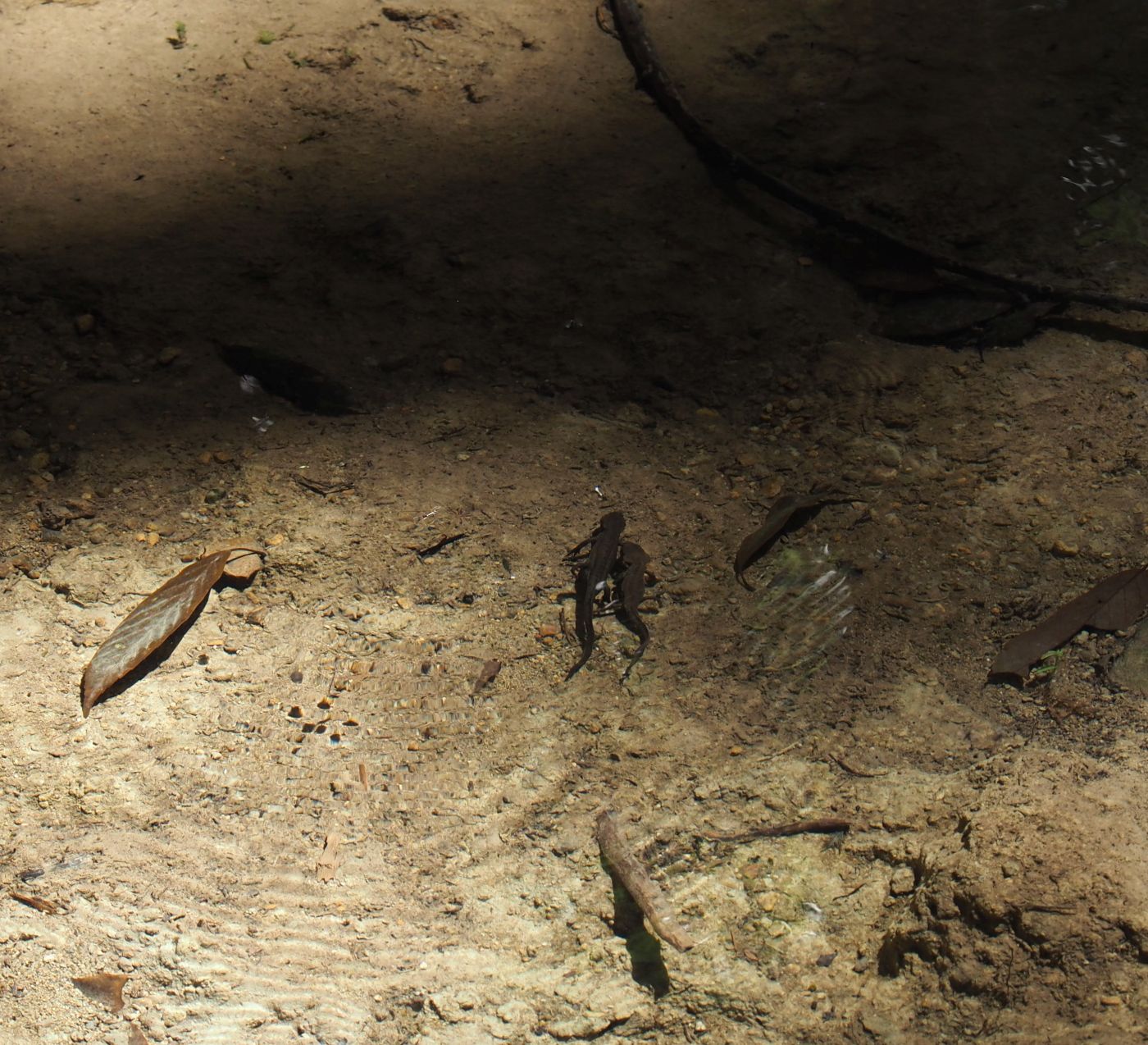
After a half hour walk along the road, we come to cross a tributary of Nachi River, and get into a forest of narrow valley. It is pretty surprising to witness such wilderness just a few hundred meters apart from the busy road. Plenty of water is running along the track and you can see tiny salamanders in a clear water pool. The trail goes up gradually and reaches a flat platform where Amashogun memorial stone (尼将軍供養塔) stands.
 |
| Water is running along the track |
 |
| Walking through woods |
 |
| Passing by a pool |
 |
| Tiny salamanders in clear water |
 |
| Looking down the flat platform |
Amashogun means a female (nun) general, Hojo Masako (北条政子). She was a wife of Minamoto Yoritomo (源頼朝), a general who established Kamaura Government (鎌倉政権) in 1192. After her husband death, she became a nun and was involved in politics assisting her son. She established this monument for her deceased son on her pilgrimage. She did not fight in actual battles but she encouraged her husband's subordinates to fight against enemies. That is why she was called a nun general.
 |
| Amashogun memorial stones |
 |
| Entering a cemetery |
The trail goes down from the monument and exits into a large cemetery on a hillside. We go further down to a paved lane, which leads to Ichinono Ohji (市野々王子). This is a point of about two thirds of our journey in distance today. We eat food that we bought at Nachi Michinoeki for lunch. It is hot by now and everybody gets under tall trees of the shrine for cool shade.
 |
| A view of Nachi valley from the cemetery |
 |
| Ichinnono Ohji |
 |
| Keep walking along the local lane |
At 11:43 we take off for our last leg of today's journey. It is a boring walk as we walk further along the paved lane. We finally gets into the section of Daimonzaka at noon. Daimonzaka is a steep slope of about 600 meters in length with wide stone steps. The entire length of the stretch is covered with tall and thick seeder trees of a few hundred years old. This is so impressive that is can be called "the Kumano Kodo" and that this section is shown on every single advertisement of the trail.
 |
| Almost to Daimonzaka |
 |
| The head of Daimonzaka section of the trail |
 |
| Torii gate to the Daimonzaka |
 |
| Women in ancient cloths by Meotosugi seeders |
This is a must for all visitors to Kumano Kodo. In fact many visitors park their cars at the bottom of the stone stairway of about 600 meters in length and go up on foot. They take a bus down to fetch their cars. As we step onto the section, a pair of women clad in ancient costume come down. There is a rental shop nearby for ancient cloths. Everybody takes time to go up this section. At 13:02 we finally meet and go further up to the shrine, where we reach in another 15 minutes.
 |
| All members at Meotosugi |
 |
| Tafukeno Ohji |
 |
| Old and tall seeder trees in line |
 |
| Tough to climb |
 |
| About two-thirds point |
 |
| Last stretch |
 |
| Another tourists in ancient cloths |
 |
| Top of the stairway |
 |
| More way up to the shrine |
 |
| Main torii gate to the shrine |
This is one of the three Shrines and stands at the highest location of approximately 240 meters in elevation. Our members take some time to look around on their own and gather to proceed to our next destination, Nachi waterfall. We pass by Nachisan Seiganto-ji temple (那智青岸渡寺), an ancient Buddhist temple and go down. The water fall is visible from the distance, which reminds me of my last visit with my friend almost a half century ago.
 |
| All members in front of Nachi shrine |
 |
| View from Nachi shrine |
 |
| Seiganto-ji temple |
 |
| Pagoda and the waterfall |
 |
| Going down to a lower level |
We go further down to a lower level and get into a wide path to the front of the waterfall. The waterfall itself is regarded sacred and a shrine stands in front. In Japanese native Shintoism, everything can have spirit of its own even down to a rock. So why not such an impressive waterfall as this. Massive water free falls for such height, which causes people to feel awe, not to mention ancient people. We go back up to a bus stop and wait for our bus for about a half hour. The bus comes a little after 15:00, which brings us to Nachi station in thirty minutes. We then take another bus back to Shingu.
 |
| Entrance to the waterfall |
 |
| Waterfall and shrine |
 |
| Author |
 |
| Almost back in Shingu |
The bus fare from Shingu to Ukui in the morning was 370 yen while from Nachi water fall back to Shingu (two bus services combine), 990 yen. We walked 12.6 kilometers in about 6 hours and a half.
DAY 5: April 26: Kamikura Shrine (神倉神社)→Hayatama Shrine→Shingu Castle Park→Hama Ohiji (浜王子)
 |
| Walking clockwise |
 |
| Kamikura jinja on the steep hill (in red circle) |
This is our last day to follow the Kumano Kodo. Before taking a train to Misetani (三瀬谷) for our next phase of trip in the late afternoon, we have a whole morning to look around points of interest in Shingu town. We have a late breakfast, deposit our luggage at hotel and leave for our journey at 9:45. Today we will go all way around on foot. Our first destination is Kamikura Shrine perched on a hillside, which we can see from our hotel window.
 |
| Entrance to Kamikura shrine |
 |
| Main torii gate |
 |
| Precipitous stairway |
Twenty minute walk bring us to the gate of Kamikura shrine. It is believed that this was the very place whole Kumano Shrines originated. Its origin dates back much earlier than Shingu Hayatama Shrine and now regarded as a original part of the latter shrine. A large sacred boulder sits on the high cliff, under which now a small shrine house stands. You have to climb a long and precipitous 538 stepped slope to get to the rock. The legend has it that stairway were built under an aid of Minamoto Yoritomo. This place is also designated a World Heritage site.
 |
| Very hard to climb |
 |
| Lenient section of the stairway |
 |
| Picture taken by a local guide |
We climb up the steps and get to the shrine house at 10:28. An old man just next to the shrine is very helpful to take pictures of visitors for them as a volunteer. I exchanged a few words with him. He says that he comes to this place very often to help visitors as he is a tourist guide. On our way back we take a women's route down to the bottom. On such steeply inclined paths, there are often more lenient paths usually called women's path. We take that path down to the bottom after coming down halfway. We get out from the shrine and walk through residential areas down to Hayatama Shrine.
 |
| Sacred boulder and shrine house under it |
 |
| Panorama of Shingu town |
 |
| Going down along women's slope |
The Hayatama Shrine has a large main house and three auxiliary smaller houses. They are all painted in bright scarlet in the same manner as Nachi Shrine. From the shrine we follow Nakahechi route down to Shingu castle. The castle houses and facilities on a hilltop have all long gone. Now remains tall stone walls and steps that were a part of the castle. It is now a park for local people. |
| Passing through residential areas |
 |
| Main gate of the shrine complex |
 |
| Members in front of Hayatama Srine |
 |
| Shrine viewed from its corner |
 |
| Going out from the main gate |
 |
| Follow the sign |
 |
| Shingu castle park |
We buy some food stuff on our way and get to the castle gate a little after noon. A stairway leads up to the large platform where many primary school pupils are having fun. They seem to be on their excursion. We pass through the crown and up to a higher platform where a pavilion stands. A few cherry blossoms still hang on branches by the pavilion. We have a lunch there.
 |
| Gate of the park |
 |
| Going up to the hilltop |
 |
| Open platform |
 |
| Pavilion for lunch |
 |
| A view from a higher level |
We go up to the highest platform after lunch where important buildings once stood. This was a strategic point as you can have a good view over the entire town as well as the mouth of Kumano river and harbor. We keep on our stroll along the Kumano Kodo to visit Asuka Ohji remains (阿須賀王子跡), which we reach at 13:00. This part of Kodo is just a paved lane through residential blocks. Another twenty minute walk brings us to our final point of our journey, Hamano Ohji shrine and then finally back to the hotel to pick up our luggage.
 |
| Panorama towards the south |
 |
| Panorama towards the northwest |
 |
| Asuka Shrine |
 |
| Heading for Hama Ohji |
 |
| Hama Ohji |
 |
| Ocean view on our way back to the hotel |
 |
| Shingu train station |
We leave the hotel for Shingu train station and reach there at 14:40. Our train to Misetani leaves at 15:31. A short two-car train has left on time, thus ending our four and a half day trip of Komano Kodo. This trip gave me a good chance to look back and appreciate the history of my own country Japan, about which I learned as a school student decades ago.


0 件のコメント:
コメントを投稿