 |
| Going down along Datun-xi river (大屯溪) |
This is a record of a hike which took place seven years ago, July 2015. I began writing this article shortly after the hike, but did no complete it. Now that I am not able to go hiking due to my injury for a few months to come, I complete the unfinished record and place it public.
Some friends who joined this hike may no longer stay in Taiwan. No matter where they are now, I hope that this little article could help them recall the enjoyable day along the cool water of mountain. It still vividly comes back to my mind even after all those years.
--------------------------------------------------------
太平洋高気圧が優勢な台湾の夏は、とても暑い。空は晴れて山を登るのには天気の心配が無いが、低い山の尾根道は風が吹かないと、暑くて大変だ。台北付近の山は、標高もそれほどでなく高度による温度差は少ない。そこで、今回は登りを少なくし、沢沿いにくだるという安易な山行である。いままでに、何回か歩いている場所である、気分的にも気楽だ。
今回のメンバーは、自分もふくめて外国人が多い。台湾人でも海外生活が長い。自分の登山グループに参加するメンバーは、時にはこうした混成部隊も多い。陽明山系の小觀音山を大屯山の鞍部から登り、主峰と北峰を過ぎた後、大屯溪古道を下り、一部歩いていなかった燒炭古道の一部をへて北新荘へと出た。やはり熱いため、メンバーの一人は少し熱射病にやられた。幸いしばらく休憩したら回復した。
==================================
 |
| Route of our hike |
 |
| Members at the cabin |
Cool clear water is very refreshing. I scoop water with my both hands and wash my face. Heat of summer in Taipei is oppressive. Even if you go to mountains around the city, you cannot escape from it. Only when you reach cool creeks like one in front of me, you can forget about it for a moment. One of our hiking members today has gotten heatstroke. He feels weak and is resting on a bench near the cabin. He has a wet town over his head. He has recently been back from Canada, and the heat here is getting on him. We just reached this small cabin by a stream after hiking over Mt. Xiaoguanyinshan (小觀音山) and down along Datunxi river (大屯溪). The temperature in the city must have reached as high as 37 degrees in Celsius by this time of a day. Here in the valley is not that high but should be something like 32 or so, still very hot. We have come to this location like this:
 |
| "Anbu" bus stop |
We started from a bus stop of #108 service line called Anbu (鞍部, meaning a depressed point over a ridge of mountains) of Mt. Datungshan (大屯山) at 9:00, 5 hours ago by now. We have nine friends today. Some of them come from abroad (to put it precisely I am also one of them) and stay in Taiwan for some years. The weather was very good and we walked up along a paved road towards the main peak of Mt. Xiaoguanshan. There are many radio transmission facilities on the top of this mountain, like commercial aviation radio tower and military radar camp. This road servers these facilities. The road were winding up between woods, but the sun was directly over us and shone on us mercilessly.
 |
| Climbing under the big sun |
 |
| Telecommunication towers up in front |
A little more than a half hour climb on the paved road brought us onto an open area where many radar and telecommunication facilities were standing. This is the southern edge of a mountain range that runs north all the way up to Mt. Zhuzi-shan (竹子山). On our left found a 的惡valley of Datunxi river (大屯溪) engulfed with a series of peaks on its both sides. Mt. Qixing-shan (七星山) and Mt. Datun-shan (大屯山) stand on the south. The metropolitan Taipei between the two peaks was barely visible under a rather hazy sky. The mountain slopes were almost all covered with waves of thin arrow bamboos (箭竹).
 |
| The valley of Datunxi river |
 |
| Mt. Qixing-shan (left) and Mt. Datun-shan |
 |
| Hiking trail starts just by the tower |
Just at several meters to the end of the road with a facility gate opened our hiking trail. This location was just by a tall steel tower. At 9:48 we stepped onto the trail and went along the right (east) side of the mountain slope, which led us to the summit of Mt. Xiaoguanyin-shan main peak (elevatin 1070 meters) in ten minutes. This was in fact the highest point of our hike today. It was known that the temperature would drop 0.6 degree in Celsius for every 100 meters in attitude, but at this height it would not help much.
 |
| Water running down through several pools |
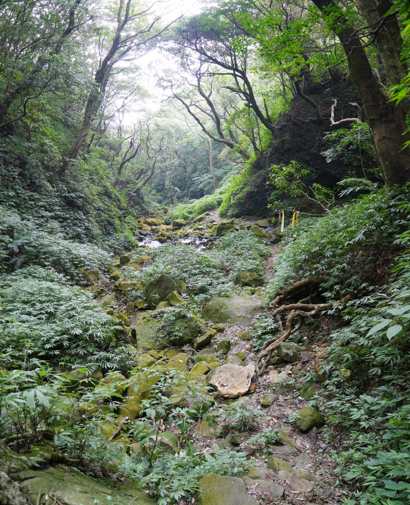
After an hour or so of lunch break, we set off. The trail went down along the stream, crossing it five times from the right bank to the left and back again and finally proceeded on the left bank. Ropes were fixed at each crossing point for easy and safe passing. There were more small crossings over sub streams pouring into the main one on our further way down. At 13:05 we reached a junction where our path to a small cabin diverged to the left.
 |
| A friend washing with cool water beneath the cabin |
 |
| Crossing the last stream |
The cabin looks no longer inhabited. But there are some articles that suggest the owner visits this place sometime. There is a stream just beneath by the cabin where you can get down to wash you hands and faces for refreshing. While we were coming along the Datongxi river, we did not feel much heat. Once we left it and came here along the mountain side, it became definitely warmer. That may well have aggravated our friend's heatstroke.
 |
| Our bus back to Tamshui MRT station |
-----------------------------------
My record shows that we walked about 10 kilometers, mostly descending with only about 200 meters of ascent. It took us 6 hours and a half inclusive of breaks. I have been to the valley of Datunxi river for a couple of times since this hike of July 2015. While we had to have no permission to enter the area on this hike, the Yangmingshan national park now requires a permission to enter. You need to visit
their website and apply for an entry permit in advance.
 |
| Hiking height profile |
The volunteer hiker that I mentioned above is called Jixiang-ge (吉祥哥). He is a real contributor of improving the trail system of Xiaoguanyin-shan. He literarily commuted and still commutes to this area of mountain and keeps maintaining bamboo choked trails. He also opened a few new routes as well. I met him on the mountain several years ago. He was cutting bamboos one by one with a scissors. How laborious it could be!! Thanks to his ceaseless efforts, hikers like us can easily enjoy Xiaoguanyin-shan. The valley of Datunxi river has long been designated as a nature reserve. The recent increase of hikers visiting the area may have brough out a new measure of the national park.
 |
| Latest picture near Anbu bus stop (April 2022) |
Another caution: The paved road up to radar and telecommunication facilities (called 戰備道) now has a steel gate by Anbu bus stop of Bailaka highway (百拉卡公路). The gate may be closed so you would have to go up by other routes like one going by the ruin of mountain house (山之家遺址).


0 件のコメント:
コメントを投稿