三月に訪れた露門山(ルモン山,路門山)を別のルートである西坑林道から登った。山頂に至るには四つのルートがあるが、いずれも遠い。前回は南勢溪側の內洞林道を経て登頂した。今回は桶後溪側でその支流である阿玉溪にそって山中に入っていく西坑林道から登った。前回も今回も11時間を超える行動時間である。本来、この週末はこの山域を一泊二日で歩き、西坑林道をへて下山するつもりであった。ところが、
先週訪れた西阿玉山の山道があまりも状況が悪く、二日の行動に不安があるため、まずはルート確認のために西坑林道を歩き、尚且つ露門山を歩くことにした。結果として、がけ崩れがあるが西坑林道は、現状では重装備でもそれほど大きな問題がないことが確認できた。ルートは別だが同じ露門山なので、今回は英語で記述します。
Mt. Lumen-shan (露門山 or 路門山) of Wulai (烏來) may sound obscure to some readers. With a height of 1461 meters above the sea level it stands at the south of Mt. Dabaoke-shan (大保克山), a well-known peak of Wulai which is clearly visible from Wulai bus terminus and draws a lot of hikers. In terms of distance it is located just less than 30 kilometers from the center of metropolitan Taipei, a similar distance of famous Mt. Beichatian-shan (北插天山), yet very few hikers visit it. It is simply because it would take more than 10 hours of strenuous hike by any one of the four routes to reach its summit and back. It is geographically so close yet practically so distant. You could probably call it the most remote peak of Wulai. It is deep inside the range of mountains and stands amongst them so it is not easy to observe its whole body. It is as if blind men touching an elephant and commenting what it should be like. But one thing is certain - it is not easy to put your feet on its summit.
 |
| A round trip from Xiaoyi of Wulai |
 |
| Location relative to the motropolice |
There are four major routes to reach the summit of Mt. Lumen-shan. One north-west from Naidong (內洞) via Neidong forestry road (內洞林道), one west from
Mt. Bolu-shan (波路山) via the ridge between the two peaks, one north from Mt. Dabaoke-shan and one east from Xikeng forestry road (西坑林道). We had
a hike to the summit from Neidong last March and we made if rom Xikeng road this time. The both of forestry roads have long been abandoned and there are quite a few land slides, big and small, along them, which requires more efforts to go and of course more time, compared with well-maintained roads. Either trail is in fact not so in good shape like those of Qinshan trails of Taipei (台北親山步道) or Yangming-shan National park (陽明山國家公園). You have to have some skills to navigate beaten paths or you would probably get lost.
 |
| At the summit of Mt. Lumen-shan |
--------------------------------------
 |
| At Xiaoyi, the end of Tai 9A highway, Mt.Xiaayu-shan behind |
 |
| At head of Xikeng forestry road |
At 6:00 seven of us gathered at a city center and shared two cars to head for our destination. One-hour drive took us to Xiaoyi (孝義) of Wulai, where Tai 9A highway (台9甲線) ends and Tonghou forestry road (桶後林道) starts. One member came by himself and joined us. The head of Xikeng forestry road is just about a couple of hundred meters away. We set off at 7:06 on Tonghou forestry road. Mt. Xiaayu-shan (下阿玉山) stands just next to our left across Ayuxi river (阿玉溪). Another member is waiting for us at the road head and joins us. We have now nine of us.
 |
| Passing a gap of the road |
 |
| Fallen trees are common |
A first kilometer or so of the abandoned forestry road is pretty fine just as if it were still in use toady. In ten minutes we see a fallen trunk of a dead tree hangs in front, confirming this road indeed out of original use. By now the road surface is covered with weeds except a narrow path between them. At 7:26 we cross a gap where a section of the original road was washed away by flood of water and no recovery work was made. This is a fate of an abandoned forestry road. This kind of land slides can be witnessed at any one of abandoned roads in Taiwan. A couple more of such land slides, fallen trees and rocks show up as we go along. In general the condition can be said pretty good compared with other abandoned forestry roads that I have ever walked. At 8:13 we come to a point where two streams marge (elevation 440 meters). This is about 4 kilometers from the road head. The stream is pretty wide. There might have been a bridge to cross the stream but no trace of it. Typhoon Soudelor of 2015 devastated Wulai area. This spot also must have been damaged so severely that you cannot imagine what it must have looked like before the flood.
 |
| 4K point where two streams merge |
 |
| Going over a large land slide |
After a 10-minute break by the stream we continue on the forestry road. We go up to the road from the stream and soon come across large land slides one after another. You go up to the top of mound of fallen rocks and dirt and down to the road. Ropes are fixed to precarious spots. We go along the road easily for about twenty minutes and hit several land slides again. From the top of them, you can have a view of distance. You can see
Mt. Ayu-shan (阿玉山) and Mt. Xiayu-shan (西阿玉山) at the far end of valley. At 9:26 we see a stone-walled platform on our right. There must have been some facility on it in the past when logging business was here. In a few more minutes we come to Shikeng-qiao bridge (獅坑橋 elevation 650m). It still stands solid over a deep gorge after all those 50 years. We have a rest before our long way up.
 |
| Viewing Mt. Ayu-shan (left) and Mt. Xiayu-shan |
 |
| A small land slide |
 |
| Stone-walled platform by the forestry road |
 |
| Shikengqiao bridge |
 |
| Gorge beneath the bridge |
The road presently called Xikeng forestry road was once a light railway of wagons to carry camphor as well as forestry products in 1920's and 30's which was built and run by Mitsui Corporation of the time (三井物產會社). It is said that there were countless primordial camphor trees in the forest and many camphor distilleries (腦寮) existed in the mountains. The valleys of Wulai were a territory of Atayal tribe (泰雅族) and there were conflicts between the indigenous people and the authority. Just like other areas in mountains of Taiwan at that time, police roads (警備道) and police stations along them were built. The original Ayu police station (阿玉駐在所) was later replaced by the current Xiaoyi station (孝義派出所) . There were no tribe villages along Tonghouxi river valley beyond Xiayi so there was no police station either. Hikers of late 1920's and 1930's followed the light railway and got into the mountains of this area. Decades after we also follow the same route to get into the moutains.
 |
| An old metal sign swallowed up by the growing tree |
 |
| Crossing the first stream |
At 9:50 we set off for Mt. Lumen-shan. The trail first goes along the stream, and down to cross it to the right bank. A grass-covered narrow path goes up a steep hillside. A 10-minute struggle brings us to a flat path and then down to cross another stream. We go along a short but good path which looks like a former logging trail and come to a sign showing our trail to go up. Two members give up to climb and return to the trail head by themselves. The bottom half of this trail is pretty steep. It climbs 300 meters in height for the vertical distance of less than 400 meters, meaning a gradient of 75% or 37 degree! We have a short break around 10:40 and finally reach a point of about 1050 meters in elevation at 11:30 where we have a rest. The temperature is high and no wind, so it is really tiring.
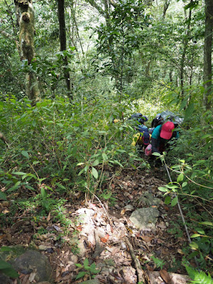 |
| Climbing the steepest section |
 |
| We have come up to a height, Mt. Xiayu-shan across valley |
 |
| Signs at the junction |
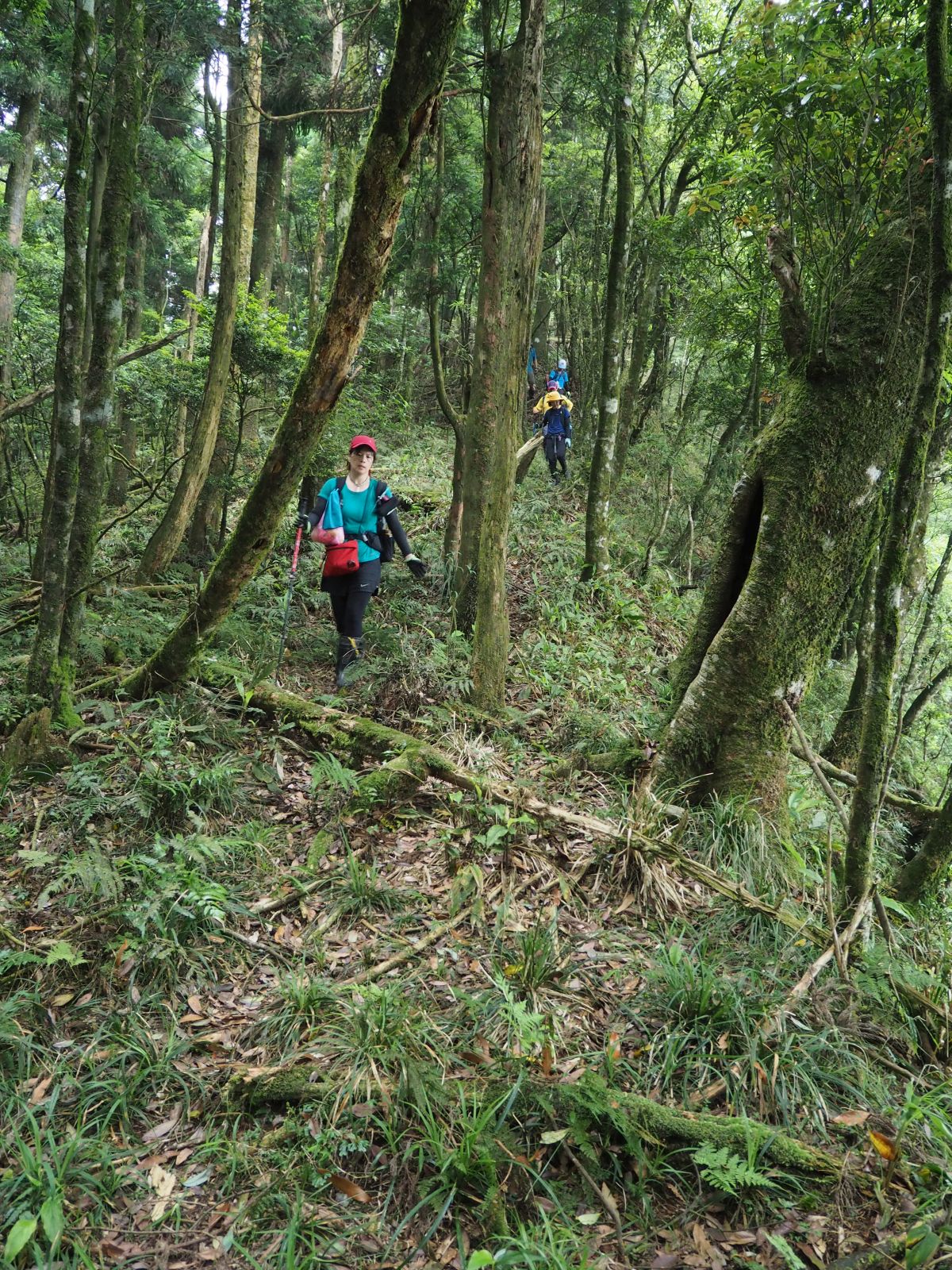
As we keep going up the ridge path we finally feel breeze. It feels good to the sweat soaked body. The gradient is now not that steep and the path goes in a sparsely wooded forest with a little undergrowth. Between the trees we see a view beyond, which proves that we have already come up high. We go up a less steep but long ridge path and reach a junction at 12:29. This is where a ridge from Mt. Xiayu-shan meets. We have a lunch break of 25 minutes by the junction.
 |
| Viewing the main ridge where we will walk later |
 |
| A row of logs for unknown purpose |
 |
| Junction below the summit |
The trail first goes down first and reach the bottom in cedar forest at 13:00. Some logs were put together to form a platform, which we wonder for what purpose. We start climbing and soon enter a primordial broad-leaf forest. At 13:15 we come out to a familiar spot of a junction. This is the last junction before the summit, which we passed last March. A small open space of the summit encircled by shrubs shows up at 13:18. The summit is the same as last visit. The overcast weather is also same. We leave the summit after twenty-minute stay and come down to the junction. It is still before 14:00 and we have more than four hours before it gets dark. So we will not go down the same route we have come, but will take a ridge trail towards Mt. Dabaoke-shan and down to the 4K point of the forestry road.
 |
| Author at the summit |
 |
| Junction to Neidong Mt. Lumen-shan northwest peak and Mt. Dabaoke-shan |
 |
| Depressed field between two humps both sides |
 |
| Passing through a cedar forest along the mountain slope |
 |
| Going small ups and downs |
We take left at the junction. The trail goes down and up again to another junction. The left trail leads to Neidong forestry road and the straight one is to Mt. Lumen-shan north-west peak. We take the right trail. It goes on a broad ridge and down to pass a depressed field with few trees. It then come out onto the right (east) side of the mountain ridge which is covered with cedar trees. This must have been a logging field in the past and the path seems to be one used by logging workers then. Passing moderate ups and downs and finally to a small hump where we have a rest at 14:42.
 |
| Near the junction to the 4K point |
 |
| The upper section is not that steep |
The rest of the ridge section is not much. We go down and up twice and supposedly come to a junction. There is no clear point that a trail diverges though my GPS indicates. We go down a moderately downward path on the sub-ridge. To our surprise we run in to a group of hikers coming up. It is already past 15:00 and they say they will keep on going to Mt. Lumen-shan. They even say that they will go down after dark. It would surely be dark on their way down if they keep doing so. The trail gets very steep after we pass about 1100 meters in elevation. The trail goes in woods with undergrowth of fern. It has just been walked by the hikers we just met and very clear to follow. The more we go down the more cedar forest spreads out. At 15:55 we have a rest at a midway point of our way down (elev. 890m).
 |
| The incline now is pretty steep |
 |
| Going down on fern undergrowth |
 |
| Aiding rope finally shows up |
We go down an ever steep trail and come to the 4K point of the forestry road at 17:00. There is no aiding ropes except the final three spots near the bottom. This trail really makes us exhausted. By the stream we have a final rest with beer! It makes you feel very easy and happy as there is only 4 kilometers of the forestry road which we came along this morning. After twenty-minutes rest we set for the final leg of our hike. The walk is eventless. We reach the head of Xikeng forestry road at 18:24 and the point where our cars are parked by 18:30. By the time we change clothes and leave for home, the sky is getting dark. The total distance we covered is 17.9km, total ascent 1620m, 11 hours and a half to complete. The route physical index is 43, which is almost same as the other route from Neidong last March. Whichever route you take, Mt. Lumen-shan is indeed remote!!
 |
| Finally arrive at 4K point |
 |
| Route comparison, Blue line from Neidong, Red from Xiaoyi Xikeng road |


0 件のコメント:
コメントを投稿