 |
| Mt. Huangzui-shan viewed from Jinshan, building in front is Taiwan university hospital(Nov. 2020) |
陽明山國家公園に属する磺嘴山は、七万年前に噴火した休火山である。山頂は灌木がほとんどなくカヤに覆われている。冬の季節風に晒され樹木が育たない。海側金山や萬里から見上げると、たおやかな山頂をいただく。天気が良ければ絶好の展望台だ。その北東に延びる尾根を追っていくと、赤石六山がある。ちょっと変わった名前の当座は、
実は3年前に登った。当時は草や樹木に覆われ、本来は大坪へ下る予定の変更を余儀なくされ直接下山した。
先月初めに雨の中で歩いた鹿堀坪古道や大坪古道の途中から磺嘴山へ登る道が二つあるが、ともに9月に藍天隊により草刈り整備が行われていた。その道をへて磺嘴山を登頂、もう一つの道を下って大坪古道の峠に降り、そこからさらに稜線を追って、三年ぶりに赤石六山を登頂した。前回の無念を晴らした形だ。磺嘴山は、擎天崗から風櫃嘴へと延びる、陽明山公園のオフィシャルルート途中から往復する登山者は多い。大坪側から登る登山者は、カヤに覆われ道筋すらはっきりしない道を経なければならず、かなり少ない。藍天隊の作業のおかげで、このルートもアクセスがとてもよくなった。一方、赤石六山は相変わらず、不人気山である。峠から一歩赤石六山へと踏み入れると、ほとんど踏み跡がない。マーカーリボンも部分的には少なく、GPSと地形をにらんで方向を定める必要があった。
----------------------------------------
 |
| Travel from south to north |
Mt. Huangzui-shan (磺嘴山 elevation 912 meters), with its massive body, dominates the southern sky line of Jinshan (金山). Swept by winter seasonal northeast gale, the upper body of the mountain has very few trees but is covered with tall silver grasses. This is one of special features of Yanmingshan mountain range (陽明山山區), and this peak clearly represents its characteristic. So the whole mountain range once was called Caoshan (草山, grass mountains). Summits of such mountains are good vantage points on a clear sunny day. The dense grass field is very hard to pass through if trails are covered with grasses. Most of the hikers to Mt. Huangzui-shan come south from Qingtiangang (擎天崗) via an official trail. This route is well kept in shape, while hikers to follow trails north from Daping (大坪) are not that lucky. They have to struggle to find the direction and swim (or dive) through a sea of vast tall grasses.
 |
| On the summit of Huangzui-shan |
Lantiandui (藍天隊) of volunteer hiker group came in Daping this September and cleared two trails from Daping to the summit. This would give hikers a very good chance to visit the peak from Daping. We hiked
Daping old trail (大坪古道) last month, which was also cleared by the Langtiandui, and noticed a trail diverging from the old trail. On this hike we went up to the summit via one of the two trails and down along the other. At the north east of Mt. Huangzui-shan stands Mt. Chishiliu-shan (赤石六山, elev. 462m) and is connected to Mt. Huangzhui-shan via a ridge of small peaks in between. We visited Mt. Chishiliu=shan three years ago. This peak is very little visited and its trails are not good. We had a hard time to get to the summit and had to gave up to continue our way to Daping but to went directly down to its foot. We were successfully pass the ridge route and to the summit of Mt. Chiliushi-shan after coming down from Mt. Huangzui-shan this time.
-----------------------------------
 |
| Mt. Huangzui-shan viewed from taxi on our way up |
 |
| Trail head of Laoliaohu, Huangzxui-shan in far front |
Just like our trip to Daping (大坪) last month, we meet at Wanliqiaotou (萬里橋頭) bus stop at 8:30. When my #1068 bus with three friends on board arrives there, two members out of the total six today are waiting. Also like the last trip, we take two taxies to our starting point of the day. The taxies shortly go up to Daping plateau. When we get on to the edge of the plateau, Mt. Huangzui-shan shows up in front. We pass by a bus stop of Daping where we took left to the head of Luquping old trail (鹿堀坪古道) last month and keep on going straight for our destination this time. Our taxies climb a final and short uphill and reach a junction to Liaoliaohu (老寮湖) tudigong shrine (土地公) at 8:51. The taxi fare to this point is NT$300 each car.
 |
| A notice board of Yangmingshan park |
 |
| Strangely shaped tree by the trail |
We go up a little passing by the tudigong high up on our left and see a sign of Luquping old trail (鹿堀坪古道). This is where we begin our hike today (elevation 435 meters). Mt. Huangzui-shan stands much nearer than when I saw on our way up. This dirt trail must have been an important work path for the local people in the past. We go up along the trail for twenty minutes and come in cedar trees. A notice board of the Yangmingshan park authority states that you are entering an ecological reserve area. You have to have a permit to go in. We applied for it last week and obtained for all of us. There is a quota for the number of daily entries. You will have more chances to get it for weekdays.
 |
| A junction of old trail to Mt.huangzui-shan |
 |
| Top of the mountain over grasses |
Getting out of cedar trees we keep on our ascent for another twenty minutes to reach a junction at 9:36. A trail diverges right to Mt. Huangzuishan. The left trail goes down to meet a trail going along Touqianxi river (頭前溪). We take the right one to keep ascending. In a few minutes we come into a silver grass field where we can see the top of the mountain. We again go into woods. A low stone wall lies long on a rather flat field with flimsy bushes. This must have been piled up by local people in the past for some use, which we cannot figure out.
 |
| A low stone piled wall |
 |
| Steep climb in woods |
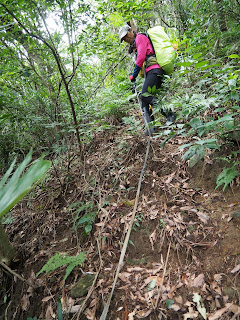
The trail traverses flat along the hillside for some time and changes its direction for a steep uphill. At 10:03 we get out of woods and see a vast grass field. The work of Lantiandui group is obvious. A single path cut out of tall grasses leads upwards in front of us. As we are out of woods, a wide view of landscape spreads over a sea of grasses under a cloudy sky. Another twenty-minutes climb brings us up to the edge of the mountain which circles around a depressed center of the resting volcano. It is said that Mt. Huangzui-shan exploded Seventy thousand years ago.
 |
| Getting into grass field |
 |
| A trail between tall grasses |
We take left and go long the ridge to the summit. The path gradually goes up passing patches of small meadows devoid of tall silver grasses. We reach the summit (elev. 912m) at 10:39. A large flat summit is encircled with tall grasses. Standing the edge allows a better view. On the north mountains of Jinshan (金山) and Wanli (萬里) are rolling down to the sea coast. Yeliou (野柳) peninsula is poking into the ocean. You can identify as far as
Mt. Jilong-shan (基隆山) of Jiufen (九份). The Daping plateau reveals its large side at the foot of this mountain. On the other side we can see
Mt. Qixing-shan (七星山) beyond waving grasses of gentle slopes.
Mt. Dajian-shan (大尖山) is very close from here. Even the buildings of
National cemetery of Wuzhishan is visible. This is my third visit to the summit and gives me the best view ever.
 |
| Going down a steep stream bed |
The trail goes down along a rocky stream bed with no water for a while. It leads into a grass filed in a few minutes. At 11:22 we pass by a site of abandoned charcoal kiln surrounded by thin trees. Local people used to come up here to produce charcoal in the past. The trail again gets into a sea of grasses with a steep downhill. Over the grasses we can identify Mt. Chishiliu-shan lying low in distance. We finally come into woods around 11:30. The grade gets flat after another 15 minutes of steep descent. At 11:57 we reach a four-way junction of Daping old trail (elev. 540m) to have a lunch break.
 |
| A old banyang tree |
 |
| Mt. Chishiliu-shan is far and high |
Passing by another shrine with a big banyang old tree (老榕樹) we cross the stream over a bridge. Looking back from the bridge, Mt. Chishilu-shan is already far and high. The road passes by a park of Huangtan community (磺潭社區) on our left. We make a right turn after passing Weiduo-si temple (韋馱寺) with a many luohan (羅漢) statutes in front. We reach the bus stop on Binhai hiighway at 15:53. Mt. Huangzui-shan with Mt. Chishilu-shan in its front stands far over Yuantan-xi river (員潭溪) as if saying goodbye to us.
 |
| Mt. Chishiliu-shan (left) and Mt. Huangzuishan |
-------------------------
Our trip lasted seven hours including rest time to cover a little over 10 kilometers. We descended more than ascended, 951 meters and 524 meters respectively. The route physical index amounts to 21.
Unlike our last visit in November, the weather was OK throughout our activity, sometime sunny and sometime cloudy. The good weather afforded a splendid view from the top of Mt. Huangzui-shan. It is a good hike to climb Mt. Huangzui-shan on a such fine day. Though you have to apply for a permit, it is well worth it. One drawback though: the authority of Yangmingshan national park requires a citizen ID for application, meaning only Taiwan nationals can do it for you if you are not. The paths among tall silver grasses will probably be clogged by fast growing grasses in a few months. Hurry if you want to climb Mt. Huangzui-shan from Daping like us.


0 件のコメント:
コメントを投稿