このブログを検索:山名などキーワードを入れてください

2022-07-12

2016年1月23日 慢集團@基隆槓子寮山 追念活潑的興哥

雨中槓子寮砲台遺址

この山行記録は、台湾の山ですが中国語で記述します。山行としては、短時間で終了しているもので、2013年6月の記録がその全行程をカバーしているので、日本語での記述をご覧になる場合は、そちらをご覧ください。


這篇文章也是過去起筆卻沒完成的山行紀錄。從六月中旬事故受傷之後已過了大約四週了,不過還需要一段漫長時間要療養。我把未完成的幾篇紀錄文檔案拿出來查看,其中一篇就是在雨中走基隆槓子寮山的慢集團活動。我曾自2013年6月起大約三年半的期間當領隊幾乎每個月一次帶領慢集團的朋友去爬山。此篇記錄也是其活動中之一。慢集團當時每逢周六開團,除非颳大風下大雨,就去爬山。這天的天氣不理想,但六位山友風雨無阻地前來參加此行。從起步的一刻起老天不給面子,一直下雨下到我們離開基隆為止。我們回到台北後,晚間有慢集團的年末聚餐,我前往板橋參加宴會與更多的山友共餐過歡樂時光。

槓子寮山山頂
查看當時相片給我很深刻的感慨是很活潑的興哥已經不在世的事。興哥是慢集團裡很重要的幹部之一。每次的活動行程中他當壓隊,在參加山友多時我與他時時用對講機彼此聯絡控制全隊的進度。後來過三年與幾個山友一起去爬新店小獅山野餐的時候,他與太太前來參加。隔了一段時間沒相見的他看起來瘦了很多,但他帶來有名的自釀梅子酒給大家共享。之後沒多久聽到他訃聞,記得懷著凝重的心情出席他喪事。沒想到癌症的病魔那麼快地奪取活潑開朗的興哥之命。當前我自己在不方便行動的情形下,也許觸發如此的感傷。

此行程地點地圖
槓子寮山是以其砲台古蹟出名的小百岳之一。站在砲台上眼前展開基隆的海洋。灣內的船隻都一目瞭然。基隆港古今都是台灣北部的重要海港。十七世紀西班牙來台佔領基隆在今日的和平島上修築城堡,十九世紀清法戰爭期間法國攻擊基隆等史事就表明基隆港的戰略重要性。等到日治時代初期,在清朝砲台基礎上擴展修築目前所看到的炮台設施。在如此有歷史遺址的地方做健行,不但有走山林的快樂舒適感也能夠了解台灣歷史的一頁,增加活動的意義。我曾在2013年造訪過槓子寮山,走一走參觀砲台等遺址。這次算是二訪。

----------------------------------------------

改建中的基隆火車站
海洋大學公車站
我們七個人搭乘台鐵區間車前往基隆站。電車八點半抵達基隆站剛建好的新月台。基隆火車站正在改建中,由舊站大廳出去走到站前公車總站。槓子寮山豎立於國立海洋大學校園的後方,經過海洋大學正門的公車班次很多相當方便,乘坐公車十幾分鐘,在9:10左右到了海洋大學公車站。天氣不佳一直下著小雨,我們先穿上雨衣,硬著頭皮就踏進雨中。

大學正門附近遠眺後方的槓子寮山和砲台古蹟山丘
登山口
水泥步道
槓子寮山步道,也被稱為龍崗生態步道起始於大學校園深處。我們由大門進入校園走到登山口。登山口有木製平台也有解釋說明板。步道是舖水泥很好走。緩緩上去不到二十分鐘走到稜脊鞍部上的涼亭。前方有條柏油馬路通往砲台遺址,往左(東)去遺址,往右(西)則去槓仔寮山山頂。我們先去砲台遺址走一走。

先去砲台遺址
砲台建築物
山洞斷崖上遠眺八斗子港
砲盤上,左遠方海上是基隆嶼
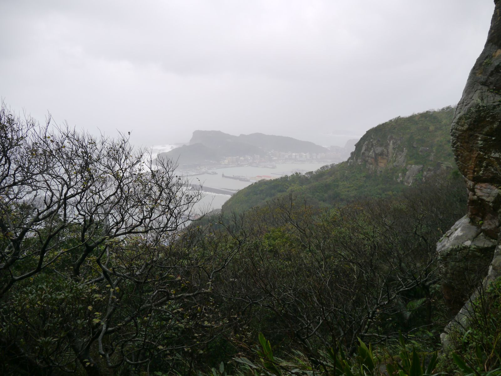
槓子寮砲台遺址,在基隆周圍的幾處砲台遺址中,算是保存最完整的古蹟:營舍、指揮所、碉堡、隧道、彈藥庫等等都還在。鑽進山洞走到面向海邊的斷崖上端,由此看到雨煙中的八斗港。回去砲台古蹟,逛一逛寬大的區內。爬上砲盤區塊,從那裡望得到更廣闊的景色。在厚厚的雨雲下,還能認出瑞芳的山峰群。

砲盤
眺望瑞芳方向
砲台後方走廊
往槓子寮山山頂前進稜線土路
費時大約四十分鐘逛完古蹟區就由原路回去,經過涼亭前方再前進柏油路。走沒多久路旁有通往槓子寮山山頂的土徑口。進入循稜走土徑一下,10:54看到山頂基石(海拔172公尺)。狹小山頂四周都是灌木雜草,沒有遠景可望,只能夠看灌木上的白牆。拍完相片就下山回去登山口,繼續走馬路回涼亭。在如此的天氣下繼續走其他路線不怎麼好玩,我們決定下山去和平島用餐。

山頂上的興哥

山頂上的筆者
槓子寮山登山口
回到鞍部涼亭
下山中
隧道
又由原路下去海洋大學校園,走到大門再越過北寧路進入對面的巷子。巷子底有隧道。順路通過隧道出來,就是原住民文化廣場。旁邊的解釋板表示凱達格蘭族之事蹟文化等,再過去一點有展示原住民相關物品的五層樓展示館。走出來海邊,看到延伸海水中的廢墟,不知原來有何用,也許是修理船隻的船塢、還在站立的牆壁上看到起重機的軌道。

原住民文化區
船塢遺址?
魚市大街魚商
11:51走到正濱路和平橋橋頭,過橋進入和平島魚市大街。路旁的十幾家魚商在賣海鮮,我們進入街上的一家餐廳用海鮮午餐。慢慢用大約五十分鐘的餐,走出店外再過橋,在附近公車站上車回去基隆火車站。我個人搭乘1550線福和公司國道客運回台北,其餘的山友則搭乘台鐵回去。我們回去台北的同一天晚間,聚集在板橋的一家餐廳慶祝年末平安。參加人員是白天山行的山友再加上十幾個朋友,場合相當熱鬧歡樂。我們邊喝酒邊歡談一年來的愉快記憶,不知不覺地店家打烊時間了。
海鮮午餐

晚間餐宴@板橋的南庄餐廳

興哥拍的同時相片

-----------------------------------------------

與興哥共享的最後野餐(2019/1於小獅山)
此趟健行本身只是不到8公里的路程,且爬上去的山峰都不高,整體算很輕鬆。活動時間也只不過是兩小時40分鐘。同一天內聚餐兩次,這卻特殊。查看那些當時的相片,我不禁地發覺光陰似箭。幾年的歲月裡基隆火車站轉為嶄新現代化的面目。想到與我們一起走的快活興哥已不在事,則令人感到歲月的無情。好吧,要緊的是每天要過充實的一天,如此活下去到時才不會後悔吧。希望我的傷勢能夠完成治好,可以像過去一樣與朋友共享走山林的樂趣。為此我想專心去治療。


2022-07-06

2015年7月18日 陽明山系小觀音山-大屯溪古道 Hiking along cool clear water on a hot summer day

Going down along Datun-xi river (大屯溪)

This is a record of a hike which took place seven years ago, July 2015. I began writing this article shortly after the  hike, but did no complete it. Now that I am not able to go hiking due to my injury for a few months to come, I complete the unfinished record and place it public.
Some friends who joined this hike may no longer stay in Taiwan. No matter where they are now,  I hope that this little article could help them recall the enjoyable day along the cool water of mountain. It still vividly comes back to my mind even after all those years. 

--------------------------------------------------------

太平洋高気圧が優勢な台湾の夏は、とても暑い。空は晴れて山を登るのには天気の心配が無いが、低い山の尾根道は風が吹かないと、暑くて大変だ。台北付近の山は、標高もそれほどでなく高度による温度差は少ない。そこで、今回は登りを少なくし、沢沿いにくだるという安易な山行である。いままでに、何回か歩いている場所である、気分的にも気楽だ。

今回のメンバーは、自分もふくめて外国人が多い。台湾人でも海外生活が長い。自分の登山グループに参加するメンバーは、時にはこうした混成部隊も多い。陽明山系の小觀音山を大屯山の鞍部から登り、主峰と北峰を過ぎた後、大屯溪古道を下り、一部歩いていなかった燒炭古道の一部をへて北新荘へと出た。やはり熱いため、メンバーの一人は少し熱射病にやられた。幸いしばらく休憩したら回復した。

==================================

Route of our hike

Members at the cabin
Cool clear water is very refreshing. I scoop water with my both hands and wash my face. Heat of summer in Taipei is oppressive. Even if you go to mountains around the city, you cannot escape from it. Only when you reach cool creeks like one in front of me, you can forget about it for a moment. One of our hiking members today has gotten heatstroke. He feels weak and is resting on a bench near the cabin. He has a wet town over his head. He has recently been back from Canada, and the heat here is getting on him. We just reached this small cabin by a stream after hiking over Mt. Xiaoguanyinshan (小觀音山) and down along Datunxi river (大屯溪).  The temperature in the city must have reached as high as 37 degrees in Celsius by this time of a day. Here in the valley is not that high but should be something like 32 or so, still very hot. We have come to this location like this:

"Anbu" bus stop
We started from a bus stop of #108 service line called Anbu (鞍部, meaning a depressed point over a ridge of mountains) of Mt. Datungshan (大屯山) at 9:00, 5 hours ago by now. We have nine friends today. Some of them come from abroad (to put it precisely I am also one of them) and stay in Taiwan for some years. The weather was very good and we walked up along a paved road towards the main peak of Mt. Xiaoguanshan.  There are many radio transmission facilities on the top of this mountain, like commercial aviation radio tower and military radar camp. This road servers these facilities. The road were winding up between woods, but the sun was directly over us and shone on us mercilessly. 

Climbing under the big sun
Telecommunication towers up in front
A little more than a half hour climb on the paved road brought us onto an open area where many radar and telecommunication facilities were standing. This is the southern edge of a mountain range that runs north all the way up to Mt. Zhuzi-shan (竹子山). On our left found a 的惡valley of Datunxi river (大屯溪) engulfed with a series of peaks on its both sides. Mt. Qixing-shan (七星山) and Mt. Datun-shan (大屯山) stand on the south. The metropolitan Taipei between the two peaks was barely visible under a rather hazy sky. The mountain slopes were almost all covered with waves of thin arrow bamboos (箭竹). 
The valley of Datunxi river
Mt. Qixing-shan (left) and Mt. Datun-shan
Hiking trail starts just by the tower
Just at several meters to the end of the road with a facility gate opened our hiking trail. This location was just by a tall steel tower. At 9:48 we stepped onto the trail and went along the right (east) side of the mountain slope, which led us to the summit of Mt. Xiaoguanyin-shan main peak (elevatin 1070 meters) in ten minutes. This was in fact the highest point of our hike today. It was known that the temperature would drop 0.6 degree in Celsius for every 100 meters in attitude, but at this height it would not help much.

The main peak is just right of the facility
At the summit of the main peak
The ridge to the north peak and Mt. Zhuzi-shan in a far distance
Neatly trimmed trail between bamboos
We kept our way over the ridge to the north peak. A very clear line of trail followed on the bamboo covered ridge. Beyond the north peak  in a far distance stood massive Mt. Zhuzi-shan. When I first visited this place a couple years earlier, the trail had not been that nice. You would have to swim through a sea of tough and unyielding bamboos. Thanks to a volunteer hiker, the trails around Xiaoguanyin-shan had been upgraded and maintained.  The valley on our left was once a volcanic crater, known as the largest one in Taiwan. Now covered with dense vegetation you would hardly recognize that it had been so hundreds of thousand years ago. We would go down into the crater later.

Look back the main peak
Junction of the north peak down to Datunxi valley
Down between tall bamboos
At 10:17 we came to a junction of the north peak to go down into the valley of Datunxi river (大屯溪) and plunged into dense bamboo forest. The bamboos were all taller than a man but fortunately the path was clear between them. One thing good about the dense bamboos was that you could grab them on your steep way down to keep you from slipping. Approximately 15 minutes of unbroken descent led us into a grove of broad leaf trees. At 10:52 our trail merged another path from Mt. Xiaoguanyin-shan west peak (小觀音山西峰) . A wooden direction post #3 (大屯溪古道防迷標誌3號) stood by the junction.

Out of bamboos into woods
Junction of trail down from the west peak
Down to water steam
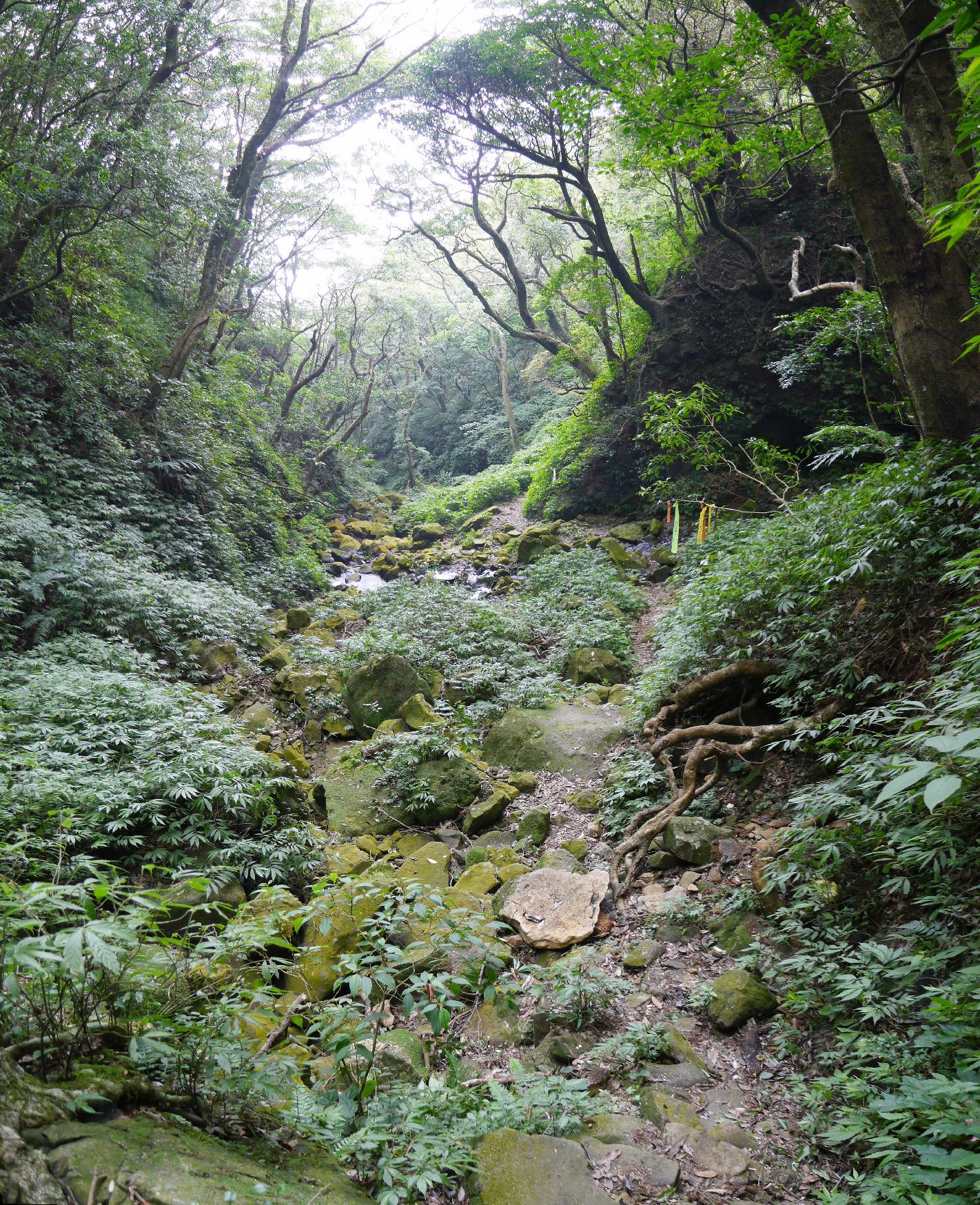
The trail called Datunxi ancient trail (大屯溪古道) was in fact a work path by which local farmers would come up to harvest bamboo shoots. I once met such farmers coming down with a load of bamboo shoots on their back along the trail. As we further went down, sound of water became louder.  At 11:09 we stood by a merging point of two water streams. We crossed water and found a cave just by the stream. It did not look like a natural formation. It could have been one of the trial caves dug during in the 1930s for gold. There were several other such caves in this region of mountain.

Cave opening across water
Going down along Datunxi
Lunch break
The Datunxi trail went along the Datungxi stream. As we wend down, the gorge on our left got deeper and revealed water falls, big and small. After a while the trail got steeply down to the stream side. A nice flat space lay by a pool of clear running water. The time was around 11:30 and we decided to have a lunch break at this cool point.

Water running down through several pools
After an hour or so of lunch break, we set off. The trail went down along the stream, crossing it five times from the right bank to the left and back again and finally proceeded on the left bank. Ropes were fixed at each crossing point for easy and safe passing. There were more small crossings over sub streams pouring into the main one on our further way down. At 13:05 we reached a junction where our path to a small cabin diverged to the left.

Crossing water
Third crossing
Forth crossing
Fifth crossing
Advancing on a left bank of the river
Crossing a small creek
Junction to the cabin
Passing by terraces
We left the river behind and started traversing along the side of a ridge running down from the west peak. This part of the trail is called charcoal kiln old path (炭窯古道). As the name suggests there was a kiln along the path for charcoal production in the past. On our way we passed by a few layers of flat terrace one top on the other and upwards. They must have once been farming fields where people grew crops in old days and left abandoned. At 13:50 we reached the cabin where we are having a long break right now.

A friend washing with cool water beneath the cabin
Crossing the last stream
The cabin looks no longer inhabited. But there are some articles that suggest the owner visits this place sometime. There is a stream just beneath by the cabin where you can get down to wash you hands and faces for refreshing. While we were coming along the Datongxi river, we did not feel much heat. Once we left it and came here along the mountain side, it became definitely warmer. That may well have aggravated our friend's heatstroke.

Final leg of our hike
Tudigong shrine
Walking down along a paved road
Beixinzhuang at last
A half hour rest apparently have helped improve the friend's condition. We leave the cabin at 14:20 for our final destination. The trail goes down a little and crosses a wide stream. We go up long a wide dirt road after crossing. In ten minutes or so we reach the highest point and the road turns downhill and gets pavement soon after. Passing by a Tudigong shrine (土地公), we follow steep paved roads. It is still very hot on a sunny July afternoon like today. It is good that our way ahead is all downhill. At 15:20 Beixinzhuang (北新庄) bus stop comes into our sight. In about forty minutes finds us on a bus bound for MRT Tamshui station (捷運淡水站).
Our bus back to Tamshui MRT station

-----------------------------------
My record shows that we walked about 10 kilometers, mostly descending with only about 200 meters of ascent. It took us 6 hours and a half inclusive of breaks. I have been to the valley of Datunxi river for a couple of times since this hike of July 2015. While we had to have no permission to enter the area on this hike, the Yangmingshan national park now requires a permission to enter. You need to visit their website and apply for an entry permit in advance.

Hiking height profile
The volunteer hiker that I mentioned above is called Jixiang-ge (吉祥哥). He is a real contributor of improving the trail system of Xiaoguanyin-shan. He literarily commuted and still commutes to this area of mountain and keeps maintaining bamboo choked trails. He also opened a few new routes as well. I met him on the mountain several years ago. He was cutting bamboos one by one with a scissors. How laborious it could be!! Thanks to his ceaseless efforts, hikers like us can easily enjoy Xiaoguanyin-shan. The valley of Datunxi river has long been designated as a nature reserve. The recent increase of hikers visiting the area may have brough out a new measure of the national park.

Latest picture near Anbu bus stop (April 2022)
Another caution: The paved road up to radar and telecommunication facilities (called 戰備道) now has a steel gate by Anbu bus stop of Bailaka highway (百拉卡公路). The gate may be closed so you would have to go up by other routes like one going by the ruin of mountain house (山之家遺址).