このブログを検索:山名などキーワードを入れてください

2022-05-20

2022年5月18日 新竹縣尖石鄉那羅山-煤源山 梅雨の合間の山歩き

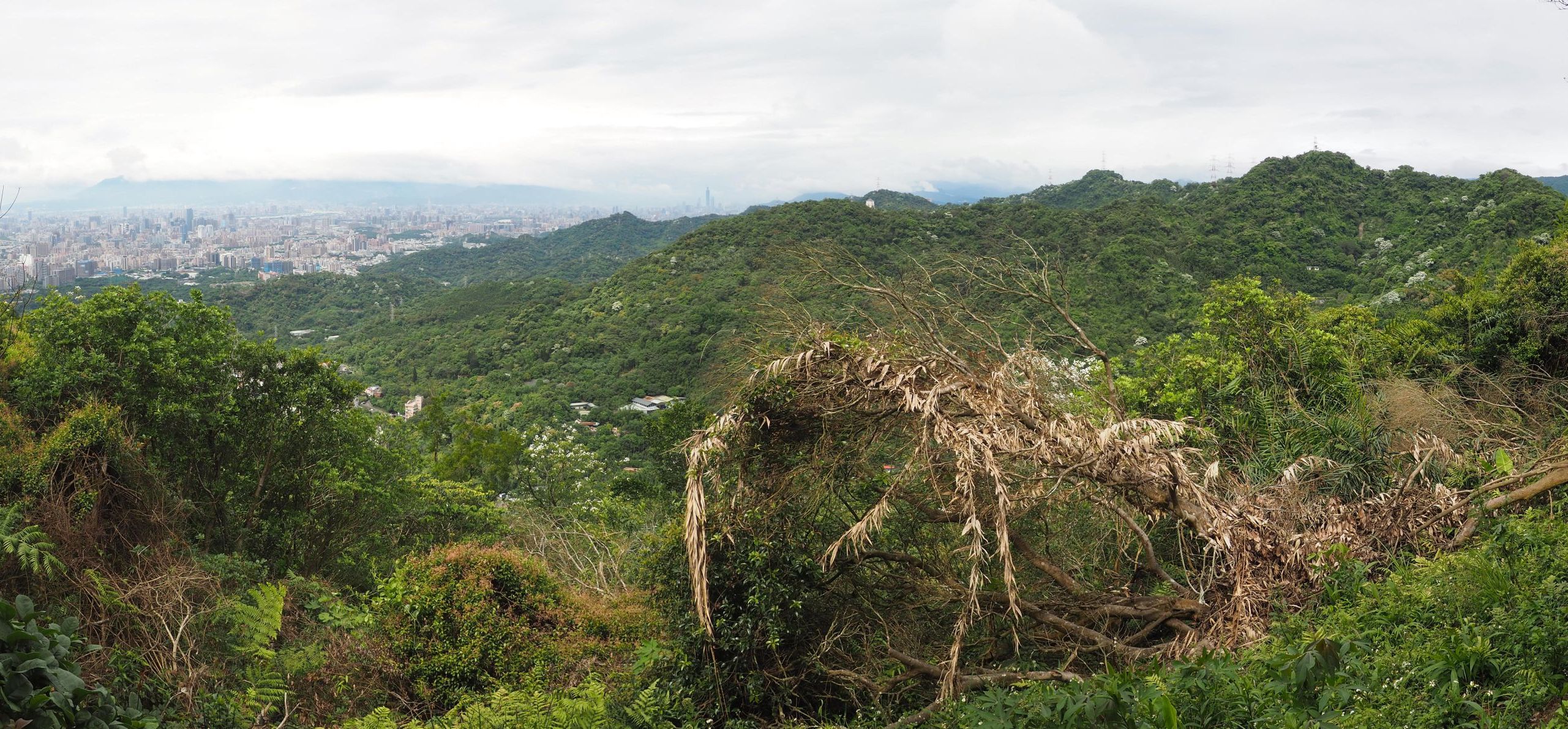
下り道でみる那羅山から 1200峰への稜線、手前にキャベツ畑
5月18日から5日間の予定で中央山脈の中央尖山の登山の予定があった。ところが梅雨の訪れで大雨が予想され、中央尖溪の沢沿いを行くこのルートは大変になる可能性もあるので、中止した。長期の縦走中に雨に遭うのは避けられないが、沢の水が増水してしまうと帰るに帰れない。そんなことで、別の機会に行くことにしたわけだ。

南の那羅村出発点から時計回りに回遊
ルートの相対位置
本来予定期間のうちに天気回復もあり、梅雨の合間の天気を利用して日帰りの登山を行った。台湾は先月から、オミクロンによる感染例が急増し、知り合いの中にも感染者がでるなど、今までに比べてはるかに身近になっている。台湾はワクチン接種率が高まり重症化する確率は低いというが、それでも感染しないことに越したことはない。そんなことで、公共共通機関を避け、少数人数で車で往復した。場所は、昨年訪れた李棟山や大混山の近くである。さらに奥の山々に行くときに通り過ぎる竹60号県道上にある部落那羅からその背後の那羅山から稜線を煤源山へと縦走するものである。車一台なので、出発点へ戻る回遊型にする必要がある。今回のルートは、山道を登り舗装路を下るというものである。

煤源山にて

-----------------------

高速道路から見る大霸尖山とその前衛の山々
那羅部落から見る魯壁山

台北を6時半に出発、一路第三高速で関西インターチェンジへと向かう。朝早いので下り線は空いている。7時10分を回り大溪を過ぎるあたりで左に桃園の山並みが見える。尖った那結山や大柄の南插天山などが並んでいる。数日続いた雨で、空気中の塵が洗い流され透明度が高い。龍潭高原インターチェンジ付近にくると、正面に前衛の山の奥に大霸尖の独特の山頂が現れる。その左右には小霸尖山や東霸尖山へとギザギザのスカイラインが続く。前衛の山は、以前歩いている島田山錦屏山,霞山などの山のようだ。

犬が吠える烏米の家の前を進む

7時20分、関西インターチェンジで降りる。関西の街をぬけ台3線から內灣へと向かう。今まで何度も通っているので、おなじみだ。尖石鄉に入り、油羅溪を渡って竹60号県道を進む。狭い那羅溪峡谷を過ぎると、前方に山並みが連なる。青空に尖って目立つピークは魯壁山だ。まだオープン間もないファミリーマートを見てすぐに、那羅部落に到着、部落内に入り8時、那羅76號民家脇に車を駐車する。台北から1時間半であった。土地の人は親切で、車を停めても構わないという。この場の標高は約610mだ。

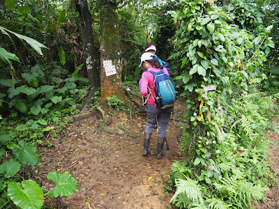
マーカーの後ろから登山道を登る
桂竹林の急坂を登る

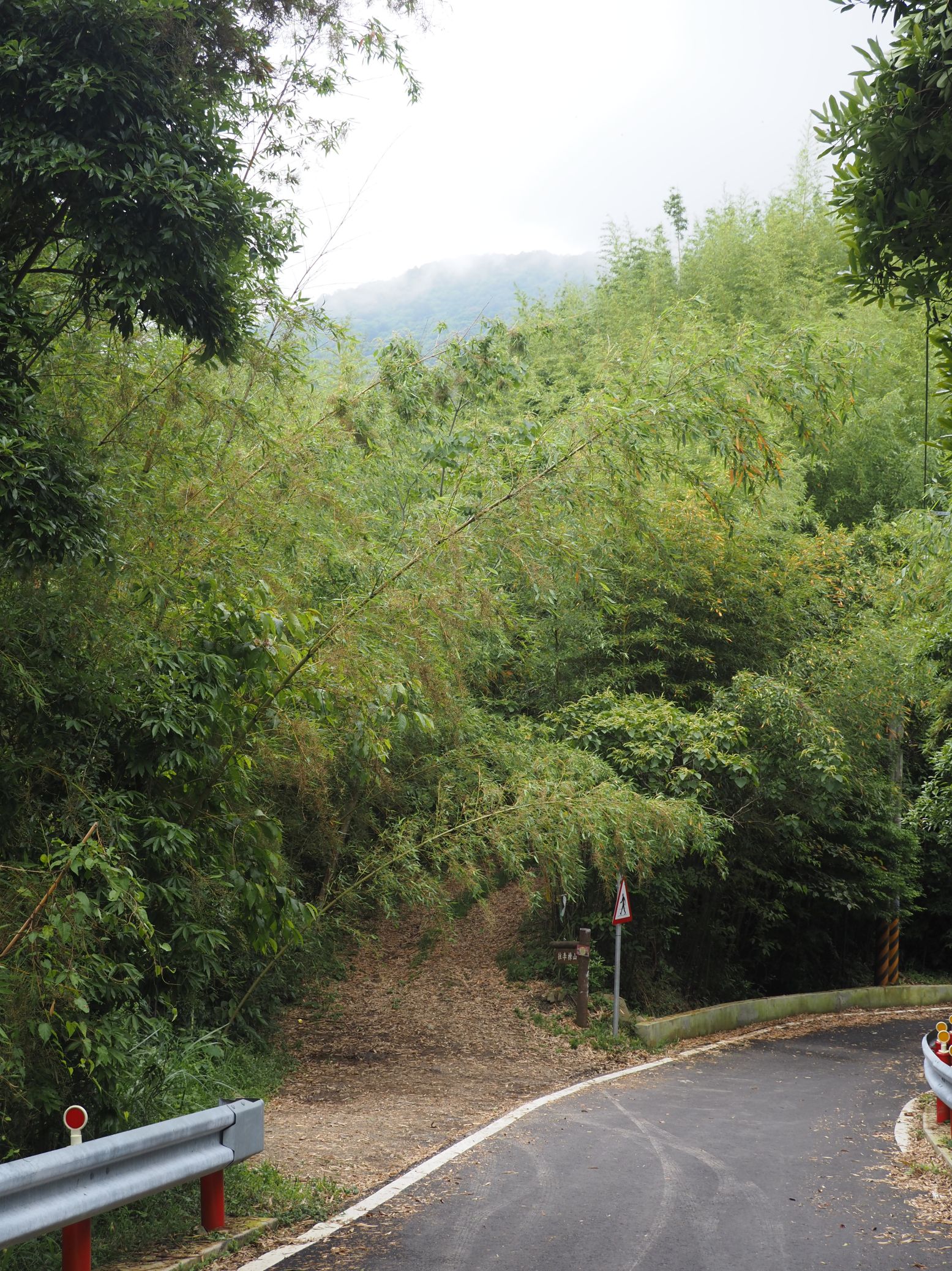
8時10分、支度を済ませ歩き始める。舗装された道を登りはじめ、烏米の家の入口前を進み、8時17分登山口(標高660m)に着く。1157mの那羅山まで約500mの標高差だ。登山口から桂竹林の中をいきなり急坂が続く。道筋ははっきりしている。等高線が立て込むこの坂は、ほとんど平らな場所がない。途中心もち少し緩やかなセクションがあるのみだ。一部切れところがあるが、約20分ほど竹林の急坂をひたすら登り、雑木林に入る。ロープが架かる急坂を登り、8時51分やっと現れた平らなスポットで休憩をとる。

ロープの架かる岩場
少し緩やかになったかと思うと、またすぐに急登である。振り返ると梢の向こうの山がだいぶ低くなっている。9時18分、ロープの架かる岩場が現れる。ちょうど上から二人パーティが降りてきてすれ違う。さらに岩場を過ぎて9時35分、那羅山山頂に到着する。拉洛山とも称される三等三角点のある山頂は狭く、周囲は木々で展望はない。山名は、ともに原住民言語の山名を中国語にあてたものだ。約1時間半のきつい登りだった。

那羅山山頂
山頂にて
稜線には岩が目立つ
9時53分、標高1300mの煤源山への稜線を歩き始める。標高差はそれ程大きくない。途中の上下も一部あるが、大きいものでも100mほどの落差だ。先ほどの那羅山の登りに比べれば楽だ。尾根上には大きな岩が目立つ。道筋もはっきりしている。桃園鐮刀隊というボランティアが前年に道整備をしたという。黄色い根節蘭の花が群生して咲いている。道脇に大きな穴がぽっかり開いている。

根節蘭
道脇の大穴
最低鞍部を過ぎ、道は登り始める。クスノキの大木がある。一世紀前の樟脳生産が盛んだっ頃、このようなクスノキ大木がたくさん原生していたのだと思う。杉の人造林に入り間もなく10時18分、1200峰につく。杉に囲まれていて、ここも展望はない。道が東側に分岐して下る。そのまま下り、密生した竹林に入る。こうした竹林は、踏み跡やマーカーなどがないと迷いやすい。尾根は幅が広がり、道は尾根の西側を進む。陽が当たらないので、薄暗い感じだ。そのうち道は登りはじめ、10時53分少し平らになったところで休みを取る。

クスノキ大木
杉人造林を行く
1200峰
竹林を抜ける
急坂を登る
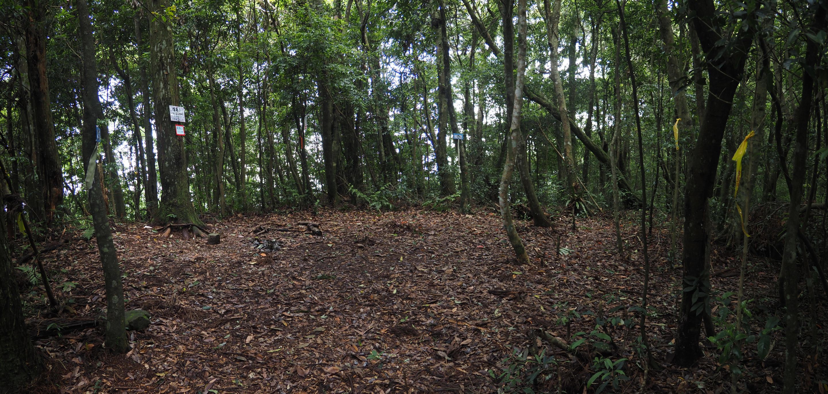
急坂を登り、11時15分1200峰と記されている道しるべを見る。特に際立ったものもない、林間の平らなスポットだ。しばらく緩やかな道を行き、煤源山への最後の登りにとりかかる。きつくなった坂を登ること約数分、左へ比麟山への道を分岐、その先すぐに右へ山腹巻き道を分ける。坂が緩くなり11時40分、樹木に囲まれそこそこ広い山頂が現れる。三角点の脇に焚火あともある。食事休憩をとる。

比麟山への分岐道しるべ
煤源山山頂
起伏の少ない尾根を進む
12時過ぎ、凌空廊道方向から登山者がやってくる。先ほど那羅山ですれ違った二人が、車で凌空廊道へ向かい、そこからやってきたという。12時12分、山を下り始める。すぐに右から巻き道を合わせ、稜線を追っていく。それほど上下はない。思ったよりも距離がある。12時30分、ひょっこり幅のある土道にでる。ここは樹木の苗床のようで、日当たりもよい。前面に展望が広がる。残念なことに、対面の內鳥嘴山や李棟山は、雲をかぶっている。內鳥嘴山は、昨年二度訪れたが、急峻な斜面に囲まれ実に勇壮だ。広い道はすぐに終わり、また森の中の道を行く。坂が終わり、竹林を抜けて間もなく、12時49分凌空廊道に着く。

雲に隠れる內鳥嘴山から李棟山への尾根
凌空廊道に着く
大混山登山口、背後に雲に隠れた山頂
凌空廊道は峠でもある。あずま屋周りには数名の遊楽客がいる。車が数台停めてある。あずま屋で10数分休憩をとり、那羅へ約6㎞の長い舗装路歩きを始める。下ること3,4分で左に大混山への登山口を見る。昨年大混山から下ってきた。普段は、舗装路歩きはつまらなく感じるが、右に先ほど歩いたばかりの那羅山-煤源山の山並みが見えると、そうでもない。変わりゆく対面の山並みや、下りにつれて現れるキャベツ畑や民家など、それはそれで変化があって面白い。平日で交通量も少ない。

谷の対面に那羅山、谷間に那羅部落
下るにつれ周囲の山が高くなる

谷間の民家
0.5K地点の橋を渡る
部落近くから来た方向を望む
那羅村の教会、原住民は信者が多い
道端に現れる0.5㎞ごとのキロポストの数字が次第に少なくなっていくとともに、周囲の山が高くなっていく。14時5分、道脇の水で長靴を洗い、その先すぐに1K標識を見る。14時12分、0.5標識のある橋を渡り、その先間もなく右に分岐する道をとる。橋を渡り那羅村の集落へと進む。歩くこと約10分、教会の上を行き集落に入る。錦屏小学校の前を進み、分岐を右に登る。14時30分、我々の車を見る。これで歩きは終わりだ。

出発点に戻った
地元の子供たち
休憩を含んで6時間20分である。登坂累計834m、11㎞で、コース定数は24だ。那羅山の登りはきついが、それ以外はそこそこで楽しいハイキングである。公共交通手段ではアクセスが大変だが、お勧めのルートである。本来タイヤル族のこの地は、今でも原住民人口が多いようだ。

2022-05-15

2022年5月4日 晩春の天上山 Mt. Tianshang-shan in late spring

登山道の黄色のカーペット Yellow carpet on a trail
天上山は、新北市の中和區から土城區に至る辺地の南に伸びる山脈である。最高峰が標高430の天上山だ。人口密集地に近く、山もそれほど高くない。つまりは都市に近い自然がある場所であり、また市民の憩いの場所でもある。アクセスも簡単である。筆者は、かなり前にほとんどルートを歩いている。その後数年ずっと訪れることがなかった。

今回、ちょうど油桐花の時期なので久しぶりに訪れることにした。全く同じルートでは、面白くないので、少し変化をつけたり下りにとった道を登るなどして歩いた。期待していた油桐花は、時期を過ぎていたようで遠目にみても山肌の白い花は少なかった。また道に散った白い花も、あまり見かけなった。目立ったのは、小さな相思樹の黄色の小さな花や、その他地元民が植えた鑑賞用の花であった。それはそれで、春が過ぎ夏の到来を予告している。天気は曇りで、気温もあまり高くなく楽であった。

-------------------------------------------------

Map of our hike
Tianshang-shan (天上山)  means a mountain of above sky. It is of course up to each person to judge whether this name fits a peak of just 430 meters in elevation. That being said, the peak is the highest point of a mountain range that runs about 20 kilometers south of the densely populated area of New Taipei City, including districts of Zhonghe (中和), Banqiao (板橋) and Tucheng (土城). The mountain range is very close to residential zones, so residents can easily access all parts of the range. It is in a sense a back yard of the nearby residents. Even a whole community has been developed on a nearly the top of the mountain range like Lvyexiangpo (綠野香坡) just next to Mt. Wenbi-shan (文筆山).

Fallen tung flowers
Not high the mountains are, they offer good vistas of the whole Taipei metropolitan and beyond because nothing stands between the mountain range and the flat land below. Every spring brings numerous flowers to this mountain range. One species worth mentioning is Tung flower (Vernicia, 油桐花), of which white flowers come in full bloom in late April through May and covers a large part of mountain green. The fallen flowers cover trails as if white snow covers, so they are called May snow. The Tianshang-shan mountain range holds countless tung flower trees and let us enjoy their white flowers in spring. I visited the place for that purpose more than a couples times in the past.

All members in front of the large stone sing of Tainshang-shan trail
The season of tung flowers this year seemed to have come earlier to Tianshang-shan. By the time we visited on this occasion more than a half of all trees had already lost their flowers and we did not see as much as the past. Instead we saw more of little yellow flowers of acacia trees. This species of acacia trees originates in southern Taiwan and was transplanted throughout theTaiwan rural areas during the Japanese era. The timber of the acacia is good for agricultural tools and furniture, and was used as material for charcoal production. Tung trees on the other hand produce seeds from which oil was extracted for industrial use. This species come from southern China a couple of hundred years ago to Taiwan and was planted at countless locations. It is associated with Hakka people (客家人),  who are known for their diligence. A story goes that tung trees have very strong resilience and endure hash environments, which would represent the characteristics of the Hakka people.

------------------------------------------

Lane 587 of Qingyun street
Since it turned into May this year, we have had more rains. It rained a lot during the labor-day holidays. I fount it raining in early this morning. The weather forecast showed that it should turn OK later, so I decided to go as planned and told my friends so. When I arrived at Banqiao bus terminus (新北板橋公車站)  for a #245 line of bus, 6 friends showed up. A #245 bus came around at 7:40 and we took a ride of it for Qinghuali bus stop (清化里站). Another member happened to be on the same bus and one more member showed up there in a short while, which added up to the total nine of us.

Going up along a winding road in the valley
Trail head
Old ties are reused as steps
We set off at 8:24 and walk along lane 587 of Qingyunlu street (青雲路587巷). A sign post stands just at the lane entrance by a convenient shop. The lane goes through residential buildings for a short while and gets windingly into a valley. The road surface is still wet. In ten minutes we come to a trail head. A brand new direction post with a route map has been installed by it and two new toilet booths stand besides. Old railway ties are reused as steps on the trail. At 8:44 we come up a junction on the ridge. We take a left trail and head for Qingfengling (青峰嶺). White tung flowers are on the trail. We further go up to a narrow top of Qingfengling (elevation 178 meters), which is a small rocky summit surrounded by vegetation 

A platform of Qingfengling
Climbing up
There is a platform just below the summit where two local people are exercising. Some exercise equipment are placed around, which local people brouth up for regular use. In fact you find many such platforms along the trails over this mountain range and other mountains near Taipei as well. The mountains are their backyard indeed. We come down to the original trail and keep going up along it for Mt. Qingshui_dajian-shan (清水大尖山), our next destination. Rain of the past few days made the trails muddy, but stairs made of wood help prevent from slipping. We come up  a viewing deck at 9:00. We are at an elevation of some 190 meters above sea level and this deck affords a wide view towards the metropolitan. Mountains behind the buildings are too hazy for us to make out their skyline.
Planks are used as steps
A good vista from the viewing deck
An old gravestone of year 1823 by the trail
On our way further up we pass two more platforms with a hut built by local people and an electric transmission tower to reach the summit at 9:20. The rather small summit of Qingshui dajian-shan is encircled with trees except a north corner, which arrows a vista over the Taipei basin. At the altitude of 274m, it reveals wider view than the observation deck of a while ago.

Another platform with a hut

Climbing by an electric tower
Qingshui_dajian-shan
Stone steps to go down
A stone paved trail leads down from the summit and branches a trail to the right. We keep on the main trail and down to a paved road where a house stand. The trail takes a left turn by the house and further down to a junction. A name plate indicates that this section of the trail is called Qingshan Lvshui trail (青山綠水步道). It  looks to be maintained by a group of local volunteers. At 9;46 we come to a junction leading to a hilltop called Singapore (新加坡). A nice little garden of flamingo flowers (珊瑚花 or 串心花) runs along the trail. The stone-stepped trail soon climbs steeply along the hillside and gets to "Singapore" flat top in a few minutes. There are two shanties at a corner of the platform and some exercise equipment is placed nearby. I wonder how this place has gotten a name of Singapore.

A nice trail maintained by local volunteers
A trail to "Singapore" with a small garden of flamingo flowers along it
"Singapore" hilltop
Summit of Mt. Niuputou-shan
Take a trail up to Mt. Wujian-shan at a junciton below
A dirt trail on the ridge from the Singapore place meets a stone paved trail. We take right and soon see another dirt trail splits to the left. This muddy trail leads to a summit of Mt. Niuputou-shan (牛埔頭山, elev. 277m). We take this trail and hit the summit in a matter of a few minutes. We then return to the original trail and follow it further. At 10:23 we come to a junction to the summit of Mt. Wujian-shan (五尖山).  A climb on a steep ridge slope for a few minutes brings us to the summit (elev. 310m) of Wujian-shan. A stone marker is placed behind a wire fence, but there is a big opening in the fence and you can get in and have a look of it.

Summit of Wujian-shan
Walking on ridge trail
We follow the ridge trail down to a untidy bottom where trashes are scattered and climb back onto the ridge.  The ridge runs above the community of Lvye Xiangpo. The community area is pretty big with many residential buildings from bottom to top of the hillside. Another mountain range of Mt. Shizitou-shan (獅子頭山) to Mt. Xiongkong-shan (熊空山)  across the valley is seen over the community buildings. The ridge trail further goes up to the summit of Mt. Wenbi-shan (文筆山, 375m) just by an electric tower, which we get to at 11:01.

Community buildings are just under the ridge
Summit of Wenbi-shan
Northward view from Wenbi-shan
A platform under Wenbi-shan summit
A trail keeps going on the ridge to our next destination Mt. Wucheng-shan (五城山), which I traveled a couple times in the past. We do not follow it this time but to go down to Shanzhonghu lake (山中湖) first and climb back to it instead. We take the trail going down. It passes a rather large platform with a good solid hut and carpeted yard with some exercise equipment. From an open side of the platform, a peak of Mt. Qingshui_dajian-shan is visible. We were there only two hours ago. Our stone paved trail goes long way down and branches a trail to the right down to Shanzhonghu lake . We take this trail further down and reach the lake at 11:27. We have a short rest under a Chinese style shelter called Zideting (自得亭) by the lake. 

A view of Qingshui_dajian-shan and beyond
A junction to Shanzhonghu lake
Shanzhonghu lake
Enter a traversing trail from the lake
An intersection on the ridge and we take left here
Steep trail to Wucheng-shan
Shanzhonghu lake, though called a lake, is not that big. Its one side is a fishing bank under a roof. A trail branches off from a road along the lake. We take it and traverse a mountain side. Some sections of the trail are paved with stones. The trail gets onto a ridge coming down from Taijiling (太極嶺) at its lowest point. We take left and climb a steep slope of the ridge trail. We pass bare rocks at some points on our way up. The summit of Wucheng-shan (elev. 417m) which we reach a little after 12:00  has two levels: a small and higher level has a nameplate attached to a tree nearby while lower level is much wider and has a hut and exercise equipment. A tall electric tower stands at the edge of the platform. 

At summit of Wucheng-shan
Lower level of the summit
A final climb to Tianshang-shan
We continue our march further to Mt. Tianshang-shan via a long ridge trail of about 1.5 kilometers. At one point sees a yellow carpet of acacia small flowers with white tung flowers scattered above it. Passing small ups and downs we come to a final climb to the peak of Tianshang-shan. At 12:40 we reach the summit (elev. 430m) without the original wooden deck. Currently a new steel deck is under construction. To our happy surprise vegetation including tall trees has been cut out to make the summit a wonderful vantage point. A 360 degree view spreads out under a cloudy sky. There are many hikers all around on a narrow summit. We leave the summit and down to reach Wangyueting (望月亭) shelter in about 10 minutes and have a long lunch break.

Summit of Tianshang-shan, a new deck under construction
Even large trees have been cut down to secure a wide vista
Wangyueting shelter
Small ups and downs show up one after another
Wangyueting shelter stands on a platform where four trails meet. At 13:40 we follow a trail that keeps going on the ridge. This section of the ridge route passes a lot of ups and downs on bare rocks and reaches a platform called Sanliban (三粒半). The platform also has a shelter built by local people. Our trail goes further down and finally meets a paved road. 
Sanliban platform
Keep going on to Huoyan-shan
We cross the paved road and get onto another trail to go up. Our trail crosses another paved road in a few minutes and leads to the summit of Mt.Huoyan-shan (火焰山, elev. 373m).  An observation deck stands by the summit facing north west. All peaks of today's hike, from Mt. Qingshuidajian-shan to Mt. Tianshang-shan, are there for us to identify.

Viewing deck of Huoyan-shan
Viewing the peaks that we have came across
Going on a short-cut
At 14:40 we start our decent. Our trail is all good of stone paved one with short-cuts of dirt path at some point. Red tromanthe (紫背竹芋) flowers are in bloom on both sides of the trail, attracting our attention. Passing another platform on the way, we come down to a wide trail from Chengtian-si temple (承天寺). This is one of the major hiking trails to Tianshang-shan and should be one of the most traveled. Many hikers are coming up and going down along it. We finally reach the end of the trail with a gate at 15:12. 
Trail gate
Going along Shibixi wooden trail
We wash our dirty boots by a toilet across the street and set off for our final leg along a wooden elevated trail called Shibixi trail(石壁溪棧道) parallel to its namesake  river. The wooden trail goes all way down for about 15 minutes. We then leave the trail and walk along streets among factory buildings to MRT Yongning station (永寧站). We complete our hike at 15:42.


-----------------------------------------------
Tromanthe flowers by the trail 
The hike lasted 7 hours and 20 minutes with all rests included and covered 12.3 kilometers. The total ascent and descent was 722 meters each, all of which calculates the route physical index to be 25. Cloudy sky of today was a forerunner of the Maiyu (梅雨) rainy season that would last for a month or so in Taiwan. It was rather cool during our hike thanks to cloudy sky which would otherwise be very hot under the sun of May.