|
| 界寮縱走友納山山頂 Mt. Youna-shan summit |
人の出会いは、面白いものである。特に10数年山登りをしてきて、特に感じる。それは当ブログを通じたり、また現地で知り合ったり、と過去仕事をしている時とは全く異なる分野の人たちとも交流ができた。表題の山行は、
3月の嘉明湖山行で知己になった若い友人との訓練山行である。筆者は若いころに、年長者から助けてもらったことが多々ある。この年になった今は、それを返す立場になったと思う。
果たして自分が、K2という世界でもまれな困難を伴う8000m峰へ挑むという登山者に、どれだけ手助けをできるのか、わからない。ただ、自分のできる範囲で計画をして、実行した。実は3000m峰登山の計画もし、国家公園の入園許可も得た。しかし、天候の問題で実現しなかった。結果的には、上記の台北近郊での訓練登山だけとなった。訓練なので、休憩も少なく距離も長い。そのため、ほかのメンバーを呼ぶことはなかった。本人は15㎏以上の負荷を追っての行動である。筆者は、日帰り装備なので、もちろん5,6㎏だけではあるが、自分の現在の体力水準を知るためにも、役にたった。
---------------------------
Acquaintance with someone new comes sometimes by chance. Since I stared hiking in Taiwan about 15 years ago, I have become acquainted with many people from different walks of life whom I would otherwise never have met during my career life. That happens through my this blog or at locations of my hiking. One of such people is Hong, whom I met during my trek to Jiaming-fu lake last March. It was just by chance. She was a member of a TV filming team and came to Jianming-fu cabin where I was staying. They came in and we had chat for sometime. When I departed on the second day, she told me that she would like to contact me in Taipei.
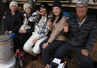 |
| Left person is Hong (Mar 2025) |
She climbed the highest mountain of the world, Mt. Everest in the year 2022. She is going to challenge K2 Peak and Broad Peak of the Himalaya in coming July. With the elevation of 8,611 meters, K2 is the second highest mountain of the whole world and known as a savage mountain, because it is much more difficult to climb. Her late father was a very talented alpinist who influenced her very much. She told me that he wanted to climb K2, so she will make her own and father's dream come true.
She told me that she needs to keep training before she leaves Taiwan in late May. A very good athlete and excellent climber she is, she still needs to keep good fitness for the expedition. For that end she would like to have some help from me. I first felt hesitant because I have never been to any Himalayan mountains nor climbed any mountains higher than Mt. Yushan (玉山) of Taiwan, less than a half of K2 height.
Then I came to realized that as a foreigner (she is a German citizen) in Taiwan, her source of help is rather limited and I may be of some help to her even with a limited experiences of high mountains. When I was young, elder people helped me out many times. At my current age, this is my turn to help young people. I promised to help in a best way that I could. I applied for a permission for a trek to 3000-meter high mountains in the Taiwan national park and got it. But it turned out that the weather was too bad and we gave up. The next best thing was to hike a long distance in mountains near Taipei. The above two hikes are what we did. She carried a load of 15 kilograms or more for training. These hikes were primarily for her training, but in fact it helped me to grasp how my current physical fitness stands as well.
-------------------------
There are three well-known long distance hiking routes near Taipei: Wu-Si trek (五四縱走, Mt. Wufen-shan (五分山) to Mt. Sifen-shan (四分尾山) about 20 kilometers and 1200 meters of total ascent; Jieliao trek (界寮縱走, Mt. Sanjie-san (三界山) to Mt. Jiantan-shan (劍潭山), 26 kilometers and 1000 meters ascent; Yangming-shan East-West trek (陽明山東西大縱走, 24 kilometers and 1800 meters ascent). Hong is familiar with the third route and does it by herself, so I picked up the former two. On the day before the planned Wu-Si trek, the area of the route had more than 120 mm of precipitation, which made me wonder how the trail would be. In order to avoid any unnecessary surprise, I changed it to the nearby and stable Nangang-shan and made a round hike going over the entire range and back with different trails, which still made up 15 kilometers and more than 800 meters of ascent.
April 30, 2025 Jieliao trek route : 10hours 24km ascent 1040m descent 1090m
 |
| From the north side to the city center |
We started from the north end of this route, Jieliao of Jilong (基隆). While you can start from either end, I took this way because we have more escapable routes in case of emergency as we progress into the city center. We headed for Jieliao by a #1815 Guoguang (國光) bus from Taipei and alighted at 6:55 the nearest bus stop (jieliao 界寮站) to the trail head.
 |
| on the way to Sanjie-shan |
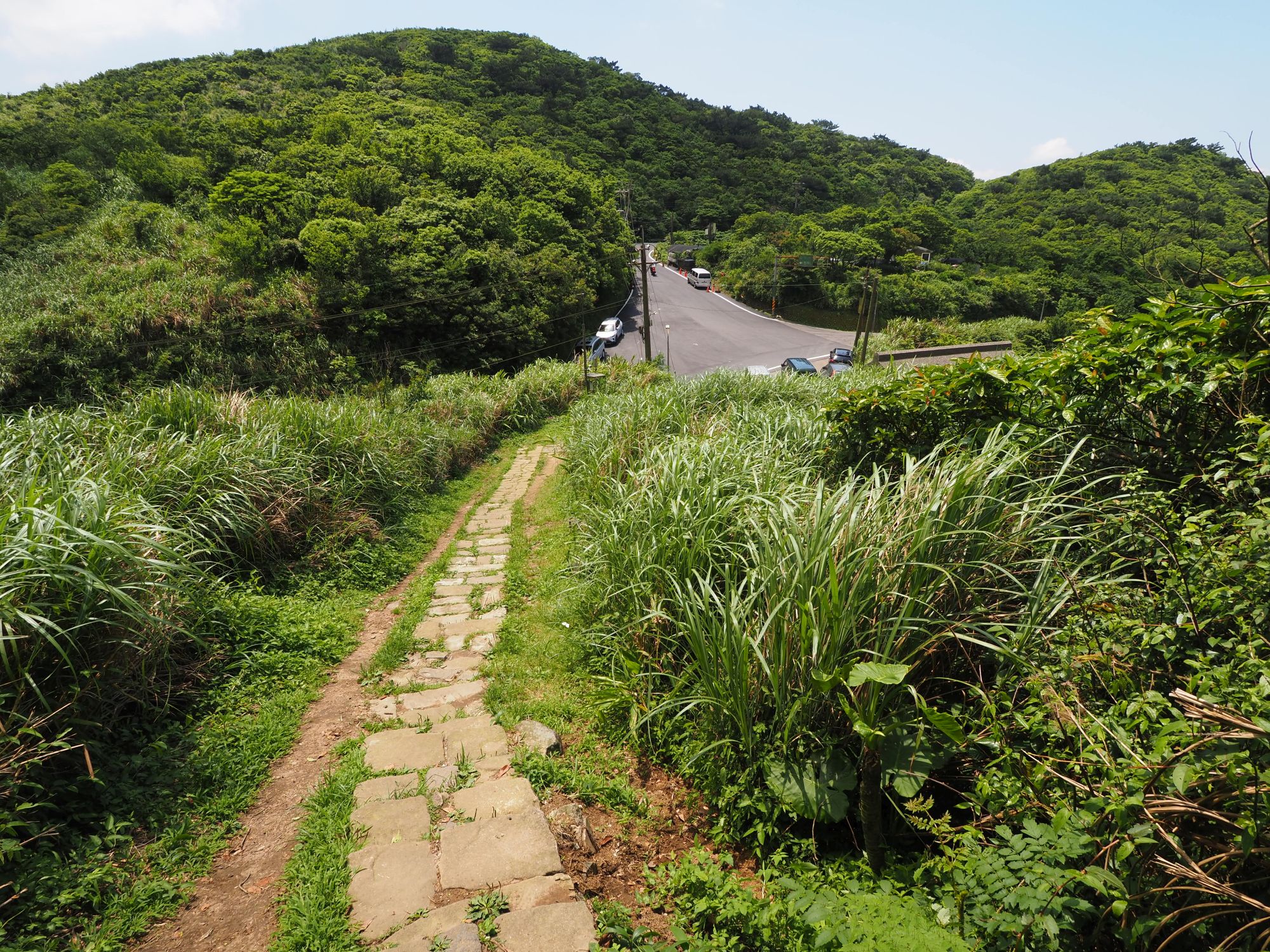
After a short preparation at a nearby temple, we started for our trail head, which is a couple of hundred meters away along the road. Our route is comprised mostly of dirt trails. I was bit warried about the trail condition after long rain, and there were indeed a few muddy points along the way, which however proved no much problem. The trail was pretty clear and easy to follow. Compared with
my first visit to this trail ten years ago, the trail condition is much better. This is because volunteers are actively maintain the trail.
 |
| An ocean view from Sanjie-shan summit |
At 8:07 we reached the junction for Sanjie-shan and further up to its summit (elev. 361 meters). Calm ocean spread behind the lower front hills under morning sunlight. We went back to the junction to followed our route. The trail went along a broad ridge with small ups and downs, and some steep climbs with ropes, to reach the summit of Kaiyanjian-shan (開眼尖山 elev. 411m). We had a short break after 2 hours and a half of walk (5.5 kilometers) up to here.
 |
| At the summit of Qifenliao-shan |
After 10 minutes of break, we went down to a junction where a trail called
Danji historical trail (淡基橫斷古道) crosses over and then up to our next peak Qifenliao-shan (七分寮山 420m), which we reached at 10:26. This summit is just by an electric tower and its maintenance trail comes up to it. We went down this wide trail and jumped onto a paved road, then followed this road for some distance and up again onto the dirt trail on the ridge.
 |
| Back onto the ridge trail |
Our next peak, Youna-shan (友納山, elev. 624m) was a kilometer of climb away. At 11:33 we reached a junction just below the summit and had a rest. It was getting hot and it felt nice under the shade. 25 minutes of break made us refreshed. We stopped at the summit for some pictures and kept on going along the trail. At 12:17 the dirt trail ended at a corner of the huge military cemetery of Wuzhi-shan (五指山).
 |
| A view from the trail towards Yangmingshan. the peak left is Youna-shan |
We passed through the main road of the cemetery and got onto a little hump by the road, the summit of Wuzhi-shan (elev. 681 m), on which a little pavilion stands. We had so far covered 12 kilometers, a half of the entire route. The long walk along the cemetery paved road under the big sun made us (or me at least) feel a little tired. We had a little nap of 20 minutes under the shade and took off refreshed at 13:15.
 |
| Walking in the cemetery |
We further went down along the paved road, passing the cemetery gate and came to a junction with a few shops. Our dirt trail starts at the road side further down. This is a junction of two dirt trails meeting the paved road. We took the left trail to went up to
Meihua-shan (梅花山, elev. 640m). A few minutes of climb brought us to the summit. From here the route is basically descent except two major peaks of
Daluntou-shan (大崙頭山) and Dalunwei-shan (大崙尾山).
 |
| On the way to Bishan |
Passing two named summit of Meihua-shan south peak and
Bishan (碧山, elev. 571m), we have come down to the bottom before climbing back to Daluntou-shan. A little more than 10 minutes climb brought us to the very wide summit (elev. 471m) at 14:37. This is 16km point. The two-thirds of the route has been completed by now.
 |
| Stone paved trail to Daluntou-shan |
A long stepway leads to a paved road at the bottom, which further leads to a dirt trail head for Dalunwei-shan. The electric panel besides showed that the temperature is 21.5 degree. We got onto the wide dirt trail and up to the summit of Dalunwei-shan (elev. 453m) which we reached at 15:27. Standing at 18.1km point from our start, It can be said that the goal is within our reach.
 |
| At Dalunwei-shan |
We again went down the stone steps and kept on descending. Some stretches of the dirt trails show a deep groove. They are the result of inconsiderate motorcyclists who ride into this hiking trail and their tires dig out such a deep groove. This kind of activities must be banned. If they want to ride in wilderness, they must build their own riding fields like other countries where field motorcycling is popular.
 |
| Very damaged trail with a deep groove, tire threads are visible |
We finally came down to a paved Jiannan road (劍南路). This road goes up to a point just below Wenjian-shan (文間山). The normal Jielao trek route goes for the final section of Jiantan-shan. The time was 16:15. If we further went for that way, we might be a little too late for Hong's next plan. Though a couple of kilometers short compared with the original plan, I judged this was good enough. We deviated from the Jieliao trek route and went
down to MRT Jiannan station (劍南站).
 |
| Down to MRT station |
On our final leg down, we passed through a open ridge trail with a nice view. On our left the long stretch of the mountains like Dalunwei-shan and Daluntou-shan goes long way up. It made us realize how long we have come today. We reached the station at 17:10. Our activity time without breaks amounts to 8 hours and 40 minutes. Our average speed of walk was 2.8km/h, which is faster than our normal hiking.
 |
| At the summit of Youna-shan |
May 8, 2025 Nangang-shan round trek : 6.3 hours 15km ascent 880m descent 920m
 |
| Round trip from the west |
Due to the reason I explained above, we changed the place of our training to Nangang-shan (南港山) in the evening of May 7. I chose this location because the entire mountain has good and stable stone paved trails, which should not be affected by the heavy rain and by the time we are on the way back, the dirt trail should be less muddy. The different routes should be less boring than doing the same route for go and back.
 |
| At Xiangshan trail head |
We met at 6:30 MRT Xiangshan station (象山站). The sky looked still gloomy and people around were walking with an open umbrella. We headed for the trail through the park and felt droplets on our way. There were very few hikers at this time of a day.
The first half of today's route is Xiangshan trail(象山步道) and Four-beast trail (四獸步道) that go all length of the main ridge of Nangang-shan and ends at Zhonghua University of Science & Technology (中華科技大學). It passes the highest peak, Jiuwufeng (九五峰), at its halfway point. The second half, our way back, is a dirt trail going over Sifenli-shan (四分里山), Rear-mountain trail (後山步道) and some short sections of the first half. The first and the second half are parallel each other.
 |
| A long stepway to Xiangshan |
Hong told me that she had been doing her training with a heavy backpack along Xiangshan trail for many times. She carries 18 kilograms of load today. We started to climb the long stone stepway at 6:57 and reached Xiangshan summit at 7:14. We then followed the trail and up to the so-called horseshoe platform (馬蹄平台) in another half hour.
 |
| At Xiangshan |
We kept on climbing and reached Jiuwu-feng summit at 8:15. It was till cloudy and the ground was still wet, but the weather was improving. We could make out the skyline of Yangming-shan mountains in haze. The thermometer clipped onto a tree trunk showed 24 degree. At 373 meters in height, this is the highest point on our way and we started our long descent after a short break.
 |
| At Jiuwufeng summit |
 |
| A view over the town |
At 8:56 we have come down to a pavilion by a tudigong shrine (土地公祠) and have a short break. The rest of our decent is eventless and we reached the trailhead by the university at 9:19. The first half, 6 kilometers of stone trails, took us about two hours and a half.
 |
| Pavilion where we had a break |
We went around the foot of the military cemetery hill and got to the campus of Academia Sinica (中央研究院). By the rear door of one building we had a short rest before taking our way back. The distance from the university was about 1.5 kilometers.
 |
| Start our way back from Academia Sinica |
At 10:00 we commenced our way back. Following a short paved road to an abandoned house, we stepped onto a dirt trail. It was still wet at some points but good enough. A first steep rock climb showed up and we got to our first peak, Maocaopu-shan (茅草埔山, elev. 140m) at 10:20. Blue sky spread over us by now and the long range of Jielao trek mountains that we hiked a week before was just there across the town below.
 |
| At Maocaopu-shan summit |
The trail was going along the upper boundary of the cemetery and we could make out the Zhonghua S&T university below which we had passed by a short while ago. We climbed another steep rock stretch and got into a section of tall and thin bamboos. Hong said, "I like bamboos because they remind me of my young days in Vietnam." They were swinging gently in wind and indeed beautiful.
We passed another and the last rock climb, saw a trail diverging down for the stone trail and reached Sifenli-shan (elev. 251m) at 11:06. After a short break on the summit, we went down to meet the stone trail that we walked a while ago, and followed the stone trail up to a junction, where we took a dirt trail on our left.
 |
| Sifenli-shan summit |
There are, in fact, many small trails crisscrossing over Nangang-shan. They are mostly traveled by local people and few hikers know them. Along those trails some cabins and huts are hidden from casual hikers. We followed such trails up and joined the stone trail again just below another junction.
 |
| Back to the stone trail |
We then turned left at the junction and got onto the rear mountain trail. This goes along the south side of the mountain where the slope is moderate. It does not reach any peaks that official stone trail passes. At 12:08 we got back onto the stone trail again, and down to the horseshoe platform.
 |
| Rear mountain tail |
We took a trail towards Miaogaotai (妙高台) from the platform, and down for a while to a junction. We would have to walk a long paved road under the big sun of today if we went for my original plan, so we took right turn, down to the stone trail again and then down to the site of former Hexing mine (和興煤礦) for a lunch break. The last leg was to walk down to Wuxingjie (吳興街) bus stop, where we reached at 13:11 to complete our hike.
 |
| At Hexing mine site |
In total we covered about 15kilometers in 6 hours and 20 minutes (including total 68 minutes of breaks). The average speed excluding the break time is 2.5km/h. Later on the day she told me that she went for running of 11 kilometers and bouldering in the afternoon!
-----------------------
For the K2 challenge Hong has a net funding scheme. I hope that more people would help her: https://gofund.me/ccf22b6f
Hong's own blog Surf-TheGlobe : https://www.surf-theglobe.com/about-me/
On May 11 she won a third prize in a 20-kilometer race of the North Face Challenge. This proves how good a athlete she is. I wonder how much our two training hikes helped her but she is humble and kind to tell me that it did good.
I sincerely wish that she succeed in challenging K2 peak and safely back!! I will keep my fingers crossed for it!!😊