|
| 馬克縱走稜線 Mark traversing ridge viewed from Mt. Manabang-shan |
苗栗縣
馬那邦山は、小百岳に選ばれている歴史的に重要な大衆路線の山である。もう一方の大克山も、その頂上近くに隘勇線時代の砲台遺跡がある、大衆路線の山だ。この二つの山だけをそれぞれ登るのであれば、普通のハイキングだ。この二つの山を結ぶ稜線を縦走するとなると、岩場や梯子や縄梯子の岩壁を登る、経験者向でランクが2段上がる。南北に走るこの稜線は、東側に大安溪が流れる。こちら側は、切り立った地形で岩壁もある。西側は緩やかな斜面が下っていく。いわゆる單面山の地形だ。北側から縦走するときは、左(東)側が切り立った岩壁の上を行くところも多い。
本縦走の活動は、一泊二日の計画で翌日の東洗水山から洗水山への縦走の前奏でもある。前奏といっても、かなりの時間と体力を要求される登山ルートではある。朝早く台北を出発、大湖(西)側の天然湖登山口から馬那邦山を登頂、その後南へ司令山を越え大克山へと縦走し、白布帆登山口へと下山した。メンバーの一人が体調がすぐれないため、少し多めに時間を要したが、それでもこの縦走路は少なくても9時間ぐらいは見る必要がある。我々は8時少し前に歩きはじめ、下山は暗くなった18時50分に白布帆登山口にたどり着いた。休憩を含め都合11時間を要した。
--------------------------------
Mark traversing route (馬克縱走) sounds like an English naming. It is in fact nothing to do with an English name: it is a trekking route between Mt. Manabang-shan (馬那邦山) and Mt. Dake-shan (大克山), so taking one word each from the two peaks to name it Mark traversing. The ridge between the two peaks and one smaller peak called Mt. Siling-shan (司令山) in the middle stands west of Daanxi river (大安溪) of Miaoli (苗栗). It runs in the north-south direction. The cross section of the terrain has an asymmetrical structure. The east side facing Daanxi river has very steep slopes, some of which reveal rock cliffs while the west side shows much more gentle slopes and famous strawberries of Dahu (大湖) are cultivated at their foot.
 |
| Traversing the ridge from north to south |
Mt. Manaban-shan (elevation 1406 meters) is one of the small hundred peaks (小百岳) of Taiwan. It has a nice view towards Xueshan mountain range (雪山山脈) from its summit. When you visit the peak in winter, you will enjoy a wonderful view of snow-capped high peaks across the Daanxi river. Mt. Dake-shan (elev. 1236m) is also a popular hiking destination. The trail is in good condition particularly from Baibufan (白布帆) trail head. Both peaks are very easy to reach their summit if you follow the popular routes. Once stepping onto the Mark traversing route, however, you will find a completely different level of the difficulty. You will pass through nearly vertical rock sections with ropes, aluminum and rope ladders and have to go many ups and downs on the way. It demands you skills as well as stamina.
 |
| Locations of the two activities |
---------------------------------
 |
| Mt. Manabang-shan viewed on our way to its trail head |
 |
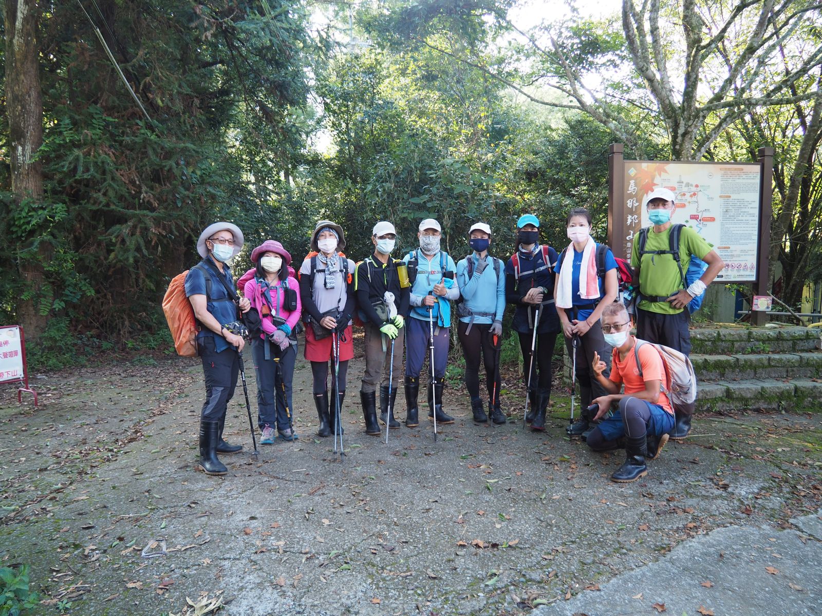
| All members at the trail head |
Our expedition is comprised of 10 members, hiring a 10-seater car for all two-day transportation. We gathered at 5:00 in Taipei and headed for Dahu by way of the national highway #1 and the express way #72. We picked up a member living in Xinzhu (新竹) en route and got to Dahu by 7:00. We purchased some food and beverages at a convenient store and headed for the Tianranhu (天然湖) trail head, which we arrived at 7:40.
 |
| A route map and a direction sign post |
 |
| Good trail in a cedar forest |
 |
| One of the wooden stairways |
The altitude of the trail head is approximately 980 meters. The summit of Mt. Manabang-shan is 1406 meters, so we only need to climb a little more than 400 meters of the altitude. In addition to that, except a few steep wooden stairways, the 2.3-kilometer trail is good with gentle grades. Passing a map board and a direction post at 8:00 we enter a dirt trail. The trail goes in a cedar forest and a forest of broad leaf trees as we go up by a zig-zag way. At 8:38 we have a rest just below the first staircase.
 |
| Last stretch just below the summit |
At 9:00 our trail merges a trail from left, which comes from the other trail heads, Shanghu (上湖) and Zhuhu (珠湖). On
my last visit several years ago I came by this trail from Shanghu. This mountain was once a stage of fierce battles of the local Han people plus Atayal indigenous people against the advancing Japanese regime more than a century ago. The trail from Shanghu passes a battle field and a military camp of the time. Climbing a final grade we come onto a long strip at 9:06 where several benches and a stone monument stands. The summit is just by this strip. We have completed the trail to the summit in about an hour.
 |
| Stone monument on the strip by the summit |
 |
| A triangulation marker and a broken stone memorial of the battle |
 |
| View from the summit |
 |
| Spacious summit |
The summit is supposed to be a great vantage point. As soon as I take a few pictures, however, fog quickly gathers and hides a view towards Xueshan mountain range and the valley of Daanxi river. By the triangulation stone maker lies a broken stone monument, which was placed in 1931 to commemorate the battle of 1902. We have a rest on this long and wide summit for some time. The name of the mountain, Manabang (or Manapan), by the way, means a beautiful mountain in the Atayal language.
 |
| Head of the traversing trail |
We set for the ridge traversing at 9:27. The trail to the summit of Mt. Manabang-shan was really easy. In contrast to it, the traversing trail from here passes very narrow ridges with vertical cliff on one side, and nearly vertical sections with ropes, metal and rope ladders. There are several peaks to go over, including Mt. Siling-shan. A small and new direction marker by the mouth of this trail warns "8 to 9 hours to Mt. Dake-shan, dangerous!!"
 |
| Going down on the ridge |
 |
| Going on a narrow ridge by a cliff |
 |
| The ridge trail |
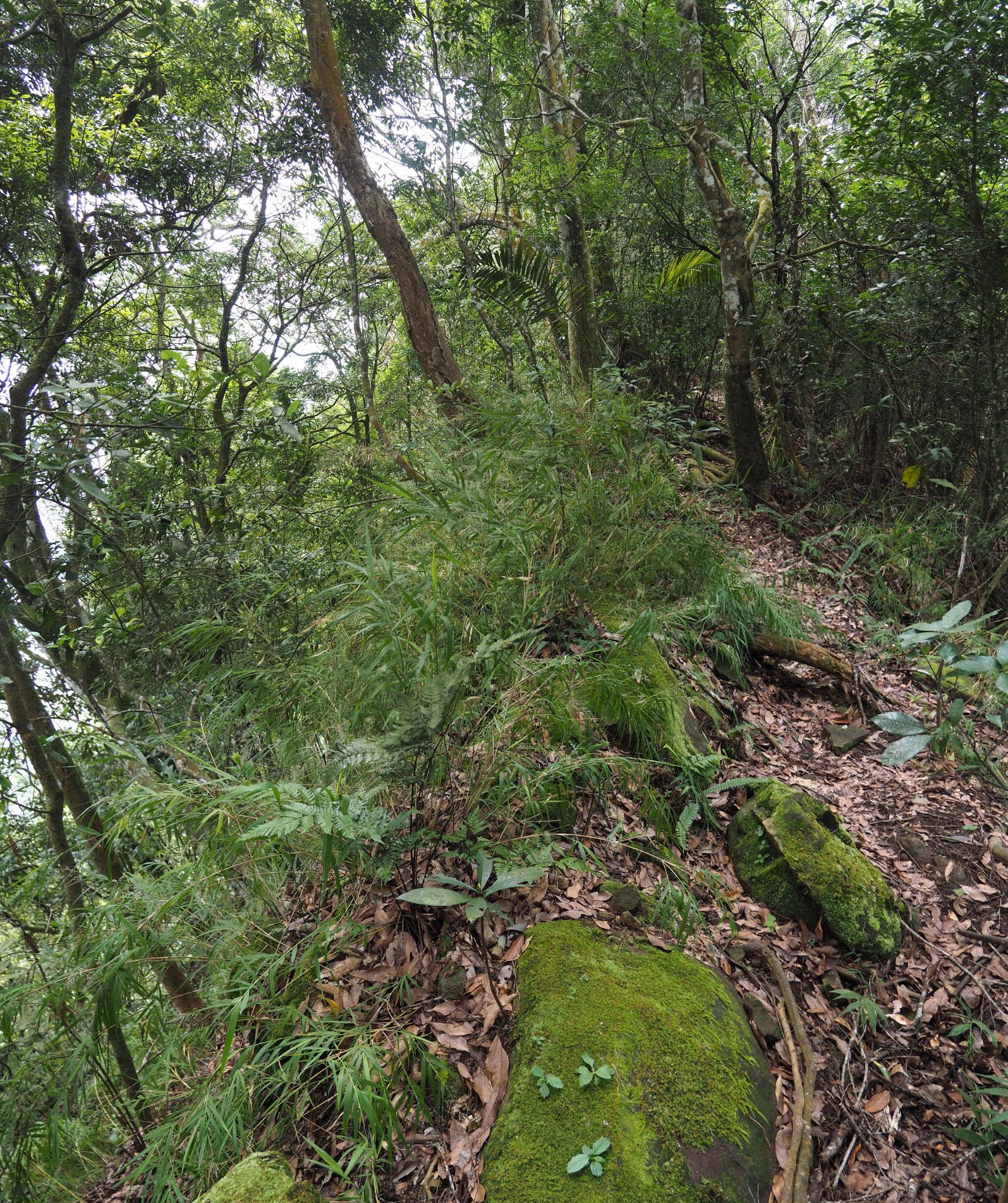
As soon as you step on the trail, you find it very different from the trail of Mt. Manabang-shan. It is covered with fallen leaves though it is still not difficult to identify its track. In a minute or two, a rescue marker #1 (救援椿號1) shows up attached to a side tree trunk, which counts to 22 at the end. The trail goes down in general but hits some small humps to makes us to climb. Some sections are wide and some sections are nearly knife ridges, We have a break at 10:35.
 |
| Three-sister tree |
 |
| Looking down the valley |
 |
| Ascent to Mt. Siling-shan summit |
The trail goes rather levelly for a while. We find a tree with three trunks sticking together from its same base, which named "three-sister tree". Passing the lowest point around 11:00 we begin a long ascent to Mt. Siling-shan. Though steep, we ascend eventless and reach the summit (elev. 1183m) at 11:25. A small summit is surrounded by trees and offers no view. A rescue marker shows #9 by the summit. We have a lunch break.
 |
| Mt. Siling-shan summit |
 |
| Vertical rock to climb down |
We begin our descent at 12:00. In about 14 minutes bare rocks show up on the ridge and we come to a rocky gap near the rescue marker #11. Ropes are attached to it, but the rock is a kind of overhung and difficult to find footholds. It takes some time for all members to pass it. The trail keeps going down. We soon come to the top of long descending rocky section. A twin-hiker group are just coming up and we wait for them, With aid of ropes we go down to the bottom. The trail then traverses the mountain side and comes to for another long rocky surface. We climb it up to the ridge again, where we see the rescue maker #13.
 |
| Keep descent |
Having a rest at 13:00 we keep on our way down. In a while we pass stone steps on a bare rock. This must be a reminiscence of Aiyong guard line (隘勇線) of a century ago. The ridge from Mt. Dake-shan south all the way to Mt. Manabang-shan north and beyond once was the Aiyong guard line. In order to control the indigenous tribes in and around the valley of Daanxi river, the Japanese regime built a path going along the ridge and placed camps, weapons and guards along the path. Passing the rescue maker #19 at 13:49 we come to another long and steep section with bare rocks. We finally come to the lowest point at 14:12 with the recue maker #22. This is a junction (elev. 940m). If you go right, you will get to a trail head. We keep on the ridge trail and go up a little to a flat place where we have a break.
 |
| going by the #18 rescue marker |
 |
| Finally at the lowest point before Mt.Dake-shan |
 |
| Climbing in a cedar forest |
We set off for our last and long climb of approximately 270m to Mt. Dake-shan at 14:30. This section is by no means easy. We have to go over a small peak first and down, then take on the final climb. The trail first goes in a cedar forest. In about a half hour we come to the top of the deceiving peak (elev. 1100m) and go down a while. On our left the summit of Mt, Dake-shan stands high on a vertical rock cliff. We go down to the lowest point before our ascent and have a rest at 15:15. We have to duck through nasty thorny stems of Huangteng (黃藤) on our way. It is said that volunteers had cut off the thorny plants along the route several months ago. We indeed witness dried-out and dead plants but some have since grown again
 |
| Mr. Dake-shan is yet far |
 |
| Duck under Huangteng thorny plant |
 |
| First metal ladder |
 |
| Climbing a nearly vertical section |
The final ascent of the day is something like a 200-meter gap, and some surprises wait for us. A steep uphill continues for several minuets and leads to the base of an aluminum ladder. Climbing up it a longer next ladder shows up. Going down a little, traversing along a vertical wall and climbing a short third aluminum ladder, a long rope ladder hangs in front. This is much hard to climb as it sways, unlike rigid metal ladders. Carefully climbing it I get on a ridge leading to the summit at 15:45. It has taken me more than 10 minutes from the first aluminum ladder to up here. Other members are coming up one by one. We follow a gentle ridge to the tree-encircled summit of Mt. Dake-shan (elev. 1236m), which we reach at 16:12.
 |
| Climbing a rope ladder |
 |
| Finally on the ridge |
 |
| Looking at the summits and ridges we have come over |
 |
| At the summit of Mt. Dake-shan |
 |
| Good and easy trail down |
While we are happy that we are through with major ascents today, there remains a long 4-kilometer way down. We leave the summit behind at 16:35. The grade is easy and the track is wide and good, which proves this is a popular trail though there are fallen tree trunks here and there, At 16:58 we pass a location with a large table and a sign saying a former cannon station (砲台遺址). This is a place where cannons were placed as a part of Aiyong guard line a century ago. There is no hint of it except the sign. Now trees obstruct clear views from here, but they were all cut clean at that time to have the cannons to aim at villages of Atayal tribes down by the river.
 |
| The former cannon station |
 |
| Golden sunlight shines in |
 |
| Going down in darkness |
We continue our way down. Around 17:25 golden sunlight shines on tree trunks along the trail. One of our members who has had hard time to follow shows exhaustion and we have a rest at 17:35. It is certain that the sun sets before we reach the trail head so we bring out head lights to prepare for it. The grades gets steeper as we go dawn. The darkness comes around 18:10. We come down to a junction and take the right trail. It soon turns to be a paved road and gradually descends. We finally reach the trail head of Baibufan at 18:50 in darkness,
 |
| Baibufan village is just below |
 |
| Baubufan trail head |
Our transportation car is nowhere to find. It is supposed to be waiting for us at the trail head. It has turned out that it is waiting at the other trail head, which is on the opposite side of the mountain. We wait for it about one hour and head for an inn in Meiyuan-cun village (梅園村). We reach the inn around 21:50. After having a simple dinner and taking a shower, we go to bed nearly at 22:30.
--------------------------------------
We spent almost 11 hours to complete our hike including rests, which should be more than one hour longer than usual cases. It was due to our slow progress. A member did not hiked for a long time and her physical strength was not up to her normal level. However hard it was, she completed the entire route on her own, which I would praise. It is my principal to avoid to walk in darkness. Knowing that the trail is in good condition and all members are experienced, I ventured it without much worry.
Mt. Manabang-shan and Mt. Dake-shan are both popular hiking destinations, but the ridge route between the two peaks are not for everybody. During our lengthy activity we just run into two groups, two members each, on the traversing section, which proves this point. The track is very clear and ropes and ladders are fixed to aid you to pass dangerous points. As long as you have experiences and skills to go through them and enough stamina to cover 13 kilometers of ups and downs, this route should be a fun for you. The total ascent was 920m, descent 1395m, which calculates the route physical index 34.