 |
| 68號快速公路から見る五指山, Mt. Wuzhi-shan viewed from #68 express way |
新竹縣竹東鎮の五指山は、すぐにその山を名指しできる特徴のある山だ。竹東鎮の街近くからだけでなく、周辺からも容易に判別できる。当峰は、その名の通り手の指のように5つのピークを擁し、親指から小指までの名前がそれぞれのピークに冠されている。その北面は、切り立った岩壁が聳え立ち、その山腹には寺院がある宗教とも関係のある山でもある。この山の位置は、ずっと南にある樂山(鹿場大山)から北に延びる尾根の北端にある。当尾根は五峰天際線という名で、地元ボランティアにより整備が行われ30キロ近いルートには、よい道と道しるべが完備されている。
五指山を訪れるのは、実は二度目だ。8年前に訪れたときは、あいにく天候が悪く中指峰まで歩いたが、山上からの展望はなかった。下山時にその特徴ある山容を垣間見ただけだ。今回は、山腹の寺院群の登山口からではなく、五峰天際線北端の起点0K地点から、天際線稜線上の上坪山(標高620m)を越え、五指山の小指峰へと登った。五指をすべて通過し、北側の山腹を行く道から一線天と呼ばれる細い割れ目が天へと続く奇岩の猴洞步道をを経て、観音寺から舗装路を数キロ下って、出発点まで回遊式に歩いた。五峰天際線は、昨年よりセクションごとに歩いてきた。この最北部が最後に残っていた。今回はそれをカバーしたわけだ。五指山は標高が1000m内外のピークで、登山口は200mほど、天気が良く風があまりなかったこともあり、その距離や登坂高度に対しかなり疲れた。汗がとどまることなく流れ、心拍数もかなり高くなっていた。
------------------------------------------------
 |
| Clock-wise round trip from Shangping |
There are more than one peak called Mt. Wuzhi-shan (五指山 meaning five-finger mountain).
One of the Mt. Wuzhi-shan peaks stands close to Taipei, which is known for the national cemetery on its broad top. Late Li Denghui president (故李登輝總總) was buried at this cemetery recently. The other one (and there may be more that I do not know of) is Mt. Wuzhi-shan of Xinzhu (新竹), one of the small hundred peaks of Taiwan (小百岳). We visited the second one on this hiking. This mountain has distinctive five peaks standing side by side, resembling stubby five fingers (or five humps to put it more correctly) and a palm. The north facade of the ring finer and the middle finger peaks show formidable rock faces as if refusing humans' access. This may be one of the reasons why there are several temples at the foot of this mountain.
 |
| The most north section of the Wufeng Skyline |
As a matter of fact, this was my second visit to Mt. Wuzhi-shan.
On my first visit eight years ago, we just started from the temple complex at the halfway position of the peak and climbed only three peaks. The weather was miserable and we had no view. It has since drawn little my attention. It again caused my interest because it was the last and remaining part of the Wufeng Skyline route, which we have covered section by section since last year. The skyline route commences its long approximately 29 kilometers of the ridge trail at Shangping (上坪). The "O" K post is placed just by a temple Guanghui-gong (廣惠宮) of Shangping. By completing this section, we could almost complete the whole skyline route. This was a strong motivation for this hike.
 |
| At the summit of the thumb peak |
On this hike five of us shared a car and parked it near the trail head. We followed the Skyline route, passing over Mt. Shangping-shan (上坪山) and climbed steep sections to the little finger peak (小指峰) of Mt. Wuzhi-shan. We went over other four peaks and down to the traversing trail (橫向步道) going along the mountain north side. This trail connects to another trail called Houdong trail (猴洞步道, meaning monkey cave trail), which we took down to Guanyin temple (觀音寺). The rest was walk down on a long 6 plus kilometers of a paved road back to where our car was parked. If you have two cars, one of which is parked at Guanyin temple, you could save a long and tiresome walk down. On our way down on the paved road, we found that the middle, ring and little finger peaks were very high up with vertical rock faces, which left me an awesome impression of the mountain.
--------------------------------------------
 |
| At Guanghuigong of Shangping |
We departed Taipei at 6:30 and got off from the highway #3 at Zhudong (竹東) junction. We then took the express way #68 east to reach Zhudong at 7:36. As we came down from the express way, Mt. Wuzhishan showed itself clearly just in front of us. It took us another twenty minutes to get to Shangping by #122 road. We parked at Hi-life convenient store and bought some food for the day. Now at 8:18 we are just in front of Guanghuigong temple (elevation 250m) ready for our hike.
 |
| A 0.5K sign by the paved road |
 |
| Tbe head of a dirt trail |
 |
| Map of Wufeng Skyline route |
Our first leg of the hike is a narrow paved road beside the temple. A sign of Wufeng Skyline route is placed on a fence of a building. The road soon gets steep and into woods. As soon as we see a sign of 0.5K at 8:30, a dirt trail shows its opening on our right (elev. 345m). The trail is clear and good. It leads us into a cedar forest, which changes to broad leaf tree and bamboo woods. The grade gets steeper as we go and ropes are fixed at some points. Passing a 1K sign at 8:42 we get onto the Skyline main ridge leading to Mt. Shangping-shan. A sight of Mt. Wuzhi-shan, still far, comes into our view.
 |
| Passing by a big rock |
 |
| The summit of Mt. Shangping-shan |
 |
| Fern has been cut out |
We pass by a big rock at 9:00 and see a 1.5K sign soon after it. In five more minutes or so the grade gets easier and the summit of Mt. Shangping-shan (elev. 620m) appears at 9:05 encircled by trees and bamboos. We have a first break. The trail goes rather flat for a few minutes and small ups and downs comes one after another. At 9:41 we come up to 2.5K sign and a bare rock on our right is a nice vantage point. Three finger peaks are high up on our left. Beyond the valley just in front, a lower ridge from Mt. Wuzhishan extends down to the valley of Shangpingxi river. More small mountain ranges stand behind. Far beyond the Shangpingxi valley, buildings of Zhudong town are visible.
 |
| Small ups and downs continue |
 |
| 2.5K vantage point |
 |
| A wide panoramic view from the rock top |
 |
| A distant view of Zhudong and beyond |
 |
| Climbing through cedar trees |
 |
| Resting place near 3K |
 |
| Climbing the steep section with no breze |
Thick fern undergrowth has been widely cut out. Going down to the lowest point by a very steep descent, our long way up starts. Soon we see a trail diverges down to left at 2.6K point. Climbing a unbroken and steep uphill trail for twenty minutes we come to a resting place with stones being piled-up to form a square shape bench. We have a rest at 10:10 there with nice breeze sweeping through. The rest of the ascent to the little finger peak is anything but easy. The last section is pretty steep in a depressed terrain, which prevents breeze to flow through. By the time we reach the summit of the little finger peak (小指峰 elev. 980m) at 11:20, I am pretty exhausted by heat. We have a long lunch break there. Very gladly we feel breeze on the summit.
 |
| At the summit of the little finger peak |
 |
| Looking down from the trail to ring finger peak |
 |
| Climbing a steep uphill |
A little before noon, we start for the rest four finger peaks. The trail from here to the last thumb peak has a lot of visitors and its condition is pretty good. Realizing that a major ascent for the day has been over, we feel much more relaxed, though the trail to the ring finger peak (無名指峰) is yet very steep. We see a sign of 4.5K on the way and reach the summit at 12:12. This summit (elev., 1047m) is also surrounded by trees with no open view. Hitting the bottom between the ring and middle finger peaks in five minutes, another uphill goes through bamboos and then thin cedar trees to reach the summit of middle finger peak (中指峰 elev. 1062m).
 |
| Summit of the ring finger peak |
 |
| Summit of the middle finger peak |
 |
| A resting place with benches |
There are radio communication facilities around the summit of middle finger peak. It has a tall steel radio tower, which is a good landmark to identify from the distance. As the tallest of the five peaks, the summit has a triangulation stone marker and an official explanatory board. A couple of sign plates showing the peak name are placed around the marker, one of which is rather funny (and provocative) probably to westerners' eyes. I believe that the creator has only a middle finger in mind and nothing else. On our way up here we run into another party and we meet two lone hikers. No wonder this is a popular hiking route. We go down for a while and have a break at a resting place with benches at 12:43.
 |
| Summit of the index finger peak |
 |
| A long way up with steps |
We have two more fingers to go over. We go down to the bottom and see a steep trail going down on our right. It is tiring to go up on steep steps to the index finger peak (食指峰), which turns to be an easier path to reach the summit (elev. 1045m). The small summit is also surrounded by tall trees, preventing any distant view. We keep on our way and down to the thumb peak (拇指峰). The trail diverges at a halfway and we take the right one. Both paths finally reach the thumb peak summit. Our path throws at us another long steep steps to struggle. At the top of it we take left to reach the summit (elev. 1024m) at 13:26. The summit has benches and we have a break.
 |
| Summit of the thumb peak |
 |
| Small white flowers on the trail |
 |
| Bridges of the traversing trail |
We begin our long way down at 13:45. The trail gradually goes down on the ridge, where a 6K sign is placed not far from the summit. In ten minutes a junction shows up. The left trail goes down to Mt. Dayi-shan (大溢山) as a part of the Skyline route. We take a right one to leave the skyline route. White flowers are scattered on a few spots of the trail, which in fact are tung flowers (油桐花). These flowers bloom in late April to May, so they are out of the season for some reason. We come down to a junction at 14:15 where the traversing trail diverges.
 |
| Narrow slits are carved on the surface |
 |
| A bench deck for rest |
The traversing trail (橫向步道) is a super walk with a lot of efforts (and presumably much money) having been put into. It has many wooden bridges and slits have been carved on all step stones to prevent slippage. It has some ups and downs as we go, but they are all easy. Passing a junction of a small dirt path a nice resting deck (elev. 780m) shows up at 14:43. This location is not far from the temples below, whose roofs are visible through tree branches. We have a break there.
 |
| An open view by a large rock face |
 |
| Distant view under a hazy sky |
 |
| Temples and shops are just below |
 |
| Junction of Houdong trail |
 |
| Yixiantian passage |
The traversing trail goes down for a while and passes by a huge bare rock surface, where we have an open view. You can barely make out building of Zhubei (竹北) area under a overcast and hazy sky. The temple and shop complex is just below your feet. The trail further goes down and joins Houdong trail (猴洞步道) at 15:01. We climb steps on our right and soon trough a stone tunnel. The trail goes up a little again to reveal Yixiantian stone passage (一線天). It is a naturally formed groove between tall stone walls, where only one person can squeeze through. We climb steps in the groove and meet a fallen tree blocking our passage. The tree must have fallen recently so not yet removed. We manage to pass through branches and get out.
 |
| An explanation board by the Yixiantian |
 |
| A fallen tree blocks the passage |
 |
| A long way down with step |
The Houdng trail goes flat for a while and up to pass a highest point (elev. 778m) at 15:20 near 0.9K point from the trail head. It then goes steeply down on long plank-step path. Passing a resting point with benches and an explanatory board of the trail at 15:26, the trail again goes very steeply down with steel-made steps. We pass by a point of old camphor trees and come down to the trail head by Guanyinsi temple at 15:44. Guanyinsi temple is a big establishment. It has a pond besides the building complex and a large parking space.
 |
| Steep-made pathway going by a camphor tree |
 |
| The head of Houtong trail O K point |
 |
| Looking up the peaks we have just been to |
We set off for our long way down on a paved road to Shangping at 15:56. The drive way of the temple soon meets a road below and we take right. The distance to Shangping is more than six kilometers. It is a kind of tedious walk, but it gives us a comfortable relief that there is hardly any traffic on this road. As we go down, a fearsome rock face and its top stands high in front of us, which give us a awesome feeling. We were up there just a couple of hours ago! There are a few houses along the road. We come down to a pavilion near 2K point of the road at 16:56 and have a final break.
 |
| The peaks gets even higher as we go down |
 |
| Finally back at Shangping |
We complete our walk on this road to meet the busy #122 road at 17:26. Taking the right, passing Shangping bridge, we finally come back to Shiangping old street (上坪老街) and further to the convenient store where our car is parked at 17:32. There is nothing better than cold beer right after completing a hike! It is good that we did not meet any rain though the sky turned overcast in the afternoon.
-------------------------------------
 |
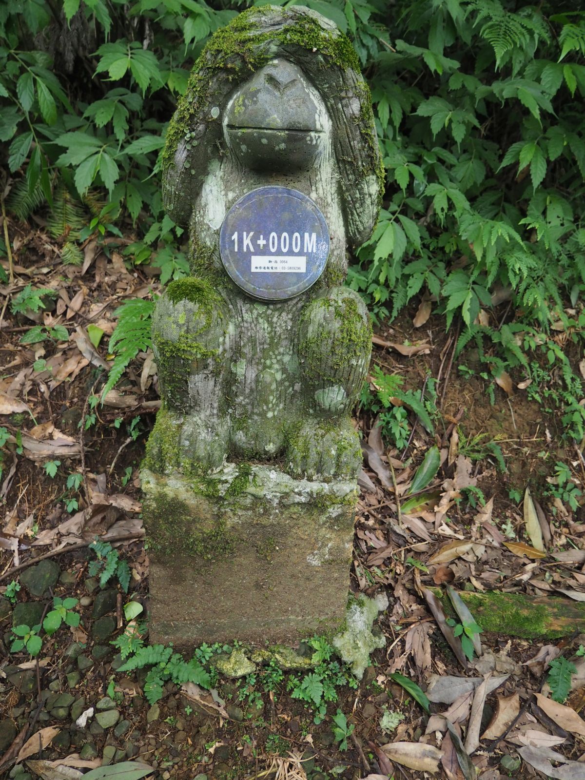
| A stone monkey of distance sign |
The drive back to Taipei took us an hour and fifty minutes on this day. Our hike lasted a little more than 9 hours including rest time to cover 15.5 kilometers. The total ascent and descent is close to 1000 meters each, summing up the route physical index 32. You can just hike to Mt. Wuzhi-shan without Mt. Shangping-shan, which makes a much easy hike and visit the temples too. I recommend to take the Hengxiang (traversing) trail including Houdong trail either on your way up or down. Both of them are really worth visiting.


0 件のコメント:
コメントを投稿