このブログを検索:山名などキーワードを入れてください

2015-05-31

2015年5月30日 烏來から卡保山を登る 75年前の日本人高校山岳クラブのルートをたどる

北107郷道德拉楠橋から卡保山を見上げる
昨年八月、卡保山(カボ山)を登った。その時は三峽の熊空から登り、逐鹿山を経て同じく熊空に下った。逐鹿山から卡保山を通り、更に南に伸びる插天山脈は東側は烏來になる。現在はバスなどの公共交通機関を含め、三峽側のアクセスがよいので烏來側からの登山は比較的少ない。しかし七、八十年前は烏來からのアクセスがメインであった。人が押す台車や理蕃警備道が整備され、原住民集落には駐在所があり、烏來からの登山のほうが便利であった。台北近くの本格的登山対象として、烏來から插天山脈には登山が行われていた。今回の登山は、その烏來から登り当時の登山の様子を偲ぶのも目的であった。

北側のカボ山東稜を登り、縦走する回遊コース
単一ピークの歩行高度
今月始め、同じく烏來から巫山を登りその後卡保山へ縦走、烏來に下る予定で登山をした。しかし、巫山登山後時間が足らず、同じルートを下った。今回の登山は、その歩けなかった部分を逆回りに歩いた。巫山には立ち寄らなかったが、それでもかなりきつい登山であった。実際、ネット上の記録でも、健脚者が十数時間掛けて歩いているので、決して楽なルートではない。我々四人も10時間半かかっている。夏が近づき気温が上がり、登りではほぼ無風であったので、辛い登りであった。

11.5kmキロポスト登山口
日本統治時代の台湾山岳会千々岩助太郎著『思い出の山々』では、彼が代表をしていた台北工業学校山岳部の烏來登山合宿(1940年)の内、トンロク(現在の屯鹿、今は駐在所も住居もない)から第一班が約九時間半を費やして、カボ山を登頂している。当時は、原住民泰雅族の道案内のもと道無き道を進んでの登頂である。果たして、どのようなルートで登ったのか、詳細な記述がないので判らないが、現在北107郷道10.5kmキロポスト付近の登山口から登り、東稜をへて登頂したものと思われる。伐採小屋などの記載もあるので杉林なども通りすぎているようだ。東稜を行く道は、現在その麓に近いところでは三本の道がある。今回歩いた道は郷道11.5kmキロポスト付近で、10.5kmからの道と標高約1100m近くで合流する。比較的新しい道なので、この部分は台北工業学校山岳部は登っていない。合流部分以上はまさに、彼らが歩いた道ではないだろうか。三峽側の登山道に比べると、烏來側の道は細く、倒木や草に埋もれた部分も多い。70数年前は、これよりも更に頼りない道だったと思う。

巫山が頭をのぞかせている
今年五月後半は梅雨で雨降りが続いた。今日は、久しぶりに快晴である。6時半にMRT古亭駅に集まり、出発。今回は常連の二名に加え、イギリス人のCさんも同行する。Vさんの車で一路烏來へ向かう。高架橋からは、烏來方面の山々がはっきり見える。烏來から北107郷道を進み7時半に、11.5km登山口近くに駐車する。登山口は沢へ下る道の近くでもあるので、釣人の車やバイクが付近に停めてある。駐車場所から、郷道を300mほど戻る。振り返ると巫山が頭を出している。

下草の密生する雑木林の登り
杉の美林をゆく
7時50分、登山口から登り始める。岩が露出して急斜面である。第一歩から苦労する。まだ樹齢が若い杉林の急斜面を登る。15分ほど来ると焚火跡がある。狩猟など登山以外の目的で来た人が残したものだろう。林相が雑木林に変わる。忠実に尾根を追って急登が続く。8時26分、少し開けた場所で休憩する。ここも狩猟者などが残したと思われる焚火跡がある。下草の茂る雑木林の中をひたすら登る。9時、二度目の休憩をとる。こうした登り一本の道は、30分登攀5分休憩のサイクルが適している。更に10分ほどで、また杉林に入る。こちらはとても高く、樹齢も進んでいる。美林である。下草は乾いているので楽だ。9時45分、三度目の休憩を取る。標高約1000m、登山口から標高差約650mを登ってきた。そこそこのペースだ。

旧登山道との分岐点
谷状の部分を通り過ぎる
相変わらずの急登が続く。9時45分、キロポスト10.5kmからの道と合流する。こちらは今までの部分と比べると道としては古い。標高は約1100m。更に登りは続く。斜面をジグザグに登る途中で休憩後、10時38分稜線上にまた出る。今までの登り一本調に比べると、稜線上は上り下りも現れ変化がでる。標高も高く、風も吹いてきた。それまで、とても暑い中を登ってきたので、そよ風は実に心地よい。10時45分、木々の間から卡保山の頂上が見えた。まだまだ距離がある。少し下り、尾根の形状がとても幅広になる。少しくぼんだ谷状の壁部分を過ぎ、また尾根上を登る。杉林が低い灌木に変わる。灌木は密集し、縫って進まなければならない。11時10分再度休憩を取る。

低い灌木林を登る
標高差残り約200mである。11時45分、密生した灌木が終わり熊笹が密生した部分にでる。台湾ブナの木々が現れる。主稜線が近い。坂はきつく最後の登りは辛い。しかし、景色が見え出すと力が湧いていくる。11時52分、主稜線の分岐に来る。頂上はもうわずかだ。左に曲がり、熊笹の間を進む。11時57分、卡保山頂上(標高1,583m)に着く。標高差約1,200m登攀時間は休憩込みで約4時間である。正直疲れた。Cさんは、過去数年間の内、もっともきつい登山だという。天気もよく、ゆっくり休憩する。メンバーが持ってきたビールやコーラが美味い。

主稜線分岐点
卡保山山頂
谷底に徳啦南橋が見える
12時35分、下山を開始する。ここからは、下りメインである。三、四分進むと展望ができる。左谷底には、駐車場所近くの德拉楠橋が小さく見える。あそこまで下っていくのだ。更にすこし進むと、さらによい展望がある。長い卡保山の端の部分の上には、北插天山やそのすぐ左に拉拉山や塔曼山などが望める。主稜線の右側にも高い山並みが見える。方向からすると那結山付近の山々だ。前回はガスで見えなかった山々が、遠くまでよく見える。熊笹の密生した道を下っていく。反対方向からのパーティとすれ違う。雲森瀑布から登ってきたそうだ。ブナと熊笹の稜線道を下っていく。

稜線から眺める山々、前方のピークの左に桃源復興の山々が見える
雲森瀑布と稜線道の分岐点
13時9分、雲森瀑布との分岐を過ぎる。左に稜線をさらに進む。前方左に特異な三角ピークがある。巫山だ。ちょうどガスが去来し、神秘的な雰囲気だ。稜線をさらに進む。前方に樂佩山が尖って見える。遅咲きの金毛杜鵑の赤い花が、緑一色の中で鮮やかに咲いている。13時47分、滿月圓からの分岐に着く。卡保山頂上から1.4kmぐらいだが、上り下りがあるので、そこそこ時間がかかっている。休憩を取る。

稜線からみる巫山
稜線の遅咲きのツツジ
鞍部から烏來へ下り始める
沢沿いで休憩する
稜線道をさらに進む。少し登り返したところで、樂佩山から下ってきた二人とすれ違う。稜線道はやはり良く歩かれている。分岐から数分で、狭い鞍部につく。風が吹き抜けていく。左に烏來に向かって下り始める。樂佩山の山腹をしばらく行ったあと、沢に向けて急降下する。14時30分、前回巫山登頂のあと、やって来て休憩した沢脇につく。ここで休憩する。Cさんは、登りで頑張りすぎたのか、足に力があまり入らないようだ。

下り道


ここからは四週間ぶりでまた同じ道を下る。稜線の道に比べると、烏來側は明らかに歩かれている程度が低い。沢を少し下って、また右に山腹を進む。雷が遠くでなっているが、今日は雨が降る気配はない。先ほどガスっていたが、また日差しも差し込んでくる。14時47分、巫山への分岐を過ぎる。左に急坂を下る。杉林を過ぎ、15時28分、涸沢を越す。しばらく山腹を進み、また下り始める。もう一つ涸沢を越し、更に下る。16時13分、大岩を通過する。16時37分、巫山山腰路との分岐に下る。鞍部から登山口までの道のりは、残り半分だ。

涸れ沢を越す


山腹道を10分ほど進む。斯莫野溪の支流を渡渉する。水量はそこそこある。17時08分、右に巫山が高い。さらに樹木の枝越しに卡保山も見える。その先、また枝尾根を下だり、高度を下げる。尾根を巻き込み進み、17時23分、テントの張ってる狩猟キャンプに着く。最後の休憩をとる。Cさんは水を飲みきってしまったようで、キャンプ脇の沢で水を補給する。距離はまだ2キロ弱あるが、ここからは道も平らで気が楽だ。17時58分、山腹道は尾根を巻き込み竹林の下りになる。下の方から郷道を行く車の音も聞こえる。もうあと僅かだ。18時13分、阿玉商店脇の登山口に降り切る。登山はこれで終わりだ。

登山口へ山腹道を行く


阿玉商店でビールなどを買って四人で祝杯を上げる。車を停めてある場所へ道を歩き始める。後方からバイクが来て、車のある場所まで便乗させてくれるという。とても親切だ。Vさんは載せてもらい、駐車場所まで向かう。残り三人はそのまま更に歩く。18時30分德拉楠橋のところで車がやって来た。見上げれば、昼間ここを見下ろした卡保山が高く夕方の空にシルエットを描いている。今日は、一日中天気がよくて、本当にラッキーだった。着替えをすませ、暗くなり始めた道を一路帰京した。

阿玉商店前で祝杯、筆者とCさん


休憩込み行動時間約10時間半、歩行距離は約12kmだ。累計で約1300mほど登っているが、大部分は卡保山の登りである。『思い出の山々』では、若い学生は山慣れている原住民に負けじと頑張って登り、かなりきつい登山をしたようである。当時は頂上に櫓が建てられていて、天気が良ければ我々よりはるかによい眺めが出来たはずだが、ちょうど曇ってしまったようだ。「...草につかまり木をよじて進むが白い手袋はたちまち真っ黒になった。まだかまだかと掛声かけながら励まして登っていく。見えた、頂上の櫓が...。」こうした情景は、実際に歩くとまさに身を持って理解できる。それから72年、当時登った学生はすでに亡くなっているだろうが、その体験の一部を感じることができてよかった。困難度はルートについては、烏來側の登山道はクラス4、稜線道はクラス3である。体力要求度はクラス5、健脚向けのコースである。体力に自身のない人は、登らないほうが良い。

2015-05-28

2015年4月19日 慢集團@七星山訓練山行 Training hike from the foot to the summit of Mt. Qixingshan

Mt. Qixingshan viewed from Qianyuan Park
陽明山山系は、台北から近くハイキングの盛んな場所である。国家公園にもなっているので、登山道やその他施設などもしっかりしている。今までに数多く訪れているが、今回は慢集團の活動として登った。目的は今年の夏の登山活動の体力訓練である。時間目標を設けて、それまでに登りきれるかのチェックもある。今までに登りについては2012年に、また下り部分については2013年にそれぞれ記述しているので、英語で記述します。

=============================================

We climbed from Tianmu all the way to the summit of Mt. Qixingshan
Hiking elevation profile
At the Tianmu historical trail head
Mt. Qixingshan (七星山) is a center of all Yanmingshan National Park (陽明山國家公園). At an elevation of 1,120m it marks the highest peak of all in the area, which is also the highest point in the boundary of Taipei City. It attracts many hikers throughout a year. Manjituan group (慢集團) will have a three-day trekking event in this coming summer which requires a good physical fitness. In order to measure how good the current fitness level of each participant is and to train their physical strength, we had a long hill climb activity in Yangmingshan: We started at the foot of the mountain, Tianmu (天母) and climbed to the top of Mt. Qixinghan all on our foot. This means ascending a little more than 1,000m in height. It is in fact a couple hundred meters short of the height that we will have to cover this summer, but we set a target of 4 hours and half to reach the summit. All members but one passed this strenuous test. After we reached the summit, we took an unofficial trail down to Yanmingshan bus terminal and completed the hike.

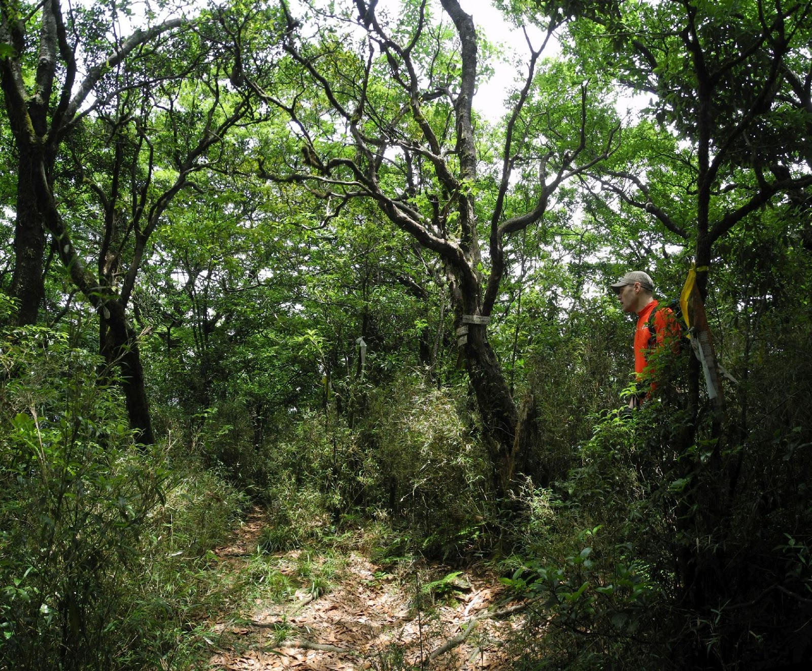
Acacia tree is high up over the trail
At 8:00 we meet at MRT Shipai Station (石牌站) and take a bus to Tianmu bus stop on Zhongshan North Road section 7 (中山北路七段). After waiting for a few more members coming directly to Tianmu bus stop, we start for Tianmu historical trail (天母古道) a little past 8:30. We go up the street and come to the trail head which is marked with a big water tank with a faucet. There is a water pipeline along the trail which belongs to one of the oldest water supply system of Taipei built many decades ago. So is the reason of why such monument stands besides the trail head. We start a long uphill at 8:45. Unlike usual hikes of Manjituan, we have only several members today because this hike is primarily for the participants of the summer hike.

Stone steps and the black water pipe on its left
Mt. Datunshan across the valley
The steep stone steps look as if endless. Tiny yellow blossoms are sprinkled on and besides the steps. Looking up and we find a big Taiwan acacia tree is full of yellow blossoms hanging way up over the steps. As we keep ascending we see a big black water pipe goes parallel on the left side of the trail. The straight uphill lasts about a half hour and we come to a pavilion at 9:10. We have a first rest here. A thermometer on the pavilion pillar shows 25 degree C. No wonder we are all in big sweat already. The elevation is 300 meters above sea level and we have covered something like 250 m in height. Another member joins us here as she has climbed very fast from the trail head because she came a little late.

Flat section of Tianmu trail
The grade of trail becomes much moderate from here on. There is no step to climb. It turns to be a graveled wide road that goes along the side of a hill. As we go along the flat trail we can see Mt. Datunshan (大屯山) across the valley between trees. There are sign boards besides the trail saying "Be aware of macaques' attack". There are supposedly many wild monkeys around the trail and they steal your things away or snatch your food. We see none this time. In fifteen minutes the easy trail ends and up we go stone steps again. We reach the top of steps at 9:40 and this is the end of Tianmu historical trail. If we go right we can reach Yangjin highway (陽金公路) and Chinese Culture University (中國文化大學). We take left and go down to the valley. At the bottom of the valley, we take a right path that goes along the stream. The river bed is in reddish color because the water contains high level of minerals. We climb back to Shamao Road (紗帽路) and take right to Qianshan Park (前山公園) where we have a short break. The altitude is approximately 400 meters now. It is 10:15 and we have walked for a hour and a half. Mt. Qixingshan is visible just across the park. We have 700 meters more to reach its summit.

Walk along the red colored stream
Yangmingshan pedestrian trail head
Visitor center, at its behind is Mt. Qixingshan
At Miaopu trail head
A couple of friends join us as they have waited for us at the park. We go further along Shamao road and come to Yangmingshan bus terminus. We pass it and go to the trail head of the pedestrian trail (人車分道) that goes around at the foot of Mt. Qixingshan. We first go into a tunnel and up a long steps, then come out to a stone paved trail. The pedestrian trail is go parallel to the Yangjin highway, sometime close by sometime in some distance. It is good that we don't have to inhale exhaust fume. We pass by Yangmingshan visitor center at 10:54 and come to the Miaopu trail head (苗圃登山步道) at 11:05. We are now at 550 m high and have come a half way in terms of altitude.

Long stone step climb of Miaopu trail
Squirrels don't afraid of man 
The Miaopu trail is also a stone paved footpath. It is a kind of dull climb as you only go up step by step. However boring it is, you surely gain altitude in this way. At 11:50 we reach a junction where the right trail leads to Lengshuikeng (冷水坑). We take a left trail and climb further. In a few minutes another junction comes up. If you take the right trail you can reach Qixing Park (七星公園). The left trail that we take is the one going straight up to the summit. In a matter of a minutes or two, the trail gets really steep. This is the most laborious part of our hike today. The steeper it gets, the more altitude you get in a given length of walk. In twenty minutes of hard climbe we come to a point where we have a nice view. At 12:30 we get out of trees and bushes and walk between tall arrow bamboos, which characterize vegetation of this area. We can see the main peak of Mt. Qixingshan now. It is only a couple hundred meters away. At 12:40 we reach the summit. The summit is full of hikers. The sky is cloudy now but all neighboring peaks are visible. We have walked for approximately four hours and covered 1,000 meters in altitude and 8 kilometers in distance. We deserve a long and good rest.

Steep climb lasts for a half hour
The summit is only a few hundred meters away
We made it (a picture by Mt. Wang)
The entrance is closed by the authority
At 13:15 we start going down. I did not set which way we go down the mountain at the time of planing and would choose a way after reaching the summit. I have made up my mind that we first take a route to Xiaoyoukeng (小油坑). We descend a steep stone trail for several minutes. We pass by an entrance to Kaidagulang ruin (凱達格蘭遺址) but it is now closed by the park authority. Probably too many hikers have gone there and the authority no longer can neglect it. We go further down the trail and come close to a observation deck at 13:26. There is an unofficial dirt trail going down at the point near to the observation deck. The members today are all in good shape so I decide to take this route down. We jump in a rat hole between tall arrow bamboos.

Footpath between tall bamboos


The trail is unexpectedly in good shape. Bamboos are taller than man but neatly cut and the path is very clear. We get out of bamboos in ten minutes and come to a top of a very steep slope. Thank god, aiding ropes are fixed. We reach the bottom of the steep slope for another ten minutes and come to a junction. If you go left, you can either reach the summit of Mt. Qixingshan South peak or the steep part of Miaopu trail. We go further down the hill and reach Jinlutiangong temple (金露天宮) at 13:57. You can have a good view from there, Danshui River (淡水河) and its basin flat land like Shezidao (社子島). Mt. Guanyinshan (觀音山) shows its part across the river. We have a last rest.

Descends a steep slope
View from Jinlutiangong temple
We are back to Miaopu trail
We take another dirt footpath going along the mountain side. The footpath graduarlly descents and connects to the Miaopu trail. We come onto the side of the Miaopu trail at 14:23. We then take right and go down the trail that we climbed on our way to the summit this morning. At 15:08 we reach Yangmingshan bus terminus. Before going down by bus, all of us went to a small eating place near Qianshan park and had a light meal with beer!

We are back at Miaopu trail head
The first training hike was successful. I believe that everyone gained confidence in their physical strength. The activity time totaled 6 hours 40 minutes including rest. The distance we walked was 12.4 kilometers. The trails are very good and can be rated level 1 except those unofficial footpath we took on our way down. The physical stamina to go from Tianmu all the way to the summit of Mt. Qixingshan is rated level 3. If you want to train yourself before any expedition, this route from Tianmu to Qixingshan is good for the purpose.

2015-05-24

2015年5月23日 平溪-三貂嶺瀑布ハイキング Hike to visit waterfalls of Pingxi and Sandiaoling

嶺腳瀑布 Lingjao waterfall
台湾は梅雨に入り、天気がすぐれない。中南部は日照りが続き給水制限も行われているので、慈雨であるが山登りには、あまり歓迎でないのは変わらない。今回はもともと、まだ歩き残している平渓基隆河右岸の石古井や和尚尖などをめぐるつもりであったが、天気が良くないようなので変更し、まだ訪れていない平渓の滝めぐりにした。また、それだけでは短すぎたので三貂嶺の滝を以前とは反対方向に歩いた。山行中ずっと雨かと覚悟していったが、ほんの僅かの雨を除いて幸い雨には降られなかった。以前も歩いている場所でもあるので、今回は英語で記述する。いつもどおり、地名などはピンインで表記、初出は中国語も併記します。

枇杷洞瀑布 Pipadong waterfall
===========================================================

We walk first the left part and take a train to the other section
Two separate sections of hike
Wangu Station (望古車站)
Jilong River (基隆河) is one of the main streams that flow through the metropolitan Taipei. It originates in mountains of Pinxi District (平溪區) of New Taipei City. It flows eastwards first and then changes its direction to northwards at Sandiaoling (三貂嶺). As it flows down through the valley of Pingxi, water goes over waterfalls like Shifen waterfall (十分瀑布) and Lingjiao waterfall (嶺腳瀑布). Its sub steams also have impressive waterfalles like Wanggu waterfall (望古瀑布) and the three waterfalls of Sandiaoling (三貂嶺瀑布群). This hike was to visit these major waterfalls of Jilong River and its sub streams except Shifen waterfall. Lingjiao waterfall and Wanggu waterfall are close each other and an improved trail connects the two locations. We first visited these two and then took a train ride from Lingjiao station to Dahua station (大華站). We followed a trail that goes over a hill and started down to Sandiaoling Station passing by the three water falls, Pipadong waerfall (枇杷洞瀑布), Motian waterfall (摩天瀑布) and Hegu waterfall (合谷瀑布). The second half is a roue just in the opposite direction of my previous hike here two years ago.

Trail head is just across the roadbed and next to the house
My original plan was to visit peaks of Pingxi first and then visit Wanggu waterfall. Bad weather made my mind to change not to climb peaks but to visit waterfalls only. I expected that we would have rain for the entire course of hiking, but we were lucky enough to have almost no rain after all. The dirt trail was wet and mushy at some section but it was way better than getting wet. We completed our activity in about five hours, which was rather moderate compared my recent hikings of nine or ten hours.

Wangu waterfall (望谷瀑布)
New wooden staircase
Because we would have a short hike today, we meet at 9:20 to catch a #795 bus at MRT Muzha (木柵) bus stop. Five of us meet there and take a bus which comes at 9:38. A fifty-minute ride takes us to Qinghe bus stop (慶和站). We take a road going down to the valley from #106 road. We cross Qinghe bridge (慶和橋) and see Wangu train station (望古車站).  A road goes parallel to the railroad for a few minutes and we cross it for the trail head, which leads to Wangu waterfall. An old seemingly abandoned house stands by the trail head. We go up steps and comes to a junction where a left path leads to Mt. Lingjiaoliaoshan (嶺腳寮山),  which we will go later. We go on straight and down the wooden steps. In a few minutes a big waterfall shows up. This is Wangu waterfall. One of the members, Dora, goes into a pool beneath the fall and swims around! She is prepared for it.

Go down the rope bridge
Summit of Mt. Lingjiaoliaoshan
We go back to the junction and take a path upward. This trail has recently been improved by the local government. We go through bridges made of ropes, which are very rare kind. The trail is wet but easy to walk as they are well maintained. We cross a little creek and up we go. We follow the trail on the ridge and come to the summit of Mt. Lingjiaolaioshan (elevation 297m) at 11:30. There are benches and a triangulation stone is placed in the middle. We have a rest for a while. We go down for a few minutes and come to a junction. We take left and go further down. A brick-built house shows up and the dirt trail ends here. We then walk along a paved road to Lingjao train station. The sky is gray with cloud but no rain. We pass by an old mansion of the Cai family (蔡家) who once owned coal mines in the region. The house is no longer inhabited. It is not open for public but you can see a piano in the hall from the front door, which must have been very rare in this valley of mountains back then. We further go down to a station where we reach at 11:56.

Old brick mansion
Hall of the mansion viewed from the main door
Lingjiao Waterfall
Train to Dahua
We take a road parallel to the railroad and come to an entrance to Lingjiao waterfall. Steps lead down to the river in the bottom of the valley and we see the big Lingjiao waterfall there. A canoeing lesson is under way and many people are on the top of waterfall. The water volume is very big and the pool looks pretty deep. The time is still early. We decide to go for more waterfalls in Sandiaoling. We go back to the Lingjiao station and take a train at 12:28 to Dahua station.  We have lunch on the train and arrive at Dahua staion 12:56.

Walk from Dahua station
We first walk along the railroad to a trail head leading to Yerengu (野人谷). The trail goes down to the river and crosses it over an impressive red steel bridge. The trail climbs a steep grade with slippery stone steps. We arrive at Yerengu at 13:20. The trail ends here and a paved road leads to to Xinan (新安) village.  We turn right at Dacuo bridge (大厝橋) and enter the village. We then turn right by a community bus stop and go into mountains. After climbing concrete steps for a few minutes a yellowish dirt path leads further upward. We cross a paved road and continue our trail. We then join a paved road again and go all way to the end of it. A foot trail starts again and we continue our climb over to the top. As we come to the highest point, we go down steps and come to a junction at 13:55, where a right path leads to the waterfalls.

Junction to the waterfalls
They love to play with water
Newly installed steel ladder
A dirt trail descends very steeply. A wooden ladder leads to a lower section and we soon come to a terrace right besides Pipadong waterfall.Water plunges twenty meters or so onto a big rock down at the bottom. A steep path goes further down to the bottom of the waterfall. The time is 14:12 and we have some rest. Two of us wonder around the bottom of the waterfall while I rest there. After a half hour rest we resume our way down the trail. To my surprise a new stainless steel staircase has been constructed where wooden ladders used to be. The new steps are much easier and safer than the old wooden steps. We have a good view of Motian waterfall from a upgraded observation deck at the bottom of the waterfall.

At Motian waterfall
Hege waterfall
We keep on our walk on the trail and pass two small suspended bridges. At 15:07 we come to an observation deck where we can see Hegu waterfall. Water is plenty and the fall looks great today. We follow a dirt trail and go down stone steps to the trail end. We reach there at 15:30. The rest is just to walk along the railroad to Sandiaoling station. No sooner we arrive at the staion at 15:38, a Taipei bound train pulls in and we take it back to Taipei. We later learned that it rained hard in Taipei in the daytime. We were really lucky.

Crossing the suspended brdige


The whole activity took a little more than five hours including the train ride between the two locations and all rests. We walked ten kilometers or so. The trails are all well maintained and easy to walk on. The trail is rated level 2 and the stamina also 2. It is highly recommendable to all hikers particularly for the hot summer season. If you visit Shifen waterfall too, you can have a hike visiting all major waterfalls in the region.