 |
那結山から望む南插天山, Nanchatian-shan viewed from Najie-shan (2015/1)
The ridge in front is the west ridge that we traveled |
台北から近い本格的中級山である插天山脈の盟主南插天山(標高1907m)は、
数年前に一度登頂した。その時は最も一般的に歩かれている上宇內から登る北稜経由であった。下山も同じルートを下っている。数年たち、最近の付近の中級山登山の際に見ている南插天山を再び登ろうと考えた。ただ、同じルートで登ってもつまらない。そこで、南插天山への他の二つのルート、義興山山稜ルート及び待失負山山稜ルートである。両者とも、一般的な上宇內ルートに比べると、登山者ははるかに少ない。ネット上の記録記事も多くない。この二つを登頂と下山にとることはできるが、道の状態を把握しない状態で、長時間を有する南插天山登山は、下山に手間取り闇夜を下山しなければならない恐れもある。したがって、今回は待失負(タイヤフ)山経由で登り、下山は途中まで同じルートを下り、途中から別ルートを出発点に戻った。
果たして、踏み跡はあまりはっきりせず、マーカーリボンも少なかった。天気が良いのは歓迎だが、大汗をかきながらの急登はきつかった。途中で道探しに時間もとられた。登坂に7時間を要した。下山は、様子がわかっていることや急坂は逆に時間が短くなり、登りの半分3時間半で出発点に戻った。ちょうど日照時間が最長の時期であったのも助かった。ちなみに待失負山は地元原住民タイヤル族(泰雅族)の急な山腹という意味のタイヤフに日本語読みに漢字をあてた、ということだ。その急坂の登りには苦労した。
--------------------------------------
 |
| Left route to go up and right route down |
On a day of clear sky, you can observe many mountains from or nearby points of the metropolitan Taipei. If you look south, lets say from a little higher point of Nangang-shan (南港山), you will find a series of higher peaks reveals their heads above the skyline of lower mountains at their front. They are members of Chatian-shan mountain range (插天山脈). The peak on the furthest right and highest of all is Mt. Nanchatian-shan (南插天山). With its elevation of 1907 meters above sea level, this one is the king of the mountain range. Besides its altitude, it stands with a colossal body, proving its reign over the range.
 |
| Nanchatian-shan viewed from #7 highway |
 |
| Chatianshan mountain range seen from Nangangshan |
If you want to climb to the summit of Mt. Nanchatian-shan, you have to prepare a whole day just for a round trip. There are three routes for a single day hike, and one for two-day trek from Mt. Beichatian-shan (北插天山) in the north following the main ridge of the Chatian-shan mountain range. The three routes follow Nanchatian-shan's three major sub-ridges. One following the north ridge from Shangyunei (上宇內) is the most traveled route of the three. The other two are the northwest ridge via Mt. Yixing-shan (義興山) and the west ridge route via Mt. Daishifu-shan (待失負山). Compared with the north ridge route, these two routes are much less traveled, which means scanty tracks, a lot of obstacles like fallen trunks and very few markers, not to mention direction signs. In other words, they are much more primordial and demand your navigational skills.
 |
| At the summit of Mt. Nanchatian-shan |
A few friends and I
climbed this peak several years ago via the north ridge. You have to go up more than 1300 meters in elevation to reach the summit, but the trail is good and clear so you can concentrate on advancing it. We made a visit to Mt. Lupei-shan (魯培山), an adjacent peak, as well and the whole trip took us nine hours. We tried the west ridge route this time. It was indeed not easy to follow. We lost our track many times and had to looked for it. After long rain that lasted a few days the top soil of the trail was still very moisty and slippery, which gave us a hard time to tackle steep slopes. It took us 10 hours and 50 minutes on this hike including time of route finding and rests.
-----------------------------------------
 |
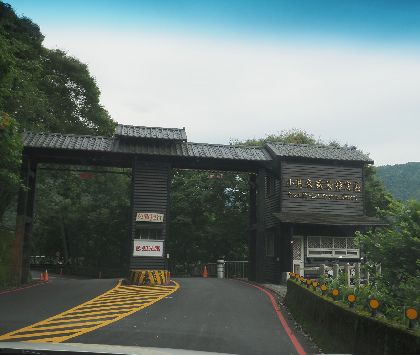
Passing through the gate of scenic area
|
We left Taipei at 5:30. We know that it would be a long day today. The earlier we start the more time we can spend for hike and the more flexibility we can have just in case. We get off at Sanxia junction (三峽交流道) and head for our destination in Fuxing-xiang (復興鄉) via #7B (台7丙) and #7 (台7線) highway. At 6:42 we pass under the gate of Xiaowulai Scenic Resort (小烏來風景區) area and further go along to Yixing community (義興部落). A narrow road diverges at the mouth of the community and goes up to Tamu recreational farm (塔木休閒農場). Climbing the winding road we reach a gate of the farm (elevation 830 meters) at 7:00
 |
| Four friendly dogs are around the gate |
 |
| Walk along a dirt road for a while |
Four dogs are around the gate. They first bark at us but soon turn friendly. Three of the dogs are handicapped, either their front or rear leg is missing. Two of them have a collar, indicating they have owners. The place is deserted, maybe because it is only open at weekends or holidays. We park our cars by the gate and set off at 7:12. The road from here obviously is not travelled by cars as the surface is all covered with fallen bamboo leaves. The pavement soon ends and turns to a dirt road. It gradually goes up along the hill and comes to a junction at 7:28.
 |
| Going down along a grass-covered path |
 |
| Black hoses running alongside the trail |
This is a junction for two trails, one going alongside the mountainside and up to Mt. Daishifu-shan, and the other going over the ridge to connect the west ridge of Nanchatian-shan, which we will take on our way back. We take the first one for now. The narrow trail goes gradually down. The track soon finds covered with thick vegetation. Several black horses go parallel to the trail. They are supplying water from the water stream ahead to the community. At 7:58 we come just over a deep gorge. There is a steel ladder ahead attached on the rock wall. Climbing it up finds another ladder. We see a water fall at the end of the gorge.
 |
| We failed to find the ascending path is much near to the waterfall at first |
 |
| Going down to look for the trail |
My map shows there is a trail going on the top of the rock wall on our right above the gorge, but we cannot find it. We go back down to the the first ladder and further down almost to the bottom of the gorge. There is no hint of trail either. So we try again the same ladder trail and advance towards the waterfall. Voila! There is a steep path going up in thick grasses. If we had gone a litter further on our first trial, we would not have wasted 40 some minutes of finding the trail. We climb on a steep slope and up onto the little ridge. At 9:06 we come to a rather flat and dry spot (elev. 1030m) and have a break.
 |
| Path in thick vegetation |
The little ridge soon blends into yet another steep slope. The precipitous path is very slippery and no dependable trees or branches to grab onto. We very carefully go up step by step. A couple of sections have aiding ropes, some of which are flimsy. We finally get onto the ridge and the incline gets gentle around 10:20. The trail merges another trail from our right and goes further up to the summit of Mt. Daishifu-shan (elev. 1354m) in ten minutes. The name of mountain comes from the local language of Atayal tribes (泰雅族), "Taiyahu", meaning very steep slope. No wander the slope we have come up is so precipitous. "Taiyahu" was then put into Chinese characters in Japanese pronunciation, and now Daishifu in mandarin way of reading. The small tree-encircled summit has a marker stone in its center. A very small name plate is placed beside it.
 |
| Steep climb continues |
 |
| Finally reaching a moderately inclined ridge |
 |
| The summit of Mt. Daishifu-shan |
 |
| Misty forest |
 |
| Broad ridge is easy to lose the direction |
After a break we head for our long way up to the summit of Nanchatian-shan. It is already a quarter to 11:00 and we are behind my original plan. The trail starts with a little descent first and ascends gently, which turns steep as we go up. Fog gathers in the forest for a short while, which disappears later. The narrow sections of the ridge are easy to follow but broad sections are troublesome. Fallen trees with branches block the scanty track and we have to find our way to go. The primordial forests have little undergrowth, which is good to go through, though. Coming down from a hump we meet another trail around 11:20. We will take this merging trail down on our way back later. We go up further and at a flat spot (elev. 1550m) to feel breeze we have a lunch break around 12:00.
 |
| Fallen branches are nasty |
 |
| Entering a rhododendron forest |
We resume our way to the summit at 12:20. We still have a long way to go. The trail gets into a forest of alpine rhododendrons. The forest floor is soft for layers of decaying fallen leaves have long piled up. The trail then gets out of it and keeps going up steeply. We finally gets to a top of a fake peak (elev. 1870m) at 13:32 and have a rest Two old direction signs are attached to the trees but they are almost broken. Despite the section from here to the summit is just less than one kilometer and the elevation profile is rather flat, the problem is the trail goes through dense primordial rhododendron forests and it is not easy to pass. You have to watch carefully for your direction as you go through many twisting branches of rhododendron trees. At 14:14 we hit a junction where the northwest ridge trail meets. Our summit is just above it. An empty small summit is dry and clean. Now there is a new name plate besides the marker stone, which did not exist on my last visit.
 |
| Closer to the 1870 peak |
 |
| Wandering the maze of rhododendron forest |
 |
| Junction of the northwest ridge route just beneath the summit |
 |
| Author at the summit |
The summit is surrounded with tall shrubs and avails no view even when the weather is fine. It took us seven hours to reach the summit, which is much more than I anticipated. So we need to hurry going down even though we are exhausted. It is good that this time of a year has the longest daytime, and we still have more than four hours before dark. We take the same route down. We could have planed to follow the northwest ridge down, but this is also less travelled route and may hide nasty surprises, which may well be time consuming. So for the sake of safety we chose the same route, which we left many marker ribbons as we have come up.
 |
| Still a long way down |
 |
| Steep slopes are faster to go down |
After a short stay of 15 minutes we leave the summit. It takes time to navigate through the dense rhododendron forests, but once we come out it can get fast to go along steep downhill. On our way down we take a short brake and hit the junction at 16:25. We take the right trail which goes along a ridge that splits from the west ridge. It first goes along the west side of the ridge slope and come to meet the ridge line (elev. 1305m) at 16:45, where we have a final break. Fog gathers around, which is just like on our way up before noon. I wonder whether fog stays all day long at this heigh of the mountain today.
 |
| Misty forest again near the junction |
 |
| Primordial forest with very tall trees |
The final leg of our hike is to go over the ridge of approximately 2 kilometers and then a wide road that we walked this morning. The trail here is better than the ones we have come along so far. Some sections of the trail are steeply going down. At a halfway point there is a fake path diverging to left, which we soon find wrong and get back on the right one. At 17:40 we hit the end of the wide road, which is covered with thick vegetation for a while but obviously smooth on the surface and easy to advance. It makes a round and finally at 17:48 we are happy to find the junction we passed this morning. Another ten minutes are enough for us to reach the gate of Tamu farm. The dogs of this morning notice we are approaching and come nearer to us with their tails waggling as if welcoming us back. It is good that we have made it before dark. We change cloths and are on our way back home by 18:15.
 |
| Glad to be back at the junction near our staring point |
----------------------------------------
 |
| Dogs welcome us back |
As mentioned before we spent 10 hours and 50 minutes to over 12.1 kilometer of the entire route. The total ascent is a little less than 1200 meters. The route physical index is 34. It is very much fun to follow unconventional routes to climb well-know peaks. You will probably meet no other hikers than your own for the whole day even on weekends and holidays. If you plan to try this route, you would better have ample time to do it otherwise you may end up walking in dark, which could be dangerous.
The warm weather caused us to sweat a lot. Not only myself but other member also experienced pain in our leg muscles later in our activity. Swallowing a grain of salt improve the situation. We will have summer soon and have to cope with the high temperature when we clime low altitude mountains in coming few months.


0 件のコメント:
コメントを投稿