|
| Mt. Jade Main Peak at dawn (Sept. 2023 from the North Peak) |
玉山は、台湾の最高峰であり多くの人が目指す山である。普段から登山をする登山者だけでなく、一般大衆も日本の富士山と同じように、人生中に一度は登りたいと考える山である。筆者は、
12年前の初登頂後5回ほど玉山を登った。塔塔加(タータカ)登山口からが多いが、一度は
八通関からも登頂した。昨年は、山と渓谷の台湾山岳報道のための
取材登山にも同行して登頂した。今回は、台湾の國家公園署が日本の国家公園との交流の一環として招いた日本からのゲストに同行し登頂した。コースそのものは、玉山登山の典型的なもので、塔塔加登山口近くで前泊し、排雲山荘一泊の二日コースである。日本語での記事は、以前にも記している。今回は台湾の関連メンバーに対しても考慮し、英語で記述する(日本語と中国語の二言語で記すのは、正直ちょっと手間なこともある)。また、行程中にも多くの海外からの登山者と遭遇し、外国登山者への参考になれば、とも思う。
----------------------------
 |
| At Yushan National Park office |
Mt. Jade or Yushan (玉山) is one of the best known mountains of Taiwan. With the elevation of 3952 meters it is the highest peak of the island as well as of the Far East. It attracts countless hikers and even those people who have no habit of hiking as an once-in-life experience. The peak stands in the southern part of the island and has been in the area of Yushan National Park since its establishment in 1985. Trekking to the mountain is thus controlled by the park authority.
Japan has many national parks throughout its land, from Hokkaido in the north down to those small islands in the southern waters. The Taiwan National Park Service authority has a mutual exchange program with Japan's national park authority to help each other for betterment of their services. The Taiwan authority invited several people from Japan in this November for a week-long activity including an expedition to Mt. Jade, a symposium of related subjects and visits to Yusan and Yanmingshan National Park offices. I was lucky to have a chance to accompany the Japanese guests for the whole week as an interpreter and joined the expedition to the mountain. This article is to record this journey and hope to give those English speaking foreign trekkers some insights and information about the trek to Mt. Jade.
 |
| A southward view from the Main Peak summit (6:16 a.m. Nov. 20 2024) |
 |
| Two-day expedition route map and elevation profile |
----------------------------
The word "Mt. Jade" indicates two areas: Often it points the highest main peak(主峰), but it also refers to a wider area comprising of eight adjacent peaks: Front Peak(前峰 3239m), North Peak(北峰 3858m) , East Peak(東峰 3869m), West Peak(西峰 3528m), South Peak(南峰 3844m), South Yusan(南玉山 3833m), Dong-Xiaonan-shan(東小南山 3711m) and Lushan(鹿山 2981m), all of which sit on the ridges extending from the main peak. They are all a part of so-called "Hundred Peaks(百岳)" that many trekkers are eager to try.
 |
| Mt. Jade range of peaks viewed from the west (May 2018) |
 |
| Mt.Jade viewed from the east (July 2017) |
The documented history of Mt. Jade climbing goes back to the very late 19th century. The mountain had long been a territory of indigenous Bunun tribe (布農族) who lived at the foot of the mountain. However there is no written record of reaching the summit by the indigenous people. It is regarded that Torii Ryuzou (鳥居龍蔵, Japanese anthropologist) and Mori Ushinosuke (森丑之助, Toriyi's assistant) climbed Mt. Jade in 1900 for the first time in history. At that time Mt. Jade was called Niitaka-yama (新高山, meaning new high mountain) as it became the highest peak of Japan after its acquisition of Taiwan in 1895. Niitaka-yama was named by the Maiji emperor because it was higher than Mt. Fuji(富士山 3776m). Trekking to Mt. Jade was already popular in the Japanese era(1895-1945). Excursions of schools or individuals were pretty common in the late 1920's though 1930's.
 |
| A group of Taipei No.3 women school at the trail head |
There are two major official routes to reach Mt.Jade: one from Tatajia trail head (塔塔加登山口) on the west side and
one from Batongguan (八通關) on the east. Most of trekking takes place from the west side. The trail from the west is in very good condition and has Paiyun Lodge (排雲山莊) on its way that provides accommodation and food while the trail from the east has no such facilities. You have to carry tents and food. The trail is not that good either and needs one or two days longer to reach the summit. Naturally fewer people take this route. Historically, though, the trail from the east was more major in the Japanese era.
 |
| tatajia trail head (Sept. 2023) |
 |
| Batongguan trail head (Sept. 2021) |
The typical itinerary of the west route is like this:
Day 0 - trip from Taipei or other major cities to a place near Tatajia trail head. Most of the trekkers stay at
Dongpu Lodge (東埔山莊) for a night. No camping is allowed except designated locations and none near the trail head.
 |
| Ddongpu Lodge (Sept. 2023) |
Day 1 - take a ride of shuttle service from the Tatajia control center to the trail head and walk up to Paiyun Lodge for a night. The walk takes about 5 to 6 hours to cover 8.5 kilometers in distance and 800 meters in altitude. If you get to the lodge early enough, you can make a round trip to the
West Peak, which is 2.2km away and takes about 2 hours for the whole trip.
 |
| A small Shinto shrine on the West Peak summit (May 2018) |
Day 2 - start very early in the morning to climb in the dark for two hours or so to catch the sun rise on the main peak summit. The distance is 2.3km and 590m in height gap. Go back down to the lodge and further down to the Tatajia trail head. If you get to the trail head early enough like before noon you have a good chance to catch a public bus service down to Sun Moon Lake (日月潭).
 |
| Sun Moon Lake (Sept. 2023) |
The national park imposes restrictions for trekking to Mt. Jade. There is a quota for entry because of ecological protection. If you are a foreign passport holder, you can apply for the set-aside quota from four months in advance. Here is a details of the Yushan National Park and its important information: Just
Click! Taiwan nationals, however, have to go through draw as there are a way more applications than the quota so you have to be lucky enough to trek to Mt. Jade!
================
November 19 (Tue) Tatajia trail head → Paiyun Lodge
 |
| Walk from Tatajia (塔塔加) to Paiyun Lodge (排雲山莊) |
 |
| Stroll in rainy Alishan Park on Nov. 18 |
On yesterday Nov. 18 we traveled from Taipei by High Speed Railway and chartered vehicles to Alishan(阿里山) and stayed in Tataka Recreation Area (塔塔加遊憩區). It drizzled all the way up here and during our short walk in Alishan Park. Taiwan met four typhoons even in November this year, which is pretty unusual and made a historical record. The last one caused this kind of nasty weather.
Nonetheless when I waked up and went out of the house at 7:00 this morning, the sky was still full of high clouds but I could make out mountains of Alishan across the valley. It looked that the weather should hold.
 |
| Alishan mountains are visible |
 |
| At Tatajia trailhead |
After breakfast we took a ride to Tatajia trail head and got there by 8:30. The ground is still wet but no rain, a good sign of our trek ahead. Our troop has 14 members including 6 of our guests from Japan, indeed a big group! As many as fourteen, all of us are experienced trekkers and we should not have any problems on our way.
 |
| A warning sign of likely falling rocks |
 |
| Studying droppings of an animal |
As soon as we started our walk, we has come to a point with a sign of falling rocks. The typhoon of early this month caused a lot of damages in mountains. This is one of such point of damage. We put on a helmet just in case of falling rocks. Soon after this point, we come to find droppings of a Taiwan serow (山羊). One of our guests is a specialist of wild animals and shows very keen interest for such items. Actually this expedition is not just for pleasure but carries serious purposes as well.
 |
| Pointing a ID plate of the bridge |
Our guide points out that all bridges, small or big, carry a serial number of 1 to 82 when we cross the first one. We pass by 0.5K milepost (or kilometer-post to be precise) at 8:45, which stands at every 0.5 kilometers apart to show the distance from the trail head.
 |
| Going up a zigzag section to gain height |
 |
| Monroe Pavilion |
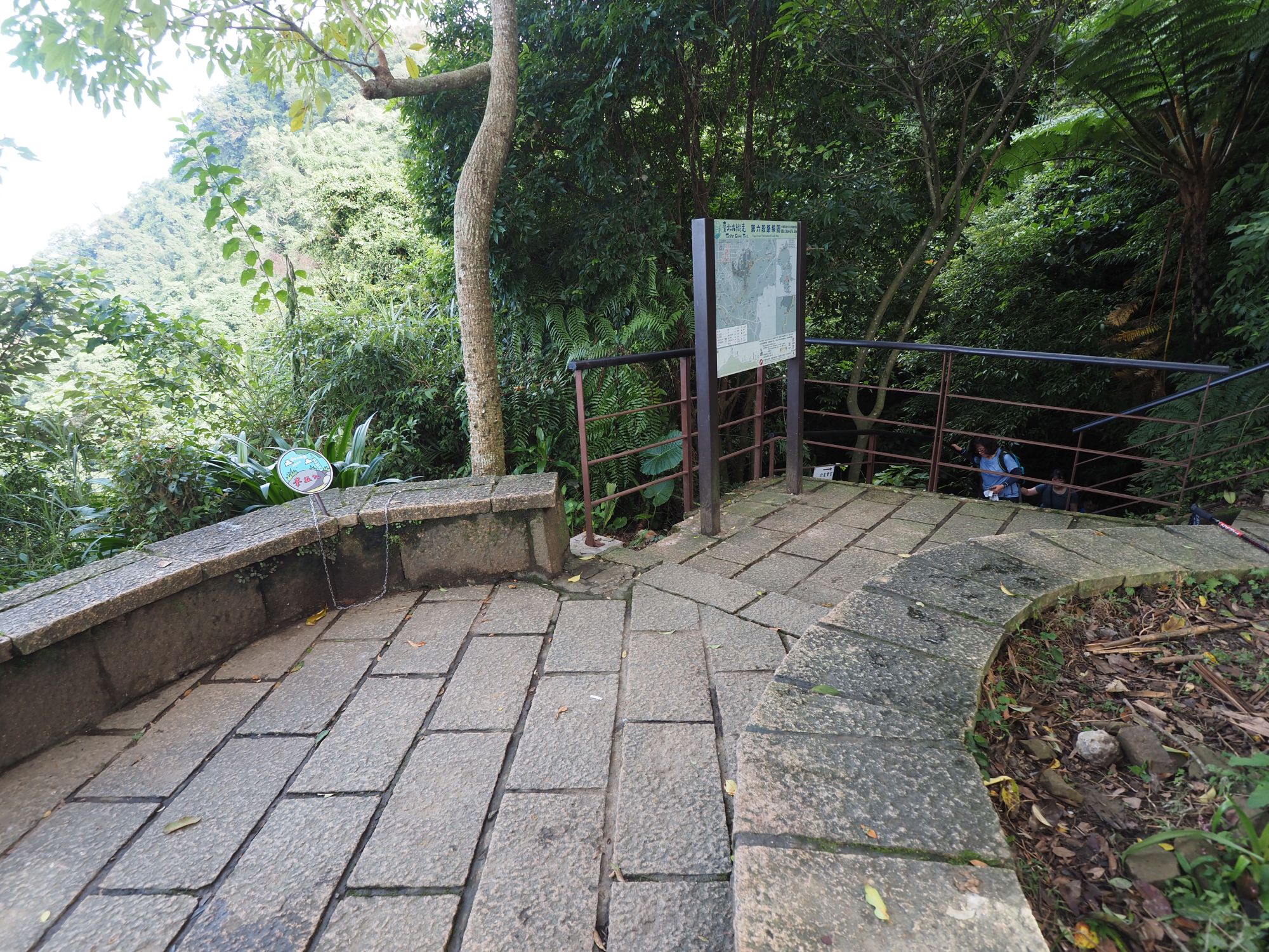
The moderate trail so far gets steep and gains height by zigzag way. After the trail reaches the top and goes down a little to Monroe Pavilion(孟祿亭), a first rest point at 1.7km from the trail head. This place was named after Mr. Monroe who was an American consultant to the Taiwan government in the 1950's and unfortunately lost his life at this point on his trek to Mt. Jade.
 |
| A explanatory board by the Monroe resting spot |
Our local guide tells us that behind a thick wall of thin bamboos still stands an old metal plate showing that this is a boundary where the forest structure alters from temperate to subalpine one. It has since been proven inaccurate and that actual alternation takes place at higher location. The altitude measured back in 1960's was not precise and made an inaccurate indication. Anyway you can have a look at the explanation board there when you go by this point. As a matter of fact, there are many other explanatory boards placed all along the trail. You can get first hand information on site, which is very good for associating the environment and knowledge.
 |
| Toilet on the right |
In a short distance from the rest point finds a toilet hut on the right slope of our trail. This is an eco-friendly toilet facility with a long history of try and error. According to our accompanying park officials, they tried many different ways to solve the problem of human waste treatment and finally found a way to do it correctly. They now employ local soil or other local organic materials like pine needles that contain bacteria to decompose human excrement.
 |
| At the side of toilet hut for observing the treatment details |
 |
| Pine needles to throw into the pit |
In fact it is a very important subject to treat human waste in high altitude environments where natural conditions are harsh. We go down and take a look around containers under the toilet hut and find no bad smell. The park volunteers come twice a month to take care of the facility.
 |
| West Peak |
 |
| Keep advancing |
 |
| Stepping into a Taiwan hemlock forest |
 |
| The Front Peak is already afar |
Passing several wooden and metal bridges we gain distance and height and finally reach a rest shelter upon a high platform at 11:57. This is near 5K point, a little more than a half way to Paiyun Lodge. Just before this shelter we passed another eco-friendly toilet. We have a lunch break at this shelter. Besides us there are a dozen or so other trekkers around. This trail is very busy indeed.
 |
| Another rock cut out section |
 |
| This huge cliff contains fossils |
At 13:24 we come to a huge exposed rock. An explanation panel next to it shows that this rock contains a lot of fossils. It indicates that this was once under the sea. Mt. Jade was formed by massive force of continental plates collision. By now we only have a little less than two kilometers and less than two hundred meters in height to go, which makes us happy!
 |
| Only a half kilometer left to go |
 |
| At last we made it to the lodge |
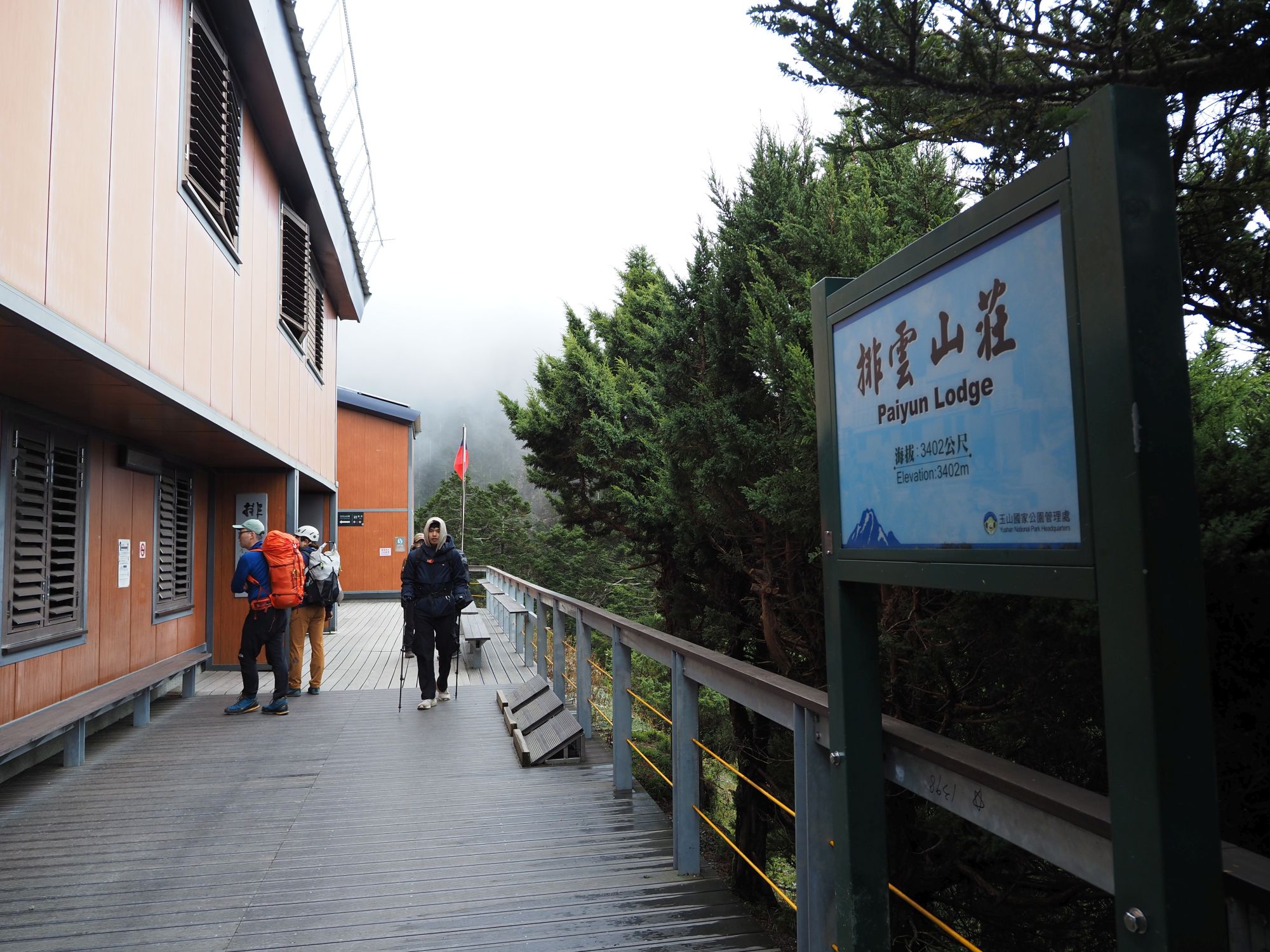
On our last leg we had a short rest before going up final ascent and reached the lodge at 14:33. This lodge is a new facility completed in 2013. There were two smaller lodges one after another prior to this new one. Further back in the past a police station named Niitakashita (新高下, meaning under Niitaka-yama) stood on this ground during the Japanese reign. The new lodge is a three-story building with a capacity of 116 guests and has an axillary toilet hut. It offers sleeping bags and food. You can choose both, just one or none to suit your own need when you apply for the stay.
 |
| Paiyun Lodge is at 3402 meters in altitude |
 |
| 1st floor of the lodge |
After settling in our room on the second floor, the park officials took us for a guided tour in the lodge including areas usually off limit. They also introduced the history of the lodge and how they run this facility. The lodge belongs to the park authority and its operation is carried out by a commercial entity, currently Yunbao Alpine Group (雲豹登山隊), a local company composed mainly of indigenous people. One of our guests Mr. Yamada, an owner of Yokoo Sanso (横尾山荘) lodge in Kamikochi(上高地). offered some suggestions for improving the service based on his long experiences at his lodge .
 |
| Dinner of the day |
The dinner started at 17:00. It tasted good and had enough volume. As we need to get up at 2:00 a.m. tomorrow, we went to bed around 18:00. Anyway there is no entertainment at this place except watching smart phones as Wifi is available.
================
November 20 (Wed) Paiyun Lodge → Yushan Main Peak → Lodge → Tatajia trail head
 |
| Round trip to the summit then back to the trail head |
 |
| Breakfast at the 1st floor dinning hall |
It is 2:00 a.m., still four hours from the sunrise. We are already up and have a simple breakfast. It is still very dark outdoor. We turn on our head lamp and step out of the lodge at 3:30. The moon hangs high through scattered clouds. The trail soon becomes steep and goes between tall trees. In the darkness like this we are forced to concentrate on walking, so do not feel hardship to go up the steep incline.
As we go up for a half hour or so, single-seed juniper trees show up here and there among white firs. Passing the junction for the South Peak, the trail starts going up in zigzag and trees besides us gets lower and lower. We are reaching the forest boundary and entering a barren world of rocks.
 |
| Climbing in the dark forest |
 |
| Distant lights on the horizon |
Lights of towns in a far distance are visible from the trail. It must be of Jiayi town (嘉義). Ascent on a long zigzag shape section comes to an end around 4:30. I feel a little dizzy maybe due to bad sleep in two consecutive nights. After a short rest I keep going up and reach the summit a little before 5:30. It is sill in the dark and feels very cold up here. I take out a down jacket from my backpack and put it on. A hot water warms up my body.
 |
| Coming in rocky section |
 |
| 0.4km to go |
 |
| Final ascent below the summit |
 |
| Author at the summit |
 |
| The sun is rising behind thinning cloud |
Dawn finally came around 5:50. Thick mist during our final ascent is quickly disappearing and revealing a spectacular wide view on the west and south side. Clouds hang over the ridge extending to the South Peak and fall onto the other side like a waterfall. Far beyond the cloud covered ridge sticks out a distinctive triangle peak of
Mt. Guanshan (關山). The sun is rising behind thinning cloude. The whole scene is so breath-taking and so beautiful!! How lucky we are!!
 |
| Could covered South Peak and Mt. Guanshan behind |
 |
| Looking down the West Peak |
 |
| Start descending from the summit |
The weather seems improving. Mist on the east side may go away if we stay longer. But we left the summit at 6:30 with total satisfaction. In front of us a gigantic shadow of Mt. Jade is projected onto the Alishan mountains. The trail goes by sharp cliffs which we were not aware in the darkness on our way up. Passing the junction for the North Peak at 7:00 we keep descending. When I look back, blue sky spreads over the summit. The weather is indeed turning better.
------------------------
We took a ride on our chartered cars and headed for the Tatajia visitor center for lunch. On the first floor of the facility exhibits ecological items of the mountain including black bears and other animals. These exhibits attracted our gusts' keep interest. On our long way back to Taipei, we stopped by Yushan National Park HQ at Shuili(水里). The director of HQ handed each guest a certificate of successful climb to Mt. Jade, which was a little happy surprise to them. After a short stay there we further got to Highspeed Railway Taizhong station (高鐵台中站). and took a 17:39 train back to Taipei.
 |
| A statute of Bunun warrior in front of Tatajia visitor center |
 |
| Japanese guests with the certificate and the director of Yushan HQ office |
 |
| A black bear exhibited at Tatajia visitor center |
Thus concluded our expedition to Mt. Jade. Our itinerary was just as typical as I described above. Trekking to Mr. Jade main peak is not difficult if you are physically prepared and well informed of the whole trail system and environment. The altitude of nearly 4000 meters is not for everyone, though. Someone may get altitude sickness. In case you fall in such symptom of the sickness, you had better stop going up and return to lower altitude. Serious cases may lead to a grave consequence.
Mt. Jade is high up there waiting for you. Come and have a wonderful trek for your ever-lasting memory!!