|
| The pointing peak of Mt. Najie (far right) viewed from Jiaobanshan (Mar. 2015) |
桃園市復興區にある那結山は、
2015年に初訪し、その後
昨年また訪れた。 漢口溪にそって山奥へ進む北横公路の入口に近いところにある、当座は尖った山頂を有し遠くから判別しやすい。尖った山頂は、当然急坂に囲まれどの方向からでも、垂直に近い急坂をロープや木の根をつかんでよじ登ることが強いられる。登山者もそこそこ多く、天候に問題がなければ週末には登山者に出会う。今回の東側からの登頂は、6年前のルートと重なるが、上りにはそのルートの尾根から北に延びる拉號山から嘎色鬧山をへて登った。下山は、6年前登ったルートを大灣登山口へ下った。同一峰の三度目の訪問なので、英語で記述します。
If you have ever been to Jiaobanshan (角板山) by Beiheng highway (北橫公路, the North Cross Island Highway) in Fuxing ward of Taoyuan municipality (桃園市復興區), you might have noticed a pointing peak in the southern sky. That is Mt. Najie shan(那結山). The pointing peak means a steep incline from any direction and you have to climb to its summit with your feet as well as hands. As a matter of fact, the two final trails leading to its summit have very steep sections, including almost vertical slope near the top. It is challenging as well as fun. If you are lucky enough, you would be able to view Shimen Dam (石門水庫) at your feet and the urban area of Taoyuan in the far end. In between there are many well-known peaks such as Mt. Nanzhatian (南插天山), Mt. Dongyan (東眼山) and so on.
 |
| North view from the summit of Mt. Najie, Shemen dam is visible down at left (Jan. 2015) |
 |
| East view from the summit, Mt. Nanchatian with cloud on its top (Jan. 2015) |
I have been to Mt. Najie twice in the past, six years ago from
Dawan (大灣) trail head on the east and last year from
Shuitian (水田) trail head on the west. On this hiking we took the east route for the final section but we went first up to Mt. Lahao (拉號山) and followed the ridge route going over Mt. Gasenao (嘎色鬧山) and met the route from Dawan for the fianl ascent. We took a route down to Dawan after climbing to the summit of Mt. Najie. The Gasenao ridge route has long existed but it was very hard to pass it as very few hikers took this route. Luckily a group of volunteer hikers, Taoyuan Liandao hiking team (桃園鐮刀登山隊) cleared the trail and renewed signage a couple months ago, which made the hike via the Lahao - Gasenao ridge route feasible.
 |
| Start from the north side |
 |
| Elevation profile |
 |
| The long ridge, a north part of which is this hike section |
The ridge on which we hiked in fact is the northmost section of a long ridge going along Hangoxi river (漢口溪) and its sub streams. This long ridge rises at Loufu (羅浮) of Fuxin and going all the way south to
Mt. Jingjie (境界山) in Jianshi manucipality of Xinzhu prefecture (新竹縣尖石鄉), extending almost 40 kilometers in length. We visited many peaks on this long ridge section by section in the past and this hike left another our footprint on this long ridge.
 |
| At the summit of Mt. Najie shan |
 |
| Beiheng zhi Xing rest area and our bus |
We have as many as twenty people, which enabled to hire a 20 seater mini bus. We gathered at 6:30 in Taipei and left for our destination, Beiheng zhi xing (北橫之星 Star of the Beiheng highway) . The bus runs very smoothly on the No. 3 Highway and gets onto No. 7 Beiheng road. This road connecting Daxi (大溪) on the west and Sanxing (三星) on the east goes over a pass which divides Taoyuan and Yilan (宜蘭). The current road is wide enough for cars, which was formerly a footpath built for security purpose under the Japanese regime and converted to a car road after the war. We pass by Luofu and see the peaks in front which we will go up later. We arrive at Beiheng zhi Xing (elevation 480m) at 8:10.
 |
| Flat section in a bamboo forest |
 |
| A steep section |
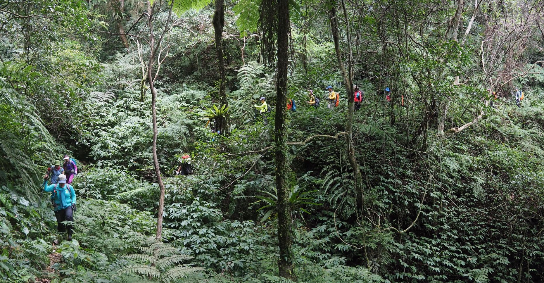
The sky is wonderfully blue, promising a nice day ahead. We start off a little after 8:20 and enter our trail, which begins by a small restaurant across the Beiheng road. The trail goes flat for a few minutes in bamboos and then a very steep climb starts. At 8:33 passing by a junction which leads to a water fall down on our left, we keep on steep ascent. In another 8 minutes we see a newly posted sign showing a trail leading a water supply spot. The incline is yet very steep for another few minutes and the trail goes down to a small stream. The water is very little, which should be running down to the water fall. If we had visited the waterfall, it would not have been so rewarding as the water is so little. We had a very dry winter this year, which brought a severest draught for a half century in mid and southern Taiwan.
 |
| New sign showing the direction for water supply |
 |
| A small stream with little water running |
 |
| Very steep incline in a bamboo forest |
 |
| A flatter section of the trail |
The incline is yet very steep. The path is clear among tall bamboos, which otherwise would be not easy to follow in such dense bamboo forest. At 9:23 we have a rest where the path gets flatter (elev. 875m). We have gained about 400 meters in height, which is more than a half way to our first summit of Mt. Lahao at 1039m in altitude. Another 10 minutes of steep climb, the path gets flatter, which looks likes an ex-logging trail. We soon enter a large man-planted cedar forest and start a steep climb again. At 9:47 we get on the ridge between Mt. Lahao and Mt. Gasenao. We take a right turn and head for the summit. A gentle incline leads to the summit of Lahao (1039m elev.) in ten minutes, which is just a small open area among trees.
 |
| Going up in the cedar forest |
 |
| The summit of Mt. Lahao shan |
 |
| The junction with a red sign board |
After 15 minutes or so on the summit, we take the same route back to the junction and keep on our hike on the ridge to Mt. Gasenao. There are ups and downs between the two peaks and, so we first goes down. A red sign of the forestry bureau at the junction cautions that the trail ahead to Mt. Najie is very far and long so no to go alone. We go over two peaks before getting onto the final approach to Mt. Gasenao. Thanks to the volunteer hikers to have cleared the trails, there are very few obstacles like thick vegetation. Rusty steel wires are on the trail, which were left after the logging business was over decades ago. The final climb to the summit of Mt. Gasenao is rather steep and you have to employ hands as well. We get to the small summit (1050m elev.) at 11:05, which is open on the east side enabling a view towards Mt. Nanchatian.
 |
| The trail was cleared by volunteers |
 |
| The summit of Mt. Gasenao |
 |
| A small peak of lunch time |
Mt. Gasenao is almost at the midway point of the ridge between Mt. Lahao and Mt. Najie, which is gradually rises its height and gets much steeper close to Mt. Najie. We continue our hike for a half hour and have a lunch break at a top of small peak. We have had sweating ascent to the Mt. Lahao and Mt. Gasenao, but here it feels a little too cool as wind sweeps over the ridge. We take a half hour break and resume our way up to Mt. Najie. The trail first goes down to the bottom and a ceaseless steep climb starts. At 12:45 we pass a junction where a path down to Gasenao village diverges to our right.
 |
| Junction to Gasenao village to right |
 |
| Going up in a cedar forest |
As we go up, a large area of cedar forest spreads up in front. We keep our ascent in the beautiful forest for a while. We enter a hardwood forest and soon get to a junction at 13:27. This is a three way junction where a trial from Dawan to Mt. Najie meets the trail we have just come through. Two hikers are just coming down from Mt. Najie and greet us. They are friends of one of our members and say that the have gone through the same route like us from Mt. Lahao. Thought they started earlier than us, they hike amazingly fast. After a short rest at the junction we take right up to Mt. Najie.
 |
| The junction right to Mt. Najie |
 |
| Steep section wih ropes |
Passing over a little peak we meet a trail directly from Gasenao village at 13:40, which is a more common route to Mt. Najie. The trail obviously becomes much clearer and we soon meet a couple of hiker groups one after another coming down from the summit. The closer we get to the summit, the steeper the ascent becomes. We pass over a small fake summit and then go up a final nearly vertical cliff which we need to hold ropes and bare roots of trees to go up. At 14:23 I get onto the one of the two summit's humps and go onto the other hump where a triangulation maker is installed (1520m elev.). Other members come up one by one and we all have a rest. It is a little pity that mist has come up and hid almost all view from the summit.
 |
| another steep bare rock section |
 |
| Summit of Mt. Najie |
 |
| Climbing down the cliff |
The vertical section is more difficult to decent than ascent. Climbing back to small peaks on the way down makes you feel tired. We get back to the junction at 16:00. There is four or five kilometers left to go down and we have to hurry, otherwise it gets dark while we are on our way. The section on the ridge has some steep incline. We reach a junction at 16:34 where the trail to Dawan diverges to our left. The trail going on the ridge to Mt. Ronghua (榮華山) was cleared recently and looks much better than on
our last hike there six years ago.
 |
| Junction left to Gasenao village |
 |
| Steep descent |
 |
| Junction left to Dawan trail head |
 |
| Going down on weed-covered trail |
Our trail leaves the ridge and gradually descend along the mountain side. A lengthy section goes in the cedar forest. The trail looks a little miserable compared with the one we have just come through. Vegetation is thicker and the path is less clear. We come across a small land slide on our trail. Luckily it is passable and some hikers still left new marker ribbons for others to follow. At 17:10 we finally come into a bamboo forest where the trail turns much better. In another 10 minutes we pass by a junction and soon run into a wide patch of open area where all bamboos have been cut out. I am happy because this means that the trail ahead should be very good as the workers have to commute the trail and must have kept it in good shape.
 |
| Keep going down on the grassy trail |
 |
| Cleared bamboo forest; the ridge at far end is the one we went up in the moring |
 |
| Coming down to the bottom of cleared area |
There is still more than one kilometer to go. The sunset takes place about 18:00 at this time of a year and I am confident we can make it before dark at our current pace. We reenter bamboo forest where the trail goes steeply down. As we hit the bottom of the clearing area again, the trail goes along a small stream. At 18:00 we come down to the trail head of Dawan (500m elev.) by the Beiheng road at last. We had no rest on our all way down. Our bus has been waiting for us by a small food shop where we have a dinner together. In fact I had a dinner at this shop six year ago too. We left for Taipei at 19:15 with our stomach full and happy.
 |
| Trail head by Beiheng road |
 |
| At the small eat-out shop |
The total distance we covered was 11.6 kilometers with the total ascent of 1400 meters and 1340 meters descent, which took us 9 hours and 40 minutes. The route physical index is 36, rather strenuous. It has a very steep and exposed section near the summit of Mt. Najie shan. This is definitely not for beginners. You have to havskills for such sections as well as to be fit for a long hike. If you love such kind of challenge, this route meets your expectation.