|
| 留龍頭から見る鳳凰山(5/12早朝) |
今回の登山は、小百岳を登る登山である。小百岳は、歩かずして車でその山頂を訪れることができる山もあるが、そこそこ体力を要求される山もある。基本は、誰でも登れる(到達できる)ことなので、登山道などは良い状態である。一泊二日で台湾中部の三座の小百岳を訪れた。三座は、松柏坑山,鳳凰山そして
金柑樹山である。前者は、車で登頂できる山で、一日目の往路で立ち寄った。後二者は、阿里山山脈の北端に位置し、南北に二つ並んでいる。
鳳凰山は、ちょうど10年前に訪れたことがある。その時は、大型バスでの行動で、人数も多くまた天気もあまり良くなかった。今回は二度目の登頂となる。10年の歳月は、山にとっては大きな差がない。但し、前回歩いた溪頭森林遊樂區からの道は、塞がれてしまいそのわきの道を経由して登った。二度目の訪問で、ルートはほぼ同じなので英語で記述します。
-------------------
 |
| A single peak hunt |
Mt. Phoenix or Fenghuang-shan (鳳凰山, elevation 1698 meters) is a mountain standing next to Xitou Forest Recreation park (溪頭森林遊樂區) in the middle of Taiwan island. It is listed as one of the "Small Hundred Peaks" (小百岳). Just south of it also stands another one of the small hundred peaks,
Mt. Jinganshu-shan (金柑樹山, elev. 2091m). Our this trip was to climb these two peaks on one visit. Besides these two peaks, as a matter of fact, we visited one more small hundred peak Mt. Songbokeng-shan (松柏坑山, elev. 341m) enroute. So we made three peaks for one shot.
 |
| Two-day activities |
There are thousands of mountains and peaks in Taiwan. It is not easy to select which to visit. So the lists of
Hundred Peaks (百岳) and Small Hundred Peaks help select which one to go. The former list in principal covers only peaks of 3000 meters and above while the latter places more emphasis on characters of each mountain that represents its region in terms of beauty, historical or cultural backgrounds. It takes some physical fitness and experiences to hike high mountains of 3000 meters while Small Hundred Peaks must be more accessible to all people as the condition of their selection dictates. Some summits of Small Hundred Peak are even reachable by car. Mt. Songbokeng-shan is just one of such peaks and we drove up to its triangulation marker that is supposed to be the summit.
 |
| At the summit of Fenghuang-shan |
-------------------
 |
| Lumungan Highway rest area |
One of our four members was generous to provide a car for all of us to share a ride. We left Taipei at 6:30 in the morning and headed for Nantou-xian prefecture (南投縣). Our car reached Lamungan rest area Nantou by 8:45 via #1 and #3 National Highway. This rest station, unlike all other rest stations along national highways, employs a name of indigenous people's language. Lamungan, according to explanations, means a lowest point of a mountain ridge. This very place once was a village of Bunung tribe (布農族) in the past.
 |
| Triangulation marker (summit) is just by a tea leave processing factory |
 |
| Author by the marker |
After a short stopover we keep our drive to Mt. Songbokeng-shan. We get off the highway at Mingjian (名間) junction and reach Songbokeng-shan via local roads by 9:15. The summit does not look like a summit at all. Its triangulation marker lies just in a large flat field of tea crops and by a large tea leaf processing plant. You can of course hike up to this point like following trails from the west side beneath this hill, which takes a couple hours. A family of four including kids are walking towards us. They have "hiked" to this summit, though I do not know how far they have come.
 |
| Passing through the town of Lugu |
 |
| Walking up along Miti street next to the name sake hotel |
 |
| Trail head (in red circle) and the park's rear gate |
A brief stay of 10 minutes is enough for Mt. Songbokeng-shan. We are back to the highway and go further down south. At 9:50 we leave the national highway for Lugu (鹿谷) and Xitou. Lugh has long been known for its good tea leaves that are grown on high hills of Lugu. Our car goes through a town of Lugu and further up to Xitou recreation park, which it reachs at 10:15. It looks too late for us to come. The parking area is almost full. We have to look for a place to park our car for about twenty minutes. It is lucky for us to finally find a space where a car has just left. The time is 10:42 already.
 |
| The trail goes by a dried creek |
Our parking space is along a road just beneath Miti Hotel (米堤大飯店). We set off for our hike by walking up Miti street (米堤街). We have come up about ten minutes along the road and find two hikers are just getting out onto the road. This is a trail head for Mt. Fenghuang-shan. I remember that my last hike started from the parking lot inside the recreational park. We have not yet reach the rear gate of the park.
 |
| A junction for banana orchard (right) |
 |
| Crossing a dried creek |
We take this trail anyway assuming that this is parallel to the trail from the park. It goes along a small creek on our right and hitting a junction in ten minutes from the head. It further goes up with increased gradient and passes a dried creek. At 11:41 a flat area shows up where a few people are resting on benches. This is a little square where a Tudigong deity shrine (土地公祠) stands. At a corner of this little place finds a grass covered trail. This is the one that I traveled on my last visit. According to a man there, the recreational park has blocked this passage because many hikers do not pay admission fee to the park.
 |
| Steep climb |
 |
| A small square with a Tudingong shrine and benches |
 |
| Blocked original official trail |
 |
| Stone paved path traverses the mountain side |
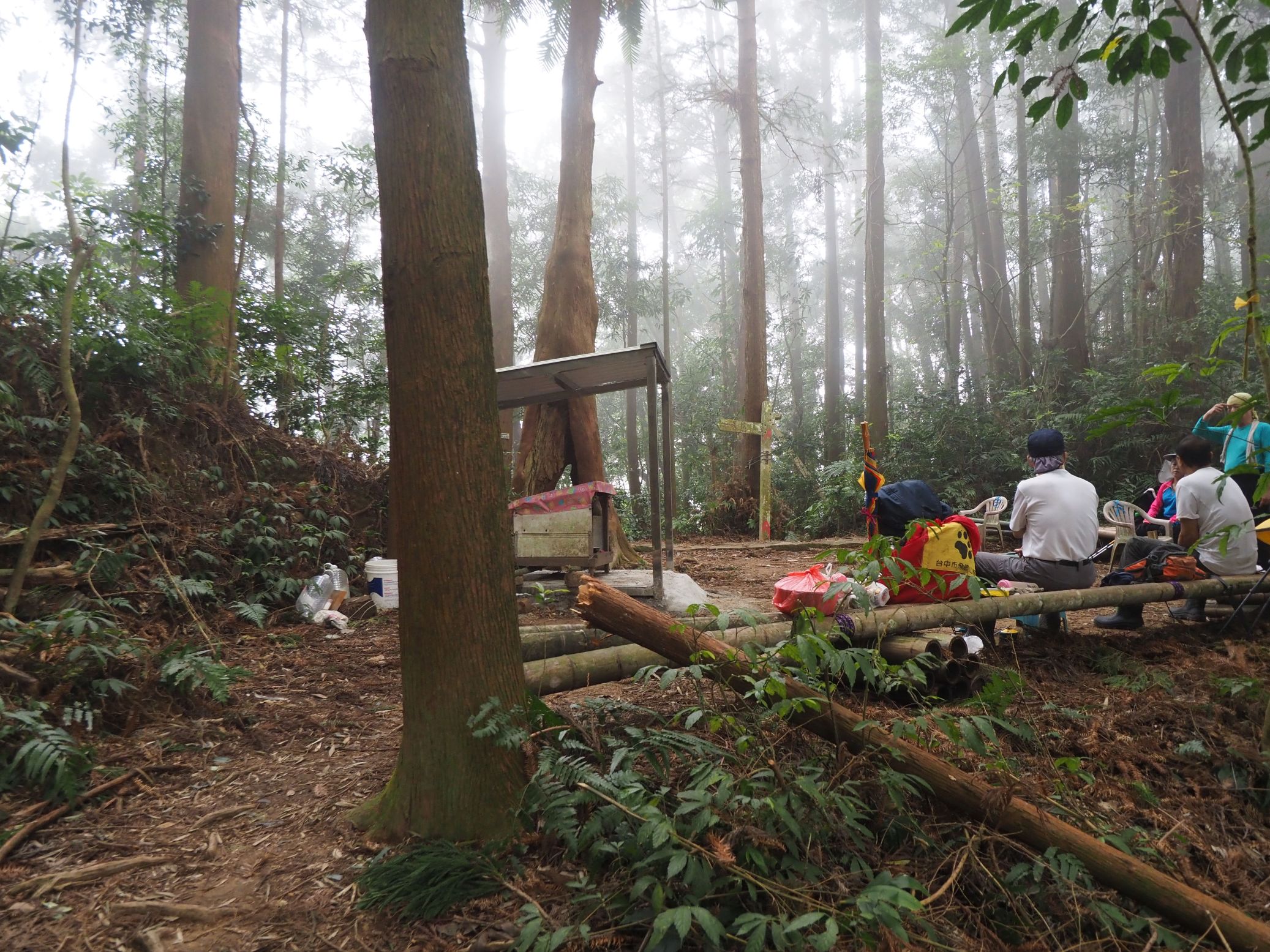
Our trail is paved with stones like my memory recalls. This is an original official trail to the mountain. It goes alongside the mountain side for a while and gains height in zig-zag way. There are a couple of spots of steep climb with ropes. The stone surface looks slippery and mist in the forest has since thicken. We reach a flat square on the ridge line at 12:16 where another Tudigong shrine stands at the foot of a big rock. There stands a small roofed bench. We have a lunch break under the roof.
 |
| Climbing in zig-zag way |
 |
| A roofed bench at a junction on the main ridge |
 |
| Steep ascent on the ridge path |
Mt. Fenghuang-shan as well as Mt. Jinganshu-shan belong to Alishan mountain range (阿里山山脈). The Alishan range runs in north-south direction parallel to Yushan mountain range (玉山山脈). It has no 3000m peaks but has many attractive peaks and lakes with the highest peak of
Mt. Data-shan (大塔山, elev 2662m) in our distant south. I have visited several peaks of Alishan mountain range in the past like
Mt. Maimai-shan,
Mt. Song-shan and others. Fenghuang-shan stands in the north end of the range.
 |
| Small summit with #3 bench |
 |
| 2.4K distance marker |
We take off for the main peak of the mountain at 12:47, which stands at 1.9 kilometers away and a big "fake summit" in between. The trail faithfully follows the ridge line and gains height with a very steep gradient. A new distance marker is placed at every hundred meters. In fifteen minutes we go over a small top with a roof bench #3. Passing a small downhill the trail goes up again and passes a bunch of white rhododendron flowers on one tree only. There are rhododendron trees around but they seems to have already done with flowers.
 |
| Rhododendron flowers on a single tree |
 |
| Keep on going up |
 |
| Looking down from the rock edge |
With a little more of uphill we come to a point where bare rocks stick out towards the cliff. This seems to be the highest point on the ridge that we travel. This is even higher than the main peak. From the top of the cliff edge I can make out a little view at the mountain foot through cloud. Compare with my last visit in very thick mist, this is at least better. We go down along an equally steep trail. There are many bamboo shoots sticking out from the soil along the trail. They are eatable and a member picks us some.
 |
| Author on the rock (Member's photo) |
 |
| Going down steep path |
 |
| Bamboo shoot |
 |
| Discarded winch machine |
At 13:37 we pass the lowest point before the main peak where a broken winch is discarded by the trail. This machine must have been used for logging in the past and now is a legacy of the era. A logging industry thrived in this area several decades ago. That is why so many man-planted cedar trees are all around. The final ascent to the main peak is rather moderate. We reach the summit at 13:56.
 |
| Last ascent to the summit |
 |
| The summit |
 |
| Triangulation marker |
 |
| Going back the same trail |
In my memory the cleared space of the summit was not as big as this. It is still surrounded by trees and bamboos so no view. We have a good rest before returning at 12:43. We go back along the same ridge-top trail, taking a brief rest at the No.3 roofed bench and the open flat space of Tudiggong shrine. Our friend has picked up more bamboo shoots on our way back. The weather turns better now and no more mist that filled the forest on our way up.
 |
| Going down steep rock point |
 |
| Back at the resting spot for a final break |
 |
| Crossing the dried creek again |
We leave the resting spot at 16:28 and take the same parallel dirt trail down. We come to the junction in 25 minutes. The left one is the one we came along this morning. We take the right one that is named a trail to a banana garden (香蕉園). This trail is not shown on my map. It turned out that this is yet another parallel trail and ends at Miti street a little below the other one we entered on our way up.
 |
| Coming out from Banana orchard trail head |
 |
| The ridge line is clear now as all mist has gone |
 |
| Our inn for the night |
Our last leg along the paved road is very easy. Now we can see the peaks high up on our right, which we have just been to. We are back to our car at 17:16. There are only a few cars parked alongside the road. Most of them are all gone. We drive back to Lugu town and check in our inn by 17:50. The inn proved quite good for the money, just $500 for each. We go out for a nearby restaurant for dinner and are back by 20:00. It is pretty quite out here and night lingers.
 |
| Shuttle bus between Taizhong and park |
Our hike covered 7.7 kilometers with a total ascent of 900 meters. It took us six and a half hours including breaks. The route physical index amounts to 24.
We drove our car for this hike but this mountain is accessible by public transportation. Xitou recreational park is well served with frequent trips of buses (台灣好行巴士) from Taizhong (台中).