 |
| 大峭壁からの五寮尖 Mt. Wuliaojian summit from the top of Big Rock Wall |
新北市三峽區の五寮尖は、台湾北部の三大岩稜山の一つである。筆者は
三年前に一度登頂し、その後
大溪白石山への五十縦走の時に訪れた。縦走の時は、時間が必要なので岩稜からではなく、今回も下りに通った玉觀音経由である。今回の登山は、岩稜のトレーニングをしたいという友人の希望に応えた山行だ。三大岩稜の他二ヶ所に比べると、五寮山はその規模と長さで一番きついが、ここを経験すればそれなりの自信ができる。友人は補助ロープのある岩壁登りは、以前台北市信義区の
南港山で経験して基本はわかっているので、こうしたセクションの登山は初めてではない。コースとしては、三年前と全く同じなので、英語で記述する。
==========================================================
 |
| Climb from Hezuoqiao down to Huzhuqiao |
 |
| Single peak climb |
 |
| Trail head at Hezuoqiao |
There are said to be three challenging rock ridge mountains in the Northern Taiwan where you can access easily. One of the three is Mt. Wuliaojian (五寮尖) of Sanxia District (三峽區), New Taipei City (新北市). The other two are
Mt. Bijiashan (筆架山) of Shenkeng (深坑) and
Mt. Huangdidian (皇帝殿山) of Shiding (石碇). I have been to all of them, and more than once to each. Mt. Wuliaojian is in my opinion the toughest of the three as its rock ridges are long and steep. It is not far from the town of Sanxia and you can complete the hike on it in five or six hours, so it is pretty popular and you see many hikers on weekends.
 |
| Safety improvements have been made |
These rock ridge mountains are now provided with many safety installments like ropes and handrails at dangerous places and have turned out not as precarious as in the past. Whatever safety measurement has been implemented, however, the height of the rock walls is same as before and you will get seriously injured or die if you fall off. You still need to pay utmost attention when you walk on the steep cliff edges.
One of my fellow hikers wants to have some experiences on the rock ridge mountains. I once took her to rock climbing routes of
Mt. Nangangshan near the central Taipei and she has basic skills to climb these rock routes. It is a kind of challenge to her to hike on Mt. Wuliaojian but she would have more confidence when she completes this hike. We went up slowly while we secured safety. It was a beautiful day but turned out to be very hot and that made us tired.
 |
| One of rock sections |
Not far from Sanxia busy streets is loacated Mt. Wuliaojian, it is not so convenient to take public transportation to go to its trail head. There are two bus services going by its trail heads like Hezhuqiao (互助橋) and Hezuoqiao (合作橋). Each service starts very early from the town of Sanxia like 7:00 or earlier. and goes only five or six trips a day. Many hikers ride their own motorcycles or drive cars to get there.
 |
| View from the trail |
I know that it will be very hot today and plan to start early. We take a very early MRT all the way to Yongning (永寧), then take #916 bus to Taipei University campus bus stop (台北大學三峽學區). We walk for a few minutes to Dayonglu (大勇路) bus stop of F627 New Taipei City community free bus. To my surprise we find that the bus just left a few minutes ago. The F627 route has two different time tables, one for weekdays and for weekends. The problem is that weekend timetable is only applied to Sunday, so the bus left at 7:00, not 7:30 of Sunday. It is my fault that I did not refer to the latest information but relied on my memory. There is another bus service, #807 bus for Xiongkong (熊空). This bus route has two tables too, one for weekdays and one for weekends. The weekend table of #807 does include Saturday. The next bus leaves at 8:30 and we have but to wait for a little more than an hour for it.
 |
| Another safety measurement |
At 8:30 the bus comes on time. There are not many hikers on this bus, mostly local people. In twenty minutes we arrive at Hezuoqiao bus stop. There are many parked cars along the road indicating many hikers are already on the way to Mt. Wulianjian summit. More than ten hikers are around ready for start. We get ready ourselves too and start climbing at 8:56. The trail starts with steep cement steps and then equally steep dirt footpath. Up we go for ten minutes or so a rock section appears up ahead of us. Upon climbing to the top of it, you can have a view beneath you feet, a river and a road in the narrow valley. We keep ascending on the trail and go by more rock sections. In another 10 minutes we come to another vantage point, now you have wider view through branches of surrounding trees.
 |
| Mr. Wuliaojian peak and sub ridge on its right which we take as a way down |
 |
| Junction with #4 signboard |
While we have come up along the rock sections, I noticed that improvements to safety measures have been made since my last visit three years ago. The ropes get plastic tubes to protect its fiber and a word "Watch your head" is applied on a rock in yellow paint. In about an hour and 10 minutes of constant climb we come onto a short flat section. We can see the triangular summit across the valley. At 10:10 we come to a junction with a sign board of #4. A trail meets from the valley on your right. We are now at 380m in elevation and have gained 270m or so, meaning at about a half way point to the summit in terms of elevation, but not in time.
 |
| Panoramic view from the ridge, looking north |
 |
| Cave in the gap |
Another steep section starts from here. More rock sections and up we go. We pass a peak on the ridge called Mt. Jiguanshan (雞冠山), meaning a rooster head. The ridge turns the direction from north-south to east-west. After a short rest we climb a rock face onto a sharp ridge where no trees hinder your view. Just across the valley below stands
Mt. Baijishan (白雞山) and its adjacent peaks. In a distance of northwest, the town of Sanxia is visible and beyond that you can see
Mt. Dadongshan (大棟山). The summit is not far by now but it will take time to get there as you have to go through the most difficult section of the climb and go up and down a few small peaks along the way.
 |
| View from the ridge looking northwest |
 |
| Walking on the top of rock ridge |
 |
| Climbing down Daqiaobi big rock wall |
We climb down a little to a gap between the rocks where a small cave is and a safety steel handrail is fixed. The cave may well have served as a religious purpose in the past but now it is empty. We go further along the side of the ridge again under trees. At 11:17 we go up again onto the top of the ridge. You will be exposed to open air with a deep cliff beneath your feet. If there is no handrail, you would probably feel very uneasy. At 11:48 we come to a big bare rock wall called Daqiaobi (大峭壁). You have to go down this big wall. Several hikers are waiting on the top of ridge. A rope goes down on the rock face and you climb down with that. There is another rope beyond the first one but it is longer than the first, probably 30 meters or so in length. We go to the second one and I start climbing down. My friend is a bit nervous and I go down about the third of the route and wait for her to come down first. After she reaches me, then I repeat another third. By the time she comes down to my position she feels OK and goes further down first. We complete the climb down and onto the trail beneath the big wall. Relieved we are, but the rock section is not over yet. We soon come to steep rock sections down and come to another junction where benches are installed at 12:24. We have a long lunch break here.
 |
| Climbing down a long rock section |
 |
| At a junction with benches, lunch break |
 |
| Going along the bare rock side, Daqiaobi is just behind |
After twenty minutes of rest, we resume our hike up. The climb starts with a steep uphill on a dirt path and in about ten minutes come to a bottom of big rock face. We climb this rock section and there is another one following the first. You can have a view of the Daqiaobi big rock wall from here. There are few hikers up on the bare rock ridge and it looks pretty dangerous from this view point. At 13:14 down we come to a bottom with a big tree and #7 sign board. It is indeed tiring to repeatedly go up and down on the ridge. We continue our climb without rest. This is the final uphill before the summit. 13:24 we reach a junction where the trail diverges to the summit and on to Mt. Longshanyan (龍山嚴). Before the final ascent to the summit, we have a short break. We feel pleasant breeze while in rest.
 |
| The summit |
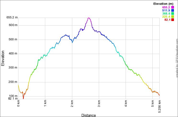
In an only few minute we come up to the summit of Mt. Wuliaojian (elevation 645m) at 13:43. It took us approximately five hours to come up here, a bit longer than my last visit alone, but we have more hikers on the way and congestion at some points delayed us. Anyway hiking is not a time competition and as long as you enjoy it, the time does not matter. There are several hikers on the top. The view from the top is not that clear as in the morning. Probably air has turned bad or more moist and blurs the distant view. I take out a beer and have it with my friend. This is indeed great! The frozen beer has just turned all liquid and the taste is good! A kind hiker of my own age sitting next me offers nuts to us. While we rest more hikers are coming up.
 |
| A very hazy view from the summit |
 |
| Climbing down a new ladder |
After a half hour of rest on the summit we start decent at 14:11. We take another route down to Yuguanyin (玉觀音). This is with more moderate incline and easy to walk. We go down one of the ladders affixed to the steep rock wall under the summit. There is an old path with very crude steel rods driven into the rock and it looks pretty primitive compared with this shinning aluminium steps. I doubt anybody uses this nowadays. There are steep downhills in the first section but the grade turns more moderate later on. We pass the sign board #11 at 14:38 and come down to a tank of water at 14:48. Water is carried over here through a pipe from a water stream up in the valley. There is a faucet and are several cups around it. We wash our hands and face, which feels very good and refreshing.
 |
| Water tank besides the trail |
 |
| Yuguanyin temple |
We go a little further down and find that some construction work is underway just below. We turn left to stone steps but find that the path is in grasses and seems not have been walked on for sometime. I last walked up here last year and wonder what happened. So we go back up to the ridge and see another path. It turns out that this new path becomes a normal route where hikers walk. The construction work of high voltage transmission towers has changed the route. We keep on the ridge route down for a few minutes and turn left. We follow a path on the hillside and reach Yuguanyin at 15:07. We have a rest here and have another can of beer!
 |
| Construction of electric tower is under way |
 |
| A land slide |
The rest of our hike is just walk on a paved road down to Huzhuqiao on the main road. After a good rest we go along the road. There are more transmission towers under construction along the road and on the opposite hillside across the valley. We pass by a landslide twice along the way. The last two typhoons in August and last month must have done this. They left devastating damages in the area up in the valley of Sanxia district and these land slides that we see are just one of them. At 15:44 we arrive at Huzhuqiao bus stop. While we have more beer that we got at a small shop, we find that #807 bus has just left before we have arrived. The time schedule seems to have changed for weekends. We wait for another hour and finally catch a F627 bus at 17:15 for Sanxia.
 |
| Huzhuqiao bus stop across the road |
It is a little pain in the neck that public transportation for this mountain is not that convenient. We spent six hours and half for the hike including rests and another three hours just waiting for a bus to and from. This is a good full-day hiking course. But keep in mind that you go through rock climbing sections. If you are not experienced for this kind of route, you need to go with those with good experience. It gets very hot in summer on the rock ridges. The difficulty level is three for the routes and stamina. If you do not regularly exercise, you will have really tough time there and would surely curse on it!


0 件のコメント:
コメントを投稿