|
| 樂山林道から望む鵝公髻山 (奥)と鳥嘴山 |
数年前に歩いた鳥嘴山から鵝公髻山への縦走路を今回も歩いた。ただしアプローチは、その時とは反対の西側苗栗縣南庄鄉からである。新竹縣五峰鄉からだと、登坂高度差も小さく道もよいので、初心者も含め楽ちんルートだ。しかし反対側からは、落差が1100m以上しかもずっと急坂、あるいは非常に急な岩壁登りがある、健脚経験者向けのルートである。親しみやすいことが条件の小百岳に選定されている鵝公髻山だが、もし西側だけのルートであれば選定されることもなかっただろう。それほど差異が大きい。稜線への上り下りは異なるが、以前と同じ山なので、英語で記述します。
 |
| Very steep section of the Egongji trail to Donghe |
--------------------------------------
There are countless peaks and hills in this Taiwan Island. Which one is worth visiting? It of course depends on each hikers to select. Nonetheless there are two major selections of peaks known to Taiwan local hikers; One hundred peaks (百岳) which comprises of a hundred peaks of 3000 meters in elevation or higher, and Little one hundred peaks (小百岳) which was selected not for their height but for their historical, aesthetic or geological significance of their location. The latter ones are generally much easier to hike than the former because these peaks were selected also as a measure to encourage people to go out and get close to the wilderness.
 |
| Trek from the south west counter-clock-wise to the north end |
 |
| Elevation profile |
 |
| Wefung Skyline route (in the red box) |
One of the two main peaks on this hike, Mt. Egongji (鵝公髻山) is one of the Little hundred peaks. It is easy to go up to the summit. You may well witness many families including small kids are hiking this mountain. However easy it is, there is a side note. You need to follow the trails from the east side, Wufeng township of Xinzhu (新竹縣五峰鄉), like the one from Shanshang Renjia (山上人家) recreational farm. The west side of the mountain belonging to Nanzhuang township of Miaoli (苗栗縣南庄鄉) is completely another story. It has a steep cliff and you have to cover more than 1,000 meters in height. If it had only this route, this peak would surely not have been selected as a Little hundred peak.
 |
| All members at the summit of Mt. Egongji |
Another peak on this hike, Mt. Niaozui (鳥嘴山), is easy to access its peak if you come from the east side. You only need to ascend 200 meters in altitude. If you do it from the west side, however, the number would be something like 1,100 meters, 5 times more and very steep all the way.
I have been to the two peaks in the past. I got to Mt. Niaozui from the trailhead on the east, followed the connecting ridge to Mt. Egongji and down to the trail head on the east too. On the hike this time we visited the same two peaks. Although the connecting ridge route is the same, we approached from the west side and enjoyed (or suffered?) the very different feature of the same mountains.
----------------------
 |
| The peak of Mt. Niaozhi in the morning light (center) |
 |
| Junction near the 6K of Miao 21 road |
It was anticipated to take many hours to complete the planed route. So we started very early in the morning. We gathered at 5:30 in Taipei and got on a 20-seat small bus. 17 members showed up in time and headed for our destination. Picking up two members at two separate locations on the way, we made a short stop over at a convenient store near Nanzhuang (南庄). At 7:30 we have arrived at a point near 6K marker of Miao 21 (苗21線) county road. This is just by the junction of a road leading to Dawo village (大窩部落) and our trail head.
 |
| The trail head with a yellow sign of 0K |
 |
| Mt. Jiali across the valley |
 |
| Steep climb in woods |
We take this road up. This place has an elevation of 380 meters. The vertical distance to the summit of Mt. Niazui (1550m elev.) is nearly 1,200 meters. The road goes up for about 200 meters in 2 kilometers and passes by some houses of the village. We see the 0K (0 Kilometer) sign attached on a thin tree at 8:00. Across the valley the pointing peak of
Mt. Jiali (加里山) stands against a clear blue sky. The yellow sign says the trail is called Niaozhuishan nanzhuang trail (鳥嘴山南庄線) and the distance to the summit is 4 kilometers. This signage has been made by a local volunteer hiker and fixed at each half kilometer to go.
 |
| The trail goes in the forest of hardwood |
 |
| 1.5K sign |
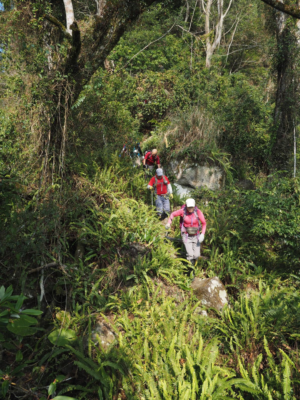
A dirt trail takes over the paved road on which we have just come along. It is not so long before we meet a steep grade. The path is clear enough but obviously not so much travelled. It is almost a ceaseless steep ascent to the poit of 1,200m in elevation. The trail goes mostly among ever-green hardwood trees and patchy areas of Japanese cedar woods and bamboos. Some very steep sections are fixed with ropes. At 9:22 we see a sign showing 1.5K and in another ten minutes we come to a rather flat and wide open area to rest (Elev 1180m).
 |
| A rare flat point in the ceaseless ascent |
 |
| Big rocks on the narrow ridge |
A milder incline continues for about 100 meters in height. The ridge gets narrow and big rocks appear on our way. And then the steep incline comes back again. At 10:17 we see a blue sheet hunters' camp and burn-out ashes (elev. 1400m), which must have been left by local indigenous people. After a short flat section, we see a sign of 3.5K, which means there is not much left to climb. A final short steep ascent of a few minutes brings us to the summit at 11:03. The wood-surrounded small summit (elev. 1550m) has three stone makers, which is rather unusual. We have a lunch break.
 |
| Blue sheet tent |
 |
| Summit of Mt. Niaozui |
 |
| Going down between cedar trees |
We take off for our next peak, Mt. Egongji at 11:40 The path going over the ridge between the two peaks is a section of a long trail called Wufeng Skyline route (五峰天際線), which extends down from Shangping (上坪 elev. 260m) near Mt. Wuzhi (五指山, meaning five-finger mountain, 1000m elev.) in the north end all the way up to Mt. Leshan (樂山, elev. 2467m ) covering 28.5 kilometers in length. The most part of it belongs to Wufeng township, though its northern part constitutes a boarder line between Wufeng and Nanzhuang where we are now. The summit of Mt. Niaozui is at 16.5K, just about a half way of the route. The path begins with a steep descent among cedar trees. The mountain sides have been planted with cedar trees for logging but the industry no longer exits in Taiwan and threes are left as such.
 |
| Sings at the junction |
 |
| Steep climb back |
On our half way down the skyline of
Mt. Dabajian (大霸尖山) shows itself in a far distance between trees. This class of mountains is mostly covered with dense forests and you have little open view even on summits. At 12:03 we pass a junction where a trail down to a trailhead on the east side diverges. This is a lowest part and the trail climbs up with a steep grade. About 10 minutes of laborious ascent brings us to the top. This is one of the two small peaks that we have to go over before a long way up to Mt. Egongji. Going down for a little and up again to the second small peak. After a steep descent we hit the lowest point (elev. 1370m) between the two peaks at 12:53.
 |
| Heading for the second small peak |
 |
| Junction of the trail to Shanshang renjia farm |
 |
| A father carrying a baby on his back |
A gradual ascent of 15 minutes leads us to another junction (at 13.5K of the skyline trail) where a popular route from Shanshang renjia trail head meets. While we are having a rest, quite a few hikers pass by us. The path from here is wide and pretty well travelled. We run into many groups and families including kids or a father carrying a baby on his back. A rather moderate ascent leads to a flat section and we come to a final steep ascent at 13:53. We reach the summit of Mt. Egongji (elev. 1574m) at 14:01.
 |
| Final steep ascent to Mt. Egongji |
 |
| Summit of Mt. Egongji |
 |
| Going down a steep slope |
Most of the hikers take routes down to the east side. We take a much less traveled route down to the west side, Donghe village (東河部落). A red sign of Xinzhu prefectural government by our trail says that you had better take the same route (from Wufeng) down to avoid getting lost. The trail down to Donghe is indeed no easy one. In a few steps you are standing on the top of a very steep way down. As you go down it gest steeper yet and rocky surface is involved. Though ropes are fixed at such steep sections, you have to be very careful to pass, otherwise you would get badly hurt. Dangerous points show up one after another.
 |
| Going on the rocky ridge |
We struggle down for about 80 minutes to get to a point of 1250m in elevation where a hunters' camp is. We have come down for about 300m, still 700m more to go. The top of the mountain is now pretty high above the rocky vertical cliff which as if would deter you from going up if you take this route up to the summit. There are less dangerous points ahead but the grade is still steep. At 16:03 we come down to a point (elev. 1060m) where the trail leaves the ridge and goes down on the mountain side. In a few minutes the trail pass a land slide and continues on a less steep section. It finally gets down to a flat section at 16:50. We go on the level trail for 10 minutes and see a paved road covered with thick fallen leaves. The trail head is just ahead! We have come down for 900m. Everybody is happy that we are through.
 |
| Hunters' camp |
 |
| At last coming out to the trail head |
 |
| The peak of Mt. Egongji is far and high |
We go further down on a paved road. The road winds down for 10 or so minutes. We see our bus is parked in a garden of a lodge (知見山莊, elev. 530m) on our left. According the driver of our bus, the owner of the lodge is kindly let him park at this place and wait for us to arrive. Looking up from the garden the summit of Mt. Egongji is towering high over woods with its rocky cliff in golden beam of the setting sun. We leave for home at 17:26. On our way back we stop over at a restaurant near Nanzhuang and had a dinner, which is of course go with wonderful beer!
 |
| The restaurant near Nanzhuang |
The hike this time took us 10 hours including rests, covering 12.6km. The total ascent was 1,630m and descent 1,460m. The route physical index is 39, a rather high figure. Either peak has two different features, moderate and beginner friendly trails from the east side and tricky and tiresome trails from the west. If you love to hike on technically challenging and strenuous routes, this is it! An only drawback is transportation. The public transportation gets you only to Nanzhuang or its vicinity and no further to either trail head. You have to have a private transportation like motorcycles or cars to get there. If you have many enough members, you can hire a bus like us.