|
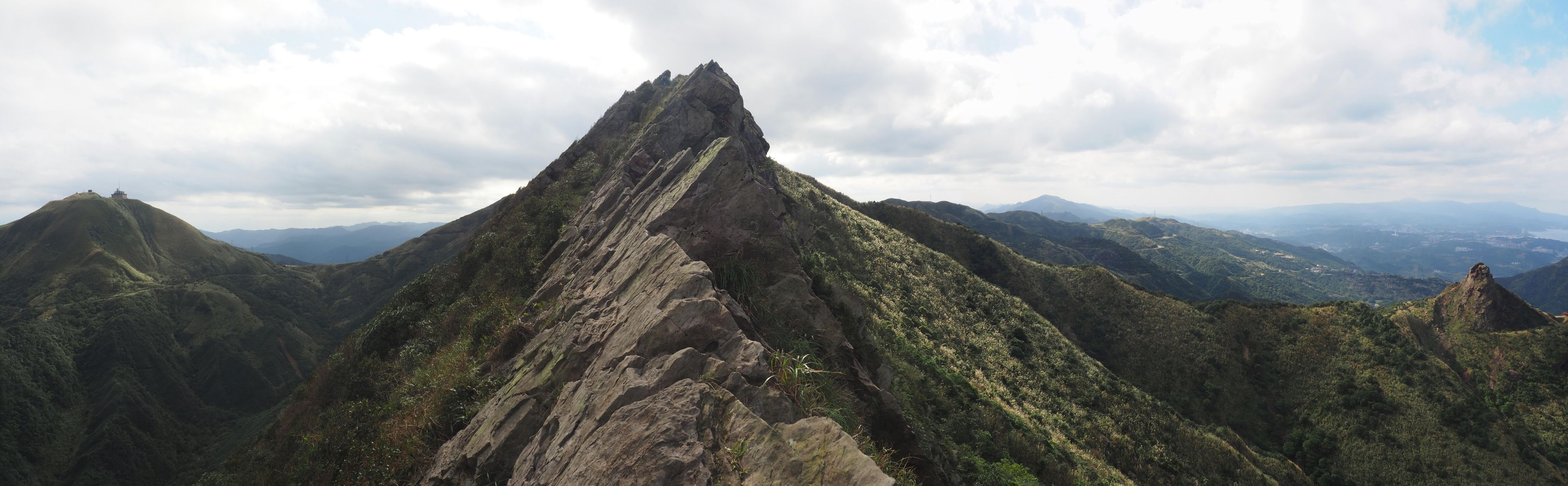
| 鋸齒稜を行く、右に茶壺山 On the Saw Teeth Ridge |
久しぶりに日本でもおなじみの九份や金瓜石の後方にある主要な山を訪れた。この時期はいわゆる東北角のはげ山は、ススキの穂が風になびき晩秋の容貌を呈するときである。11月初めに来襲した季節外れの大型台風康芮のために、ススキの穂は頭がちぎれたものが多く、夕陽に映えるススキはそれほどでもなかった。その昔鉱害対策として作られた斜面をそって登っていく煙突のある煙囪稜を経て入山、いったん黄金洞におり、555峰へ登り返して鋸齒稜にとりついた。それこそ数年を隔てて歩いた半屏山の鋸齒稜はすっかり人気ルートになっているのが、時の流れを感じさせた。半屏山から戰備道へ降り、さらに燦光寮山を登った。歩き始めたのが9時半を回っており、今の時期は日暮れも早いが、ちょうど暗くなるころに金瓜石観光地へと下りついた。
台風康芮来襲の爪痕はかなり残っており、ところどころの小規模土砂崩れのほか、黄金洞わきの沢は大きな土砂崩れが起きていた。最後に金瓜石へと下った石尾步道は、路面の土が流され、さながら涸沢の様相を呈したところもあった。10年ほど前にこの山域はかなり歩き、時間は経っているものの、すでに多く日本語での記述はしているので、今回は英語で記します。
---------------------------
 |
| From Qianjitang to make a clockwise circular hiking |
The northeast corner of Taiwan once was a biggest gold producing center of the island as well as the entire East Asia. In the 1900s through 40s under the Japanese reign, Jiufen (九份) and Jinguashi (金瓜石) were bustling with mining business of gold and copper. A large smelting plant was built at the foot of Jinguashi. It emitted poisonous fume from the smelting process, which caused environmental damage. In order to lessen damage caused by the fume, they built three long ducts climbing along the slope of mountains and a chimney at their end to exhaust the fume at a higher location. At the height of gold production, the side-by-side two towns were populous and very rich. It is said that lights were lit throughout night, and all kinds of expensive goods were available there.
 |
| At the summit of Banping-shan |
The mining business continued for a few more decades after the Japanese reign ended in 1945. It finally came to an end in the 1980s. The two towns of past glory were almost deserted but they have miraculously become one of the most popular tourist destinations of the northern Taiwan. Nowadays many tourists, domestic and foreign, flock to the narrow lanes of Jiufen and stroll along the main streets of Jinguashi. The two towns demonstrate a different kind of prosperity than the past.
 |
| The ruin of smelting plant photographed from the coast, smoke ducts are visible (Nov. 2014) |
For hikers like us, this area offers very attractive routes to explore. There are not only official trails but many paths that were originally used for mining in the past and preserved by volunteer hikers. Even some new trails are opened by them. This area is geographically unique in that very little bushy vegetation but grasses cover the majority of mountains. This is partly because strong ocean wind sweeps through and partly because the toxic chemical of the past may still remain in the soil. The rock formation is also unique. There is a rocky peak named teapot as it resembles a teapot! Next to the teapot stands Mt. Banping-shan (半屏山), which forms a rocky ridge climbing from its foot all the way up to its summit. This kind of formation is unique for a low altitude mountain. Most of low mountains of Taiwan are covered with very dense vegetation of all kinds of trees and grasses.
 |
| The saw teeth profile of the Banpings-shan ridge is pretty obvious from this angle |
I visited this area very vigorously a decade ago. I walked almost all trails that were passable at that time. Of course I have visited several times since then but not so frequently as that time.
My last visit was more than a year and a half ago. Upon a nice late autumn day eight of us went to Jinguashi and made a circular hike over the mountains behind Jinguashi, including Banping-shan and Canguangliao-shan (燦光寮山). Silver grasses that we expected to appreciate for this trip were there but their heads had been blown away by the very rare typhoon that hit Taiwan early November.
--------------------------
 |
| Getting aboard #1062 bus at 7:50 |
Because Jiufen and Jinguashi are popular tourist destinations, there are two direct bus services from Taipei. We took a ride on #1062 bus from Zhongxiao - Fuxing bus stop (忠孝復興站). The final destination of this service is Quanjitang (勸濟堂) temple and passes Jiufen en route. An hour and forty five minute ride brought us Quanjitang at 9:35. The sky is blue and promises a nice day ahead. We had many rainy days in November so this sunny sky encourages us.
 |
| Quanjitang temple |
 |
| Steps besides Quanjitang |
We go up a long staircase to a road coming from Gold Museum (黃金博物館) of Jinguashi. This road was originally a track bed of narrow gauge wagons that carried ores from quarries above to the smelting plant below the hill. The road ends at a large parking space where a tunnel opens its portal on our right. We pass through the tunnel and come out to a paved road that leads higher up to the mountains. To our surprise, a viewing deck alongside the road was washed away by the recent typhoon.
 |
| Getting out of the tunnel |
 |
| The damaged viewing deck |
 |
| Trail head for Mt. Teapot |
 |
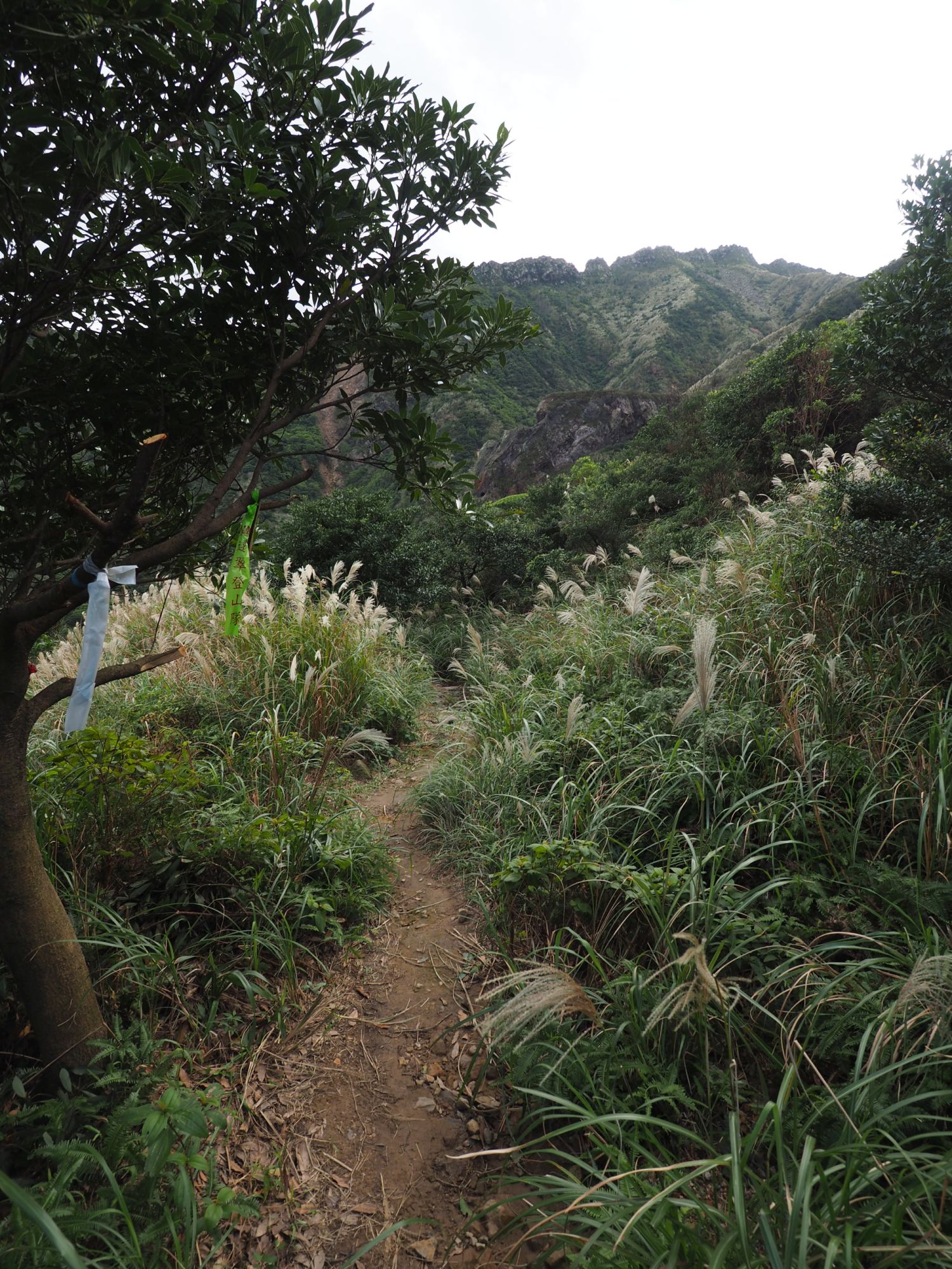
| The trail head for us to proceed |
 |
| A view from the top of #1 duct |
The road soon pass a trail head of Mt. Teapot (茶壺山) and goes up gradually. A grassy path opens its head at a corner of the road. This is a trail leading to Yanzongleng (煙囪稜) ridge. It advances levelly along the hillside and comes to a ruin of smoke duct #1. The concrete structure of the duct mostly remains intact. Climbing to the top of the duct reveals a wide view across the deep valley, including Mt. Jilong-shan (基隆山) , two-tone ocean (陰陽海) and beyond. The small village of Shuilandong (水濂洞) is clinging to the foot of the rocky east peak of Mt. Jilong-shan.
 |
| A view of opposite direction on the duct |
 |
| Inside of the smoke duct #2 |
We continue along the flat path, passing two smoke ducts of #2 and #3. You need to sneak into the inside of duct #2 for a short distance and get out. Toxic substance may remain on the inside wall so you would better not to touch it. We hit the Yanzongleng ridge at 10:30 and take the right trail to go up. We again go inside the duct #3 and reach its chimney. A large group of hikers blocks the path, and we need to be patient to pass this section. This route has become very popular over these years, which is very much surprise to me.
 |
| Passing through the #3 duct |
 |
| So many hikers around, the dog head rock is watching over the ridge |
 |
| Take a path down to Gold Cave |
We further go up along the ridge witnessing the so-called hubby dog rock below. The bolder looks like a head of the dog from this angle. Passing the highest point, the trail goes down to a unpaved road coming from the same road that we walked along a while ago. At a junction in a short distance, we take a left path down at 11:08. It goes very steeply down to the bottom, where "Gold Cave (黃金洞)" opens its wide mouth. A very large debris of rocks and dirt piles up along the stream bed next to the cave. The recent typhoon caused this land slide. We get into the cave and have a short rest.
 |
| Gold cave, a huge pile of debris on its left |
 |
| Inside the cave |
 |
| Inside the same cave 10 years ago (Nov. 2014) |
Inside the cave exists an abandoned shaft that is supposed to lead to mining spot. A warning sign besides the well says that no entry is allowed otherwise you will be liable for prosecution. The gold mining ceased four decades ago but it was mainly due to the cost of mining operation. It is estimated that 580millon tons of gold ore, which is supposedly able to produce 7.4 tons of gold, still exists at 100 meters blow the surface.
 |
| Climbing on the huge debris |
 |
| Debris filled stream bed, a rope is visible across it |
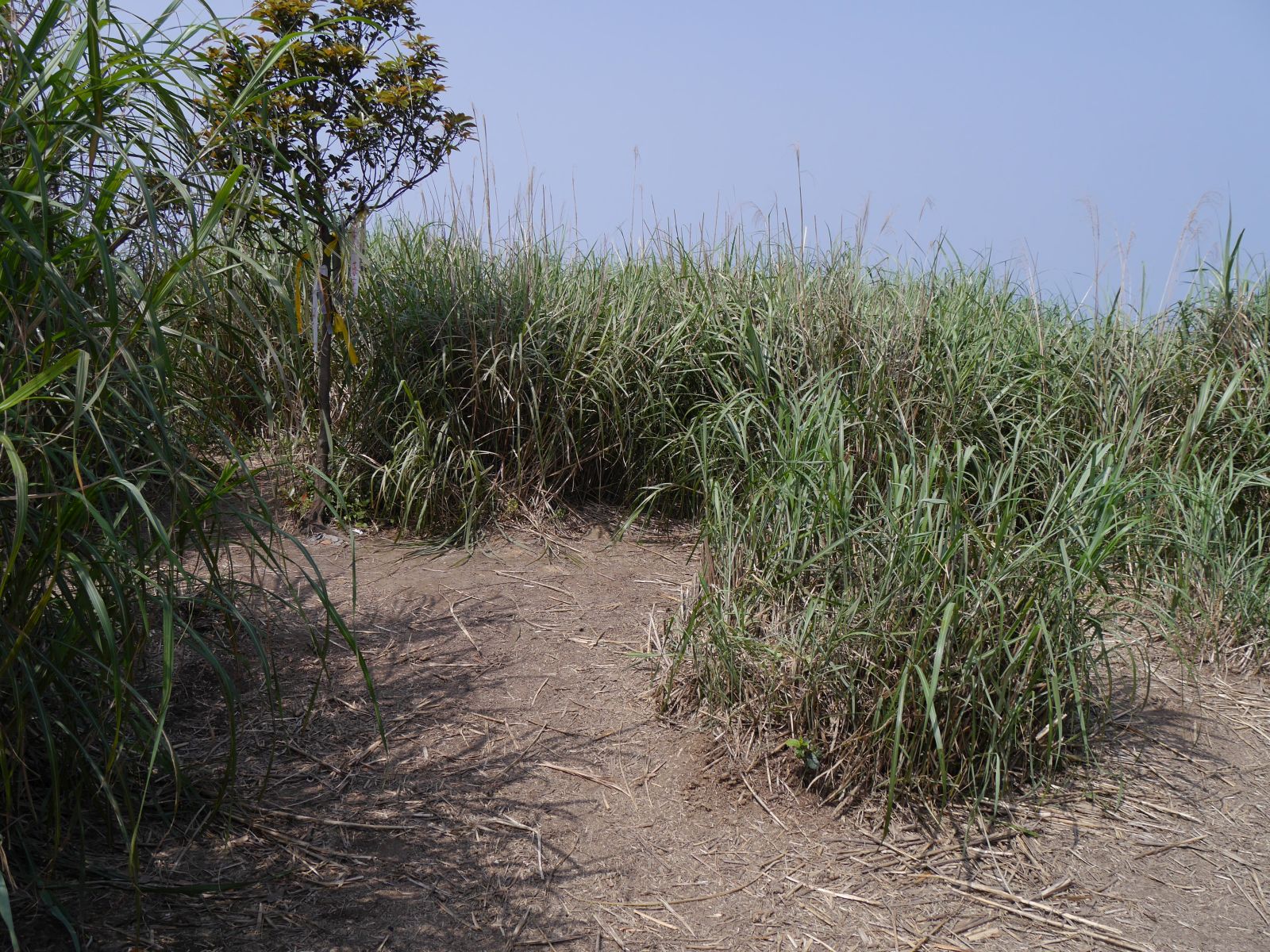
At 11:40 we leave the cave and take on an ascent to the 555 peak (555峰). The original path along the stream bed was washed away so aiming the direction we climb on the debris. At the top of the debris finds a very steep path going up. We take this trail with a long rope and up to a level path. It goes along for a while and then a steep climb to the 555 peak begins. A few stone steps are placed on a short stretch of the trail, revealing that this trail system once was a work path for mining. Another level section at a higher place passes an opening of an abandoned mine.
 |
| Flat trail for a short distance |
 |
| Stone steps |
 |
| An abandoned mine portal |
 |
| Passing a land slide section |
 |
| Final steep ascent to the 555 peak |
We pass a section of land slide and reach the 555 peak at 12:16 after a final ascent. The summit now is very wide because much of grasses are removed and even an intriguing sign stands! Compared with
my first visit a decade ago, this route has became popular and even entry-level hikers are now around. We have a lunch break for a half hour.
 |
| At the top of 555 peak |
 |
| A clear direction sign has been made |
 |
| The same summit on my second visit 8 years ago |
 |
| Going around the rock wall |
A little before 13:00 we start our ascent to the summit of Mt. Banping-shan. The so-called Juchileng (鋸齒稜, Saw teeth ridge) is a rocky ridge with many rocks of various size and shape stick out along the ridge line, resembling saw teeth viewed from afar. Both sides of the ridge are very steep and with little vegetation, so you would get very serious injuries if you fall. Due to so frequent visits of hikers, the path is now very clear and steady. Many metal chains and ropes have been fixed to dangerous spots. Even so, the height of the route is still thrilling and you would better be careful for each step.
 |
| Keep climbing on the rock ridge |
 |
| Unobstructed view from the knife ridge |
 |
| Name plate of the ridge |
 |
| In front the final peak to go over |
 |
| A rope is fixed on the rock wall |
 |
| Metal chain and a direction sign |
 |
| The junction |
An hour of climb along the rocky ridge brings us to a junction. This is where an official trail meets and it leads down to Mt. Teapot. We keep on the ridge trail and reach the summit of Banping-shan (elevation 705 meters) at 14:13. The other side of the ridge is much more lenient. The rocky sections are few and wooden steps are built for steep sections. The ridge itself is much wider. We reach the trail head on the Zhanbeidao (戰備道) at 14:55. Several cars and motorcycles are parked around
 |
| Reaching the summit of Banping-shan |
 |
| Trail on this side of the summit is easier to pass |
 |
| Wooden steps |
 |
| The trail head |
 |
| Trail head for Canguanliao-shan |
 |
| Climbing a steep section |
 |
| Waiting for the descending party to pass |
 |
| Summit of Canguangliao-shan |
The trail head for Mt. Canguangliao-shan is just a few steps away down the road. The trail is not an official one but frequently travelled. We run into a large group of hikers coming down at two different steep sections, which makes us wait for a while. At 15:23 the summit comes in sight and two hikers are there. With the elevation of 738 meters this summit is the highest point in this area. Its location offers a very good vantage point. No wonder the first level triangulation marker (一等三角點) was placed on this summit.
 |
| Panoramic view of Mt. Jilong-shan and Mt. Banping-shan |
 |
| At the summit |
 |
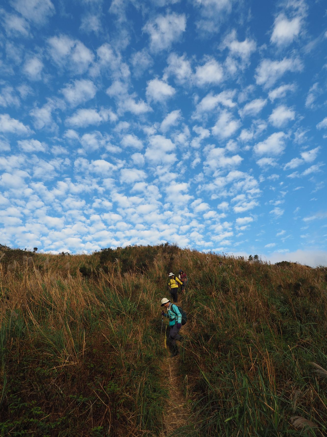
| Going down |
Having enjoyed a wonderful view for a quarter hour, we leave the summit at 15:40. There are two steep rope sections on our way down. In less than a half hour we see a small Tudigong (土地公) shrine and hit a wide dirt road, which leads to Zhanbeidao road. The paved Zhanbeidao road comes to a junction where a trail to Dizhi park (地質公園, geological park). We take a right stone paved trail down. On our right across the valley stand Banping-shan and Mt. Teapot in the golden light of the setting sun. We were on the summit of it just a while ago! At 16:30 we hit a junction where a trail to Dizhi park splits to the left.
 |
| The suummit is already afar |
 |
| The final descent |
 |
| A Tudigong shrine at the trail head |
 |
| Looking back Canguangliao-shan |
 |
| A junction for Dizhi Park (right) |
 |
| Banping-shan across the valley |
 |
| Take left at this junction |
We take the left trail at the junction and go along a moderate and wide trail. A wide cut of rock shows up on our left. This is a remain of quarry once very busy with excavation works several decades ago. Now it is just a gigantic hollow in the mountain. It is said that the long-term excavation process changed the height and shape of the original mountain. We continue on the trail and come to a junction for Shiwei trail (石尾步道) at 16:17.
 |
| Remain of the quarry |
 |
| Dusk is approaching over the former gold towns |
 |
| A section of washed-out trail |
Shiwei trail is one of those work roads for gold mining in the past. This leads directly to Jinguashi. At some points of the trail a very large volume of rain in the last typhoon washed out its surface soil. Stones of large and small are exposed, which makes walking not easy. We pass by Heirou Ping (黑肉坪, a damping field of ore residue) and come into the former residential area of officials who worked for the mining company. Now only grasses grow on the brick-fenced terraces that were built for several stages on the slope.
 |
| Heirouping |
 |
| Former residential area of the mining company officials |
 |
| A restored house of the Japanese era |
 |
| Jinguanshi bus stop |
By the time the sky darkens we have arrived at Jinguashi bus stop. It is 17:15 so we have hiked for seven and a half hours including rests to cover eight kilometers of the route. The total ascent was 670 meters and the route physical index is 22. Five of us took a #965 bus bound for Banqiao (板橋) while myself and other two friends took a #1062 back to Taipei.
 |
| A view from Jiufen on our way back to Taipei |